基于无人机可见光影像的荒漠植被分布格局研究方法
郝梦宇( ), 秦龙君, 毛鹏, 罗婕纯一, 赵文利, 邱国玉()
), 秦龙君, 毛鹏, 罗婕纯一, 赵文利, 邱国玉()
Unmanned aerial vehicle (UAV) based methodology for spatial distribution pattern analysis of desert vegetation
Mengyu Hao(), Longjun Qin, Peng Mao, Jiechunyi Luo, Wenli Zhao, Guoyu Qiu()
), Longjun Qin, Peng Mao, Jiechunyi Luo, Wenli Zhao, Guoyu Qiu()
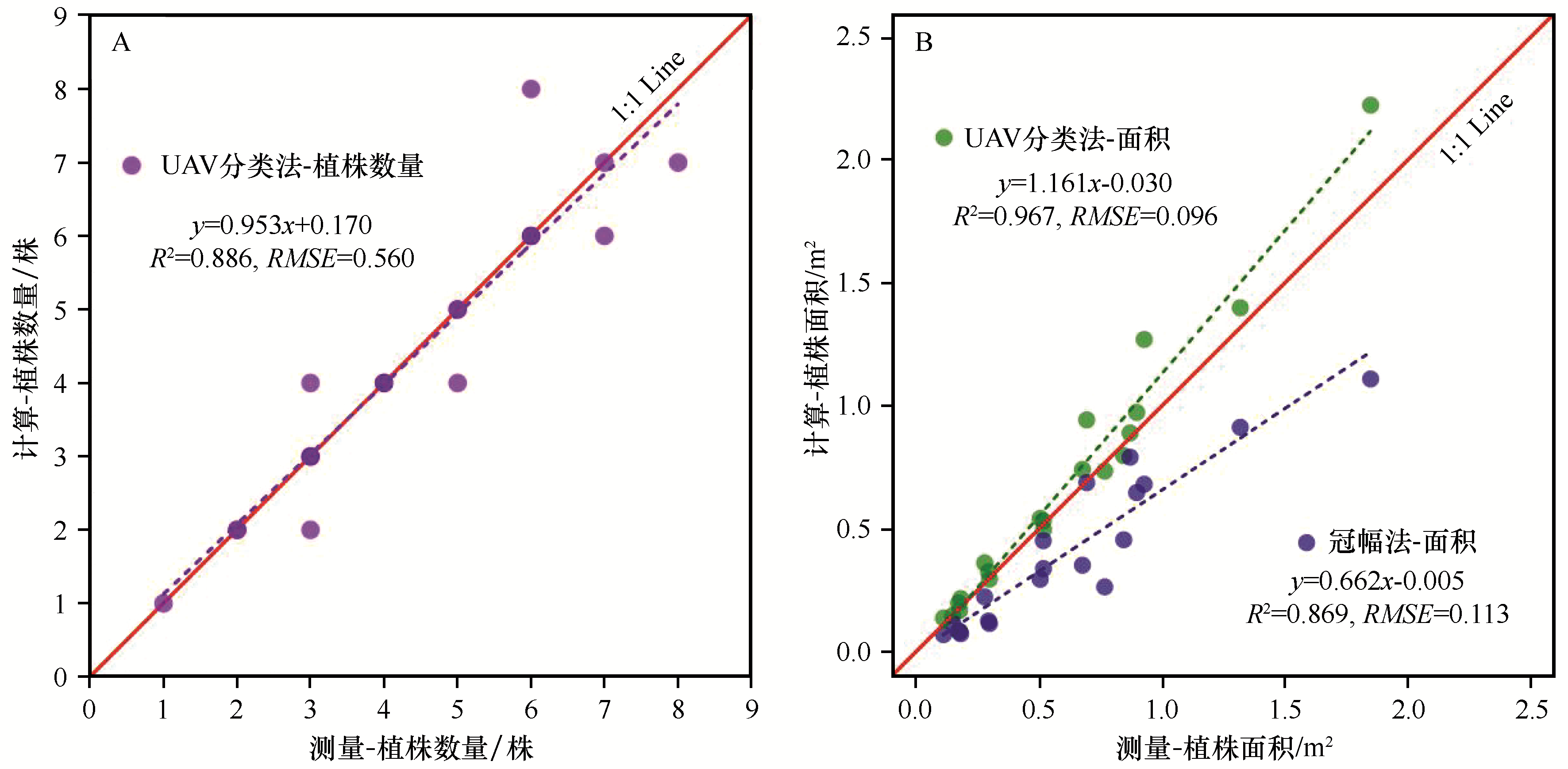
图7. 植株数量及植株面积精度验证
Fig.7. Accuracy verification of the plant number and the canopy area of plant