青海高寒草甸退化演替中的植被指数
Response of vegetation index to degraded succession of alpine meadow in Qinghai, China
青海高寒草甸退化演替中的植被指数 |
| 邢学刚, 颜长珍, 逯军峰, 翟晓慧, 贾浩巍, 谢家丽 |
|
Response of vegetation index to degraded succession of alpine meadow in Qinghai, China |
| Xuegang Xing, Changzhen Yan, Junfeng Lu, Xiaohui Zhai, Haowei Jia, Jiali Xie |
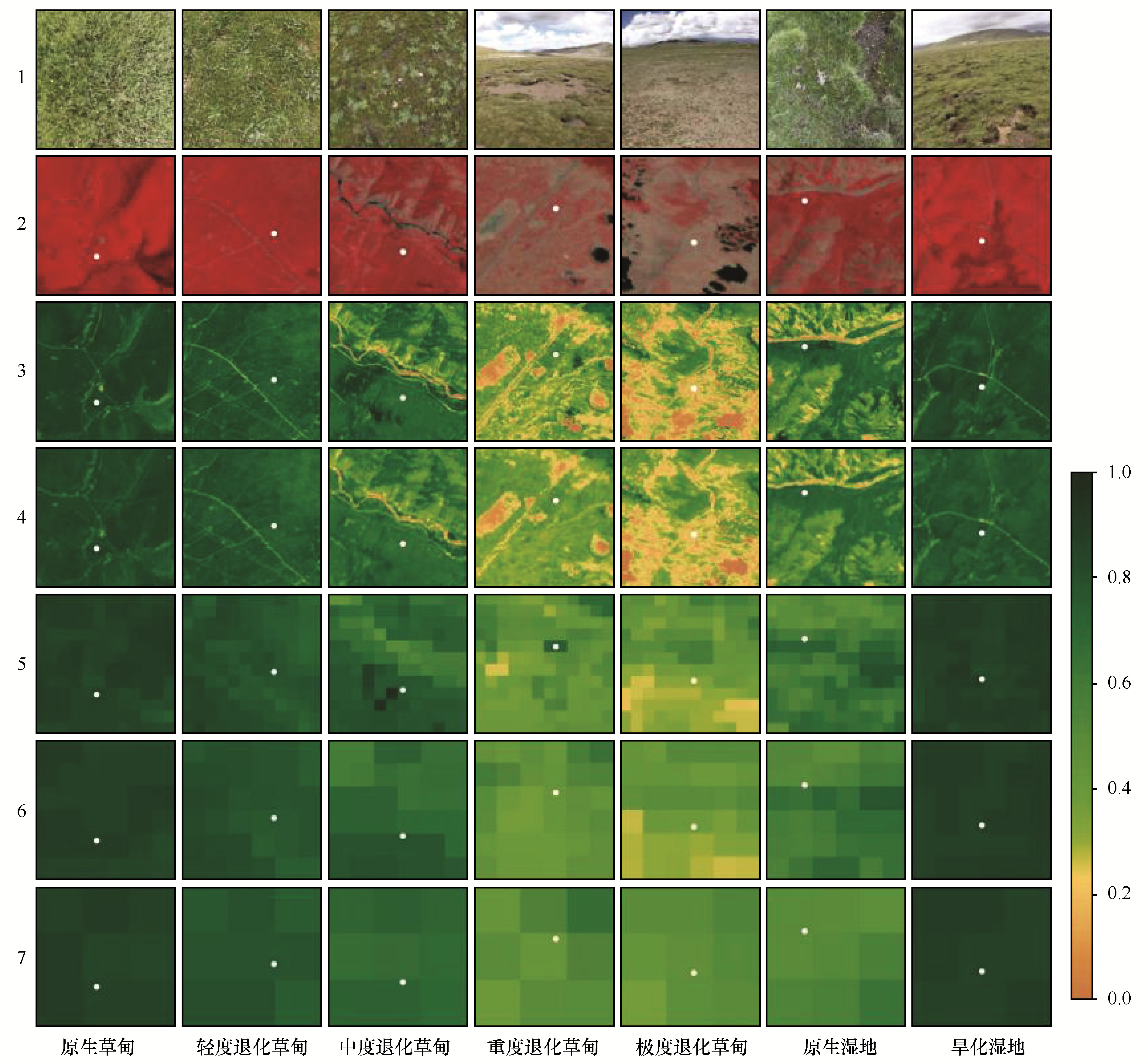
| 图3 不同退化阶段高寒草甸和湿地草甸的野外照片与NDVI可视化。1—7分别为野外拍摄照片、Landsat假彩色影像、Sentinel2_NDVI、Landsat_NDVI、MODIS_NDVI250、MODIS_NDVI500、MODIS_NDVI1000;白色点代表不同退化阶段高寒草甸和湿地草甸的采样点 |
| Fig.3 Field photos and NDVI visualization of alpine meadows and wetland meadows at different degradation stages. Pictures from 1 to 7 are field photos, Landsat false color images, Sentinel-2_NDVI, Landsat_NDVI, MODIS_NDVI250, MODIS_NDVI500, and MODIS_NDVI1000, respectively; white dots represent the sampling point of alpine meadows and wetland meadow at different degradation stages |
|
|