风速和植被对内蒙古地区沙尘天气影响的数值模拟
Numerical simulation of the influence of wind speed and vegetation on dust weather in Inner Mongolia, China
风速和植被对内蒙古地区沙尘天气影响的数值模拟 |
| 董祝雷, 姜学恭, 衣娜娜, 许志丽, 杭月荷, 于水燕 |
|
Numerical simulation of the influence of wind speed and vegetation on dust weather in Inner Mongolia, China |
| Zhulei Dong, Xuegong Jiang, Nana Yi, Zhili Xu, Yuehe Hang, Shuiyan Yu |
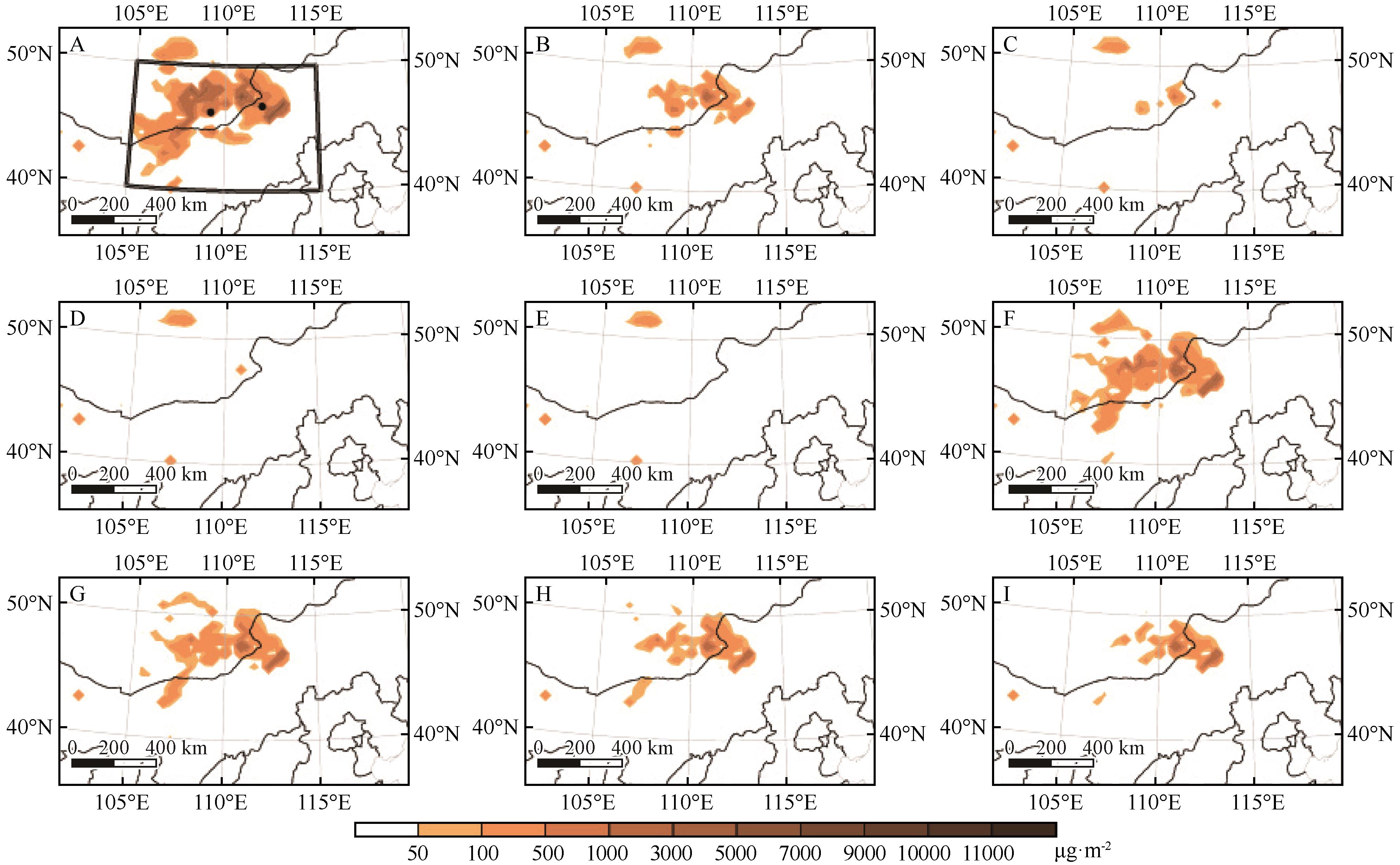
| 图7 2019年5月15日04:00实际(A)及casev1(B)、casev2(C)、casev3(D)、casev4(E)、casew1(F)、casew2(G)、casew3(H)、casew4(I)模拟起沙量(单位:μg·m-2)的空间分布。黑色矩形框为此次沙尘过程的沙源地,黑色圆点分别表示蒙古国南部站点(43.12°N,109.21°E)和二连浩特(43.39°N,112.00°E) |
| Fig.7 The spatial distribution of actual sand emission (A) and sand emission (unit: μg·m-2) simulated by casev1 (B), casev2 (C), casev3 (D), casev4 (E), casew1 (F), casew2 (G), casew3 (H), casew4 (I) at 04:00 on May 15, 2019. The black rectangular box area is sand source, and the black dots indicate the southern site of Mongolia (43.12°N,109.21°E) and Erenhot (43.39°N,112.00°E) |
|
|