基于无人机激光雷达的额济纳绿洲植被覆盖度监测及变化分析
Monitoring and change analysis of vegetation coverage in Ejin Oasis based on UAV-LiDAR
基于无人机激光雷达的额济纳绿洲植被覆盖度监测及变化分析 |
| 张浪, 党国锋, 鱼腾飞, 韩拓, 殷一丹, 陈勇 |
|
Monitoring and change analysis of vegetation coverage in Ejin Oasis based on UAV-LiDAR |
| Lang Zhang, Guofeng Dang, Tengfei Yu, Tuo Han, Yidan Yin, Yong Chen |
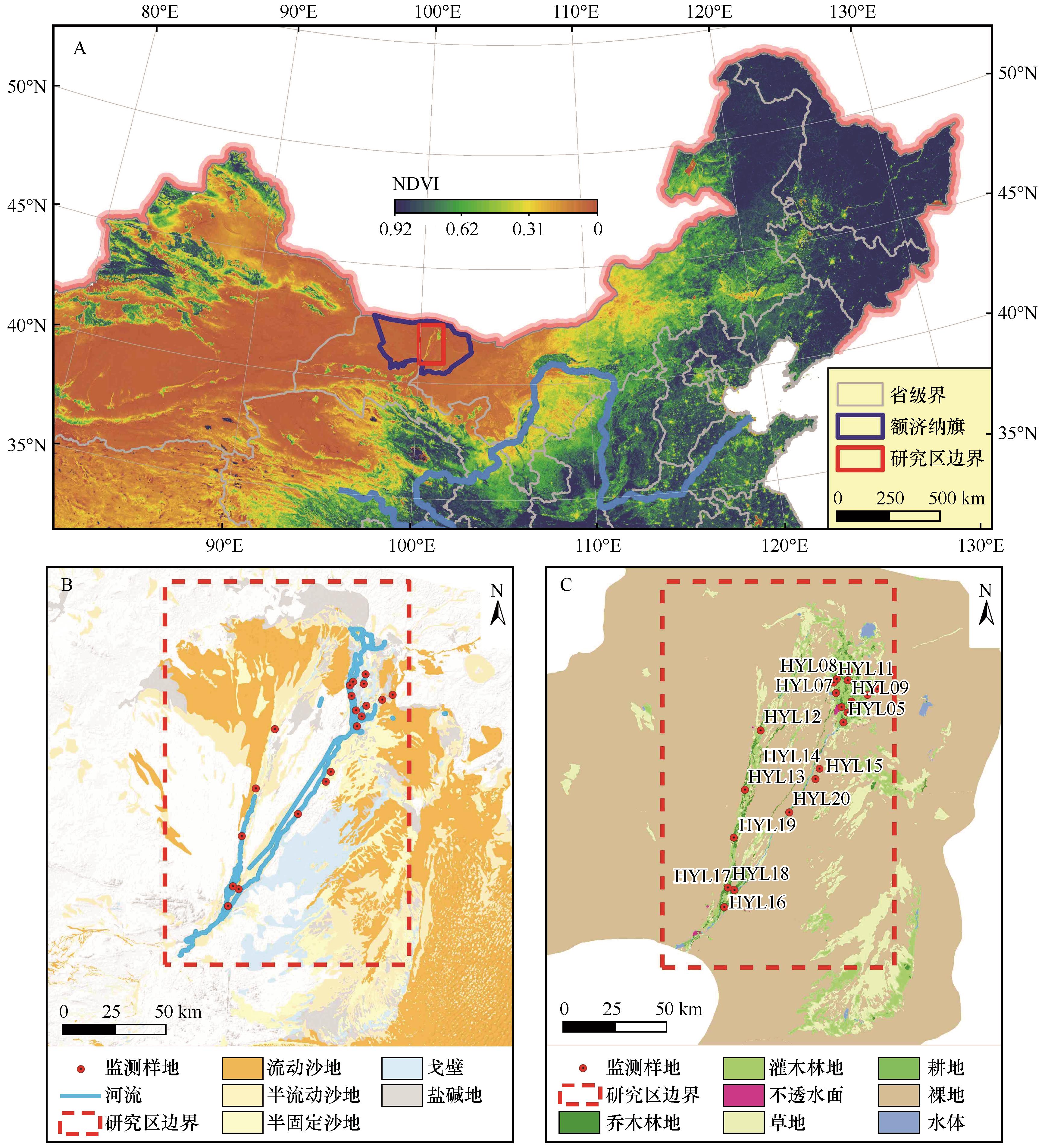
| 图1 研究区位置(A)、荒漠化类型(B)、土地利用与监测样地分布(C) |
| Fig.1 The location (A), the type of desertification (B) of the study area and the distribution of land use and survey sites (C) |
|
|