新疆三工河流域绿洲地下水埋深动态演变规律及其模拟
Evolution patterns and dynamic simulation of groundwater table depth in oasis areas of the Sangonghe River Basin, Xinjiang, China
新疆三工河流域绿洲地下水埋深动态演变规律及其模拟 |
| 柴娜英, 黄彩霞, 王泽义, 李福强, 刘蔚, 朱猛, 郑新军, 尹鑫卫 |
|
Evolution patterns and dynamic simulation of groundwater table depth in oasis areas of the Sangonghe River Basin, Xinjiang, China |
| Naying Chai, Caixia Huang, Zeyi Wang, Fuqiang Li, Wei Liu, Meng Zhu, Xinjun Zheng, Xinwei Yin |
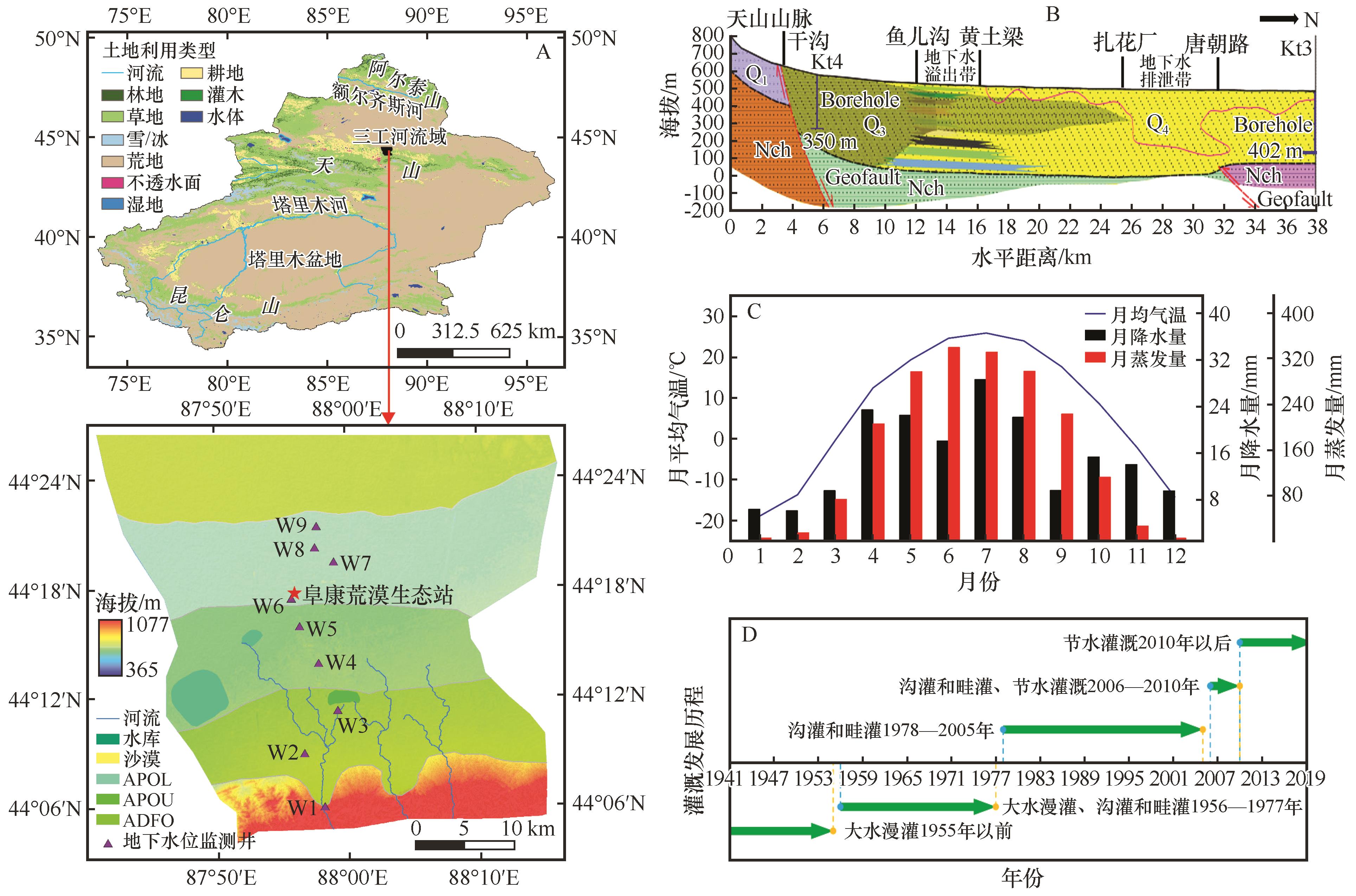
| 图1 三工河流域地理位置及地下水位监测井分布示意图(A)、南北向含水层结构剖面图(B)、1995—2016年平均月降水量、气温和蒸发量动态变化图(C)、主要灌溉方式演化示意图(D) |
| Fig.1 Schematic diagram of geographical location and distribution of groundwater level monitoring wells (A), profile of north-south aquifer structure, average monthly precipitation (B), air temperature and evaporation from 1995 to 2016 (C), and evolution of main irrigation methods (D) in the Sangong River Basin |
|
|