img

官方微信

高级检索

中国沙漠 ›› 2023, Vol. 43 ›› Issue (4): 231-240.DOI: 10.7522/j.issn.1000-694X.2023.00009

• • 上一篇    

塔里木河下游生态输水效应

王永鹏1,2(), 阿里木江2, 周龙1, 杨鹏年1(), 冯思阳1,3, 王延文4   

  1. 1.新疆农业大学 水利与土木工程学院,新疆 乌鲁木齐 830052
    2.新疆水利发展投资集团,新疆 乌鲁木齐 830000
    3.南京水利科学研究院水文水资源研究所,江苏 南京 210029
    4.塔城地区水利水电勘察设计院,新疆 塔城 834700
  • 收稿日期:2022-12-09 修回日期:2023-02-20 出版日期:2023-07-20 发布日期:2023-08-14
  • 通讯作者: 杨鹏年
  • 作者简介:杨鹏年(E-mail: ypn10@163.com
    王永鹏(1993—),男,新疆乌鲁木齐人,硕士研究生,研究方向为水文及水资源。E-mail: 924335220@qq.com
  • 基金资助:
    新疆维吾尔自治区塔里木河流域管理局项目(TGJJG-2020KYXM0002);国家自然科学基金项目(U2003105)

Ecological water conveyance effect in the lower reaches of Tarim River

Yongpeng Wang1,2(), Alimujiang2, Long Zhou1, Pengnian Yang1(), Siyang Feng1,3, Yanwen Wang4   

  1. 1.College of Water Conservancy and Civil Engineering,Xinjiang Agricultural University,Urumqi 830052,China
    2.Xinjiang Water Development Investment Group,Urumqi 830000,China
    3.Institute of Hydrology and Water Resources,Nanjing Institute of Water Resources Sciences,Nanjing 210029,China
    4.Water Conservancy and Hydropower Survey and Design Institute of Tacheng District,Tacheng 834700,Xinjiang,China
  • Received:2022-12-09 Revised:2023-02-20 Online:2023-07-20 Published:2023-08-14
  • Contact: Pengnian Yang

摘要:

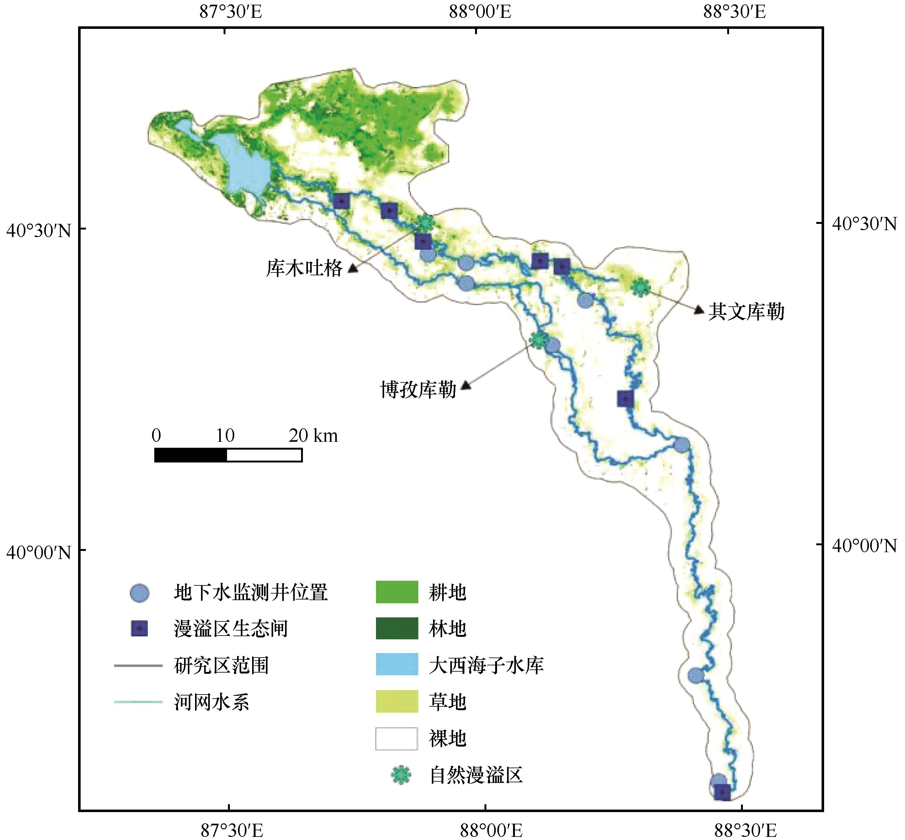
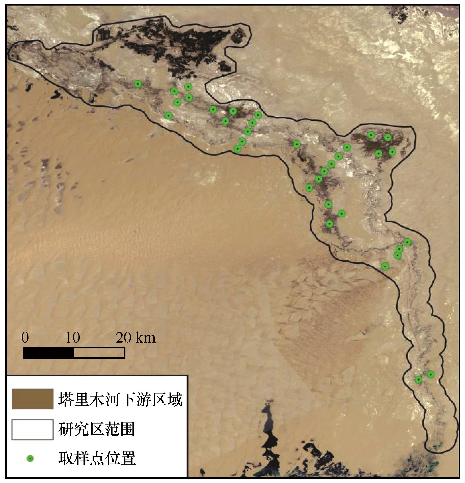
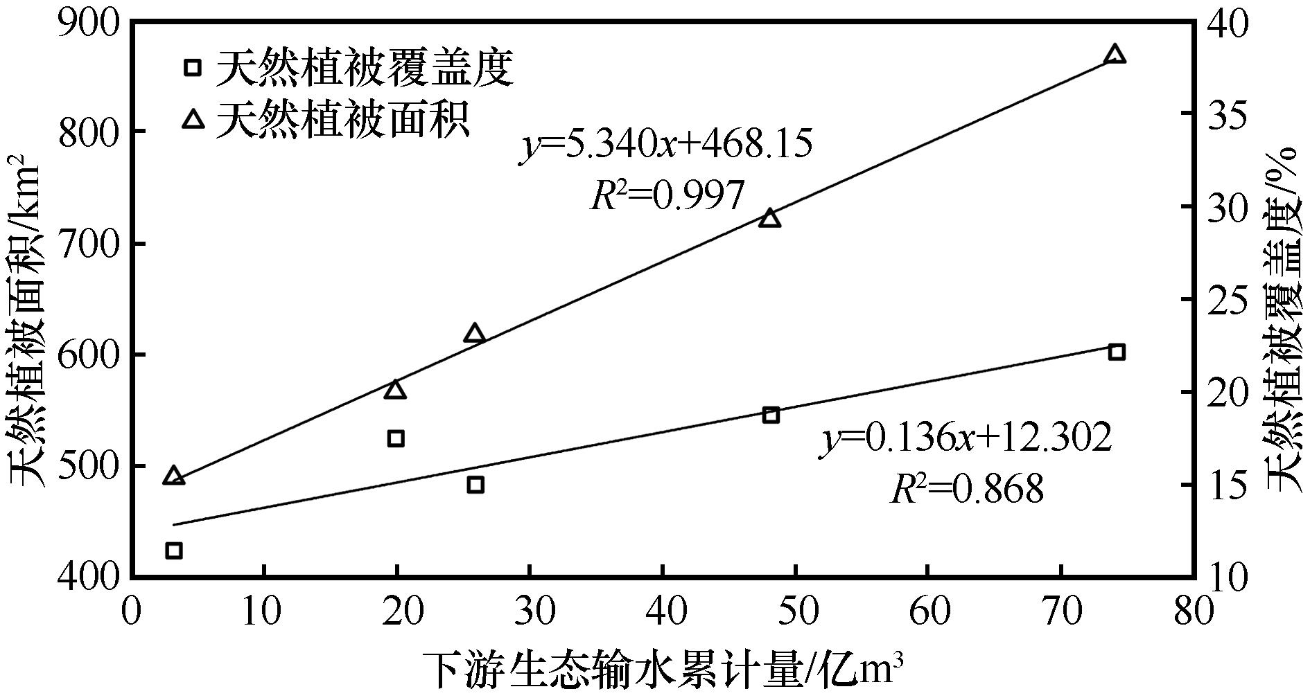
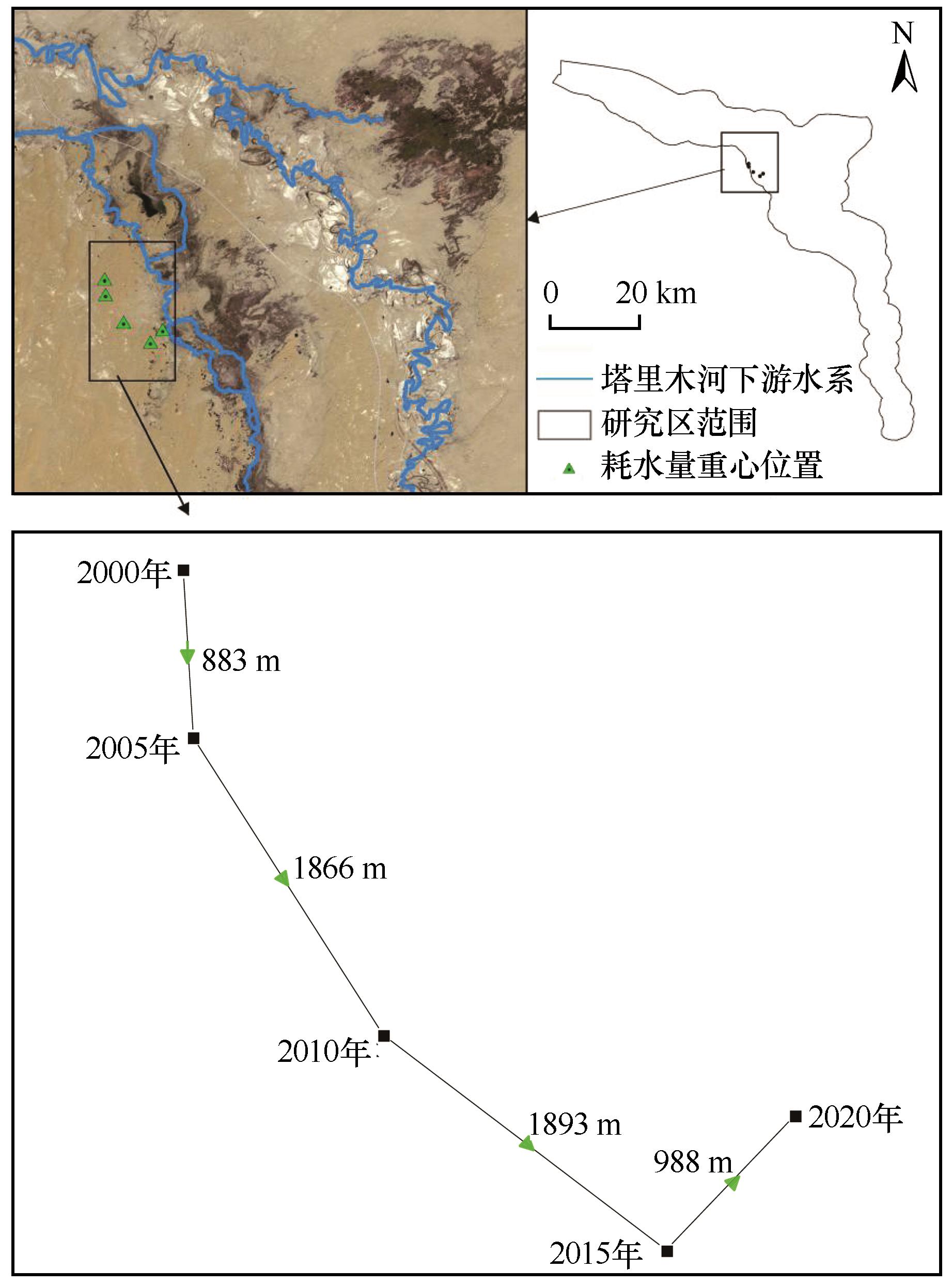
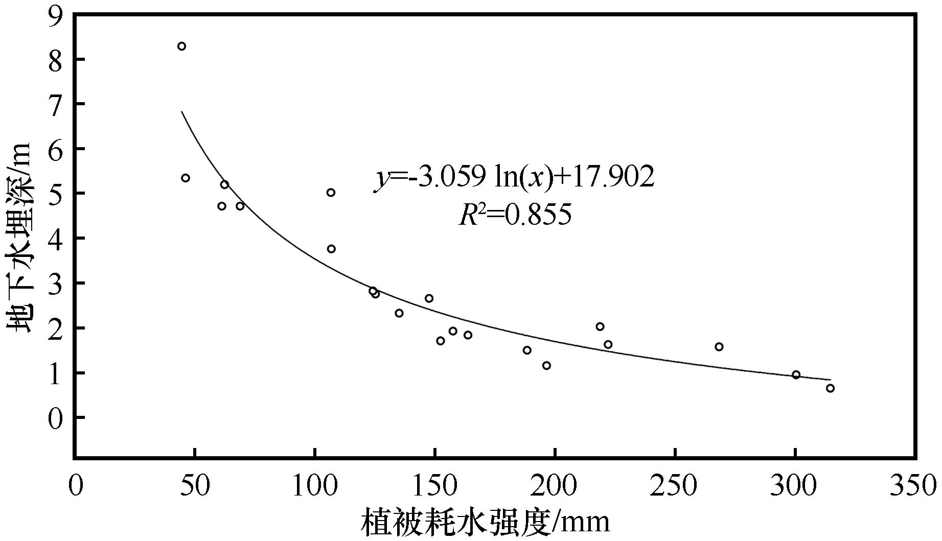
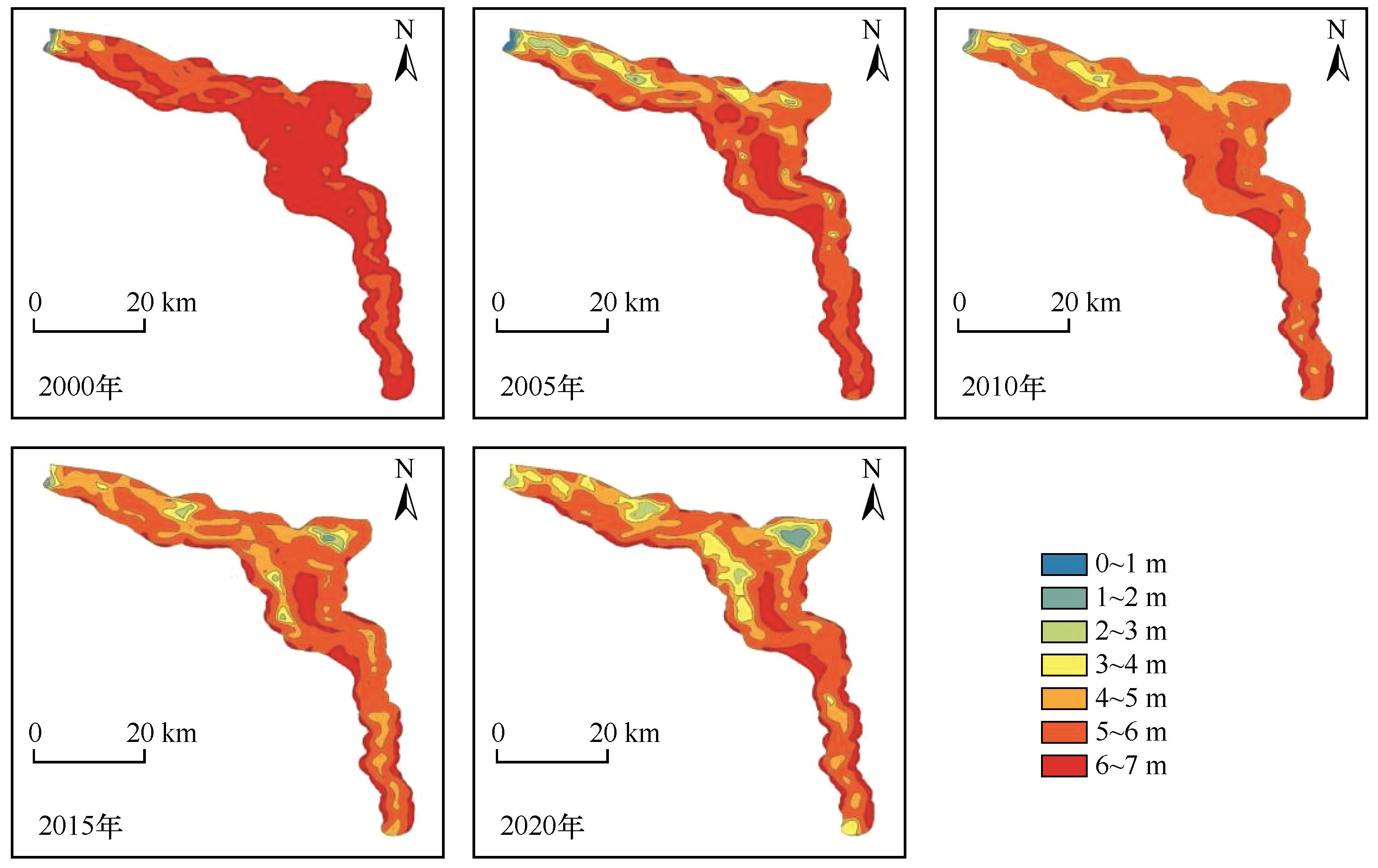
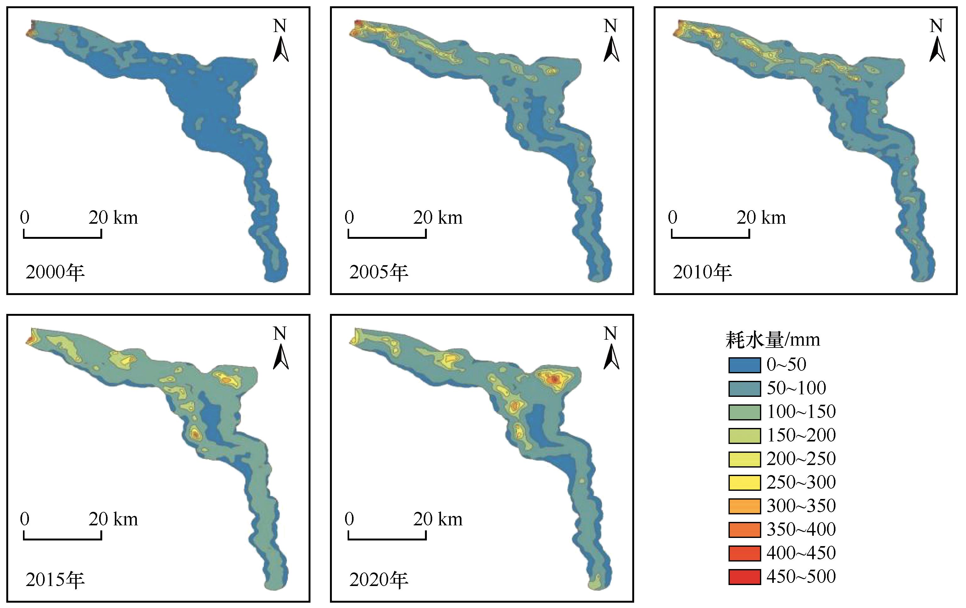
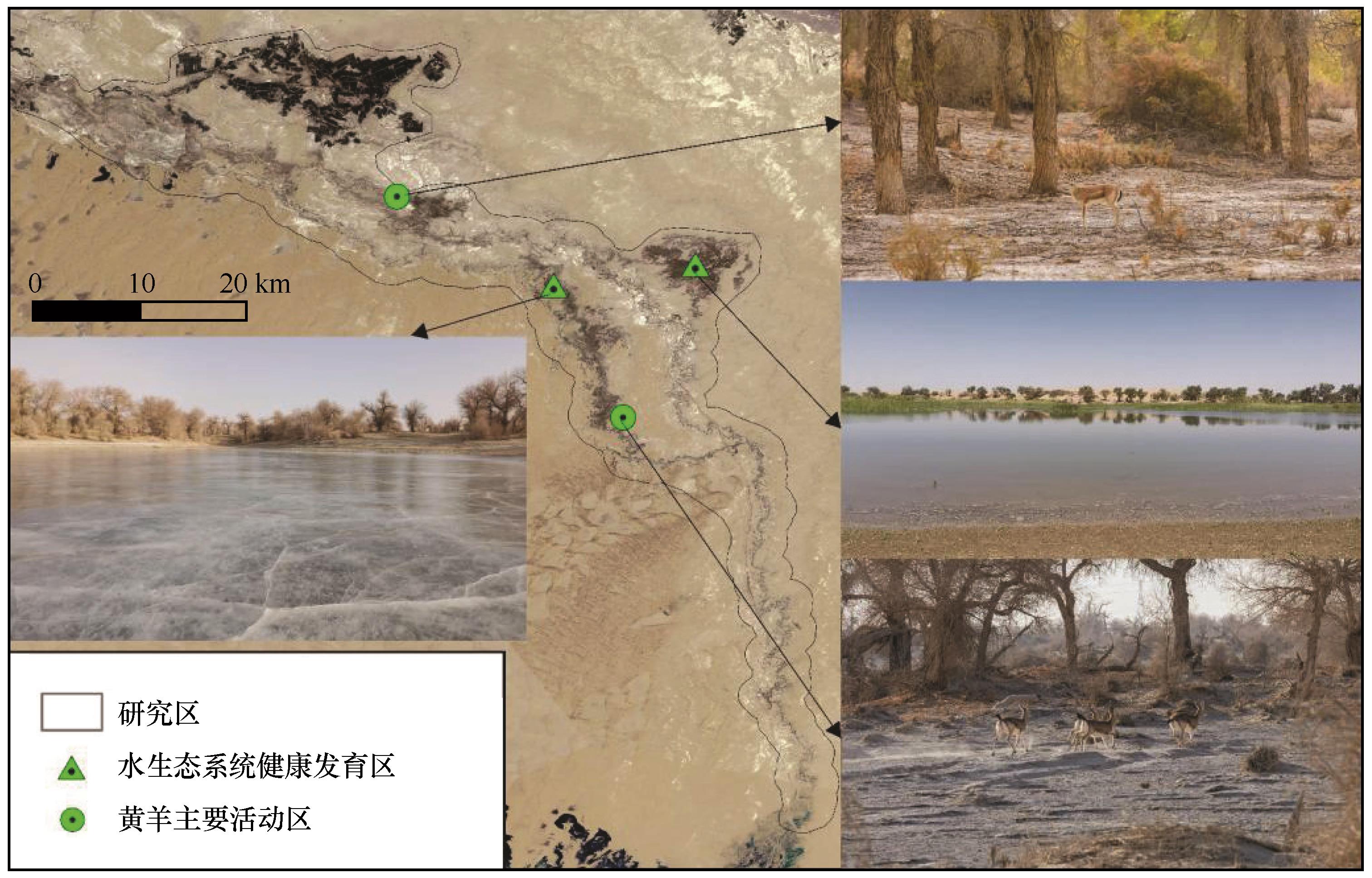
分析塔里木河下游生态输水效应可为优化生态输水调配策略提供科学指导。基于Landsat系列影像、气象数据和现场钻探数据,解译土地利用类型及植被覆盖度,确定植被耗水量及地下水埋深演变趋势,以探讨生态输水的多重效应。结果显示:(1)2000—2020年,塔里木河下游林草地面积、覆盖度增长显著,1亿m3生态水分别对应5.40 km2天然植被面积及0.14%植被覆盖度增长。(2)2000—2015年植被耗水量重心沿塔里木河干流方向迁移,2015—2020年向自然漫溢区迁移,共向东南迁移4 359 m。(3)自然漫溢区内地下水埋深增幅高达5 m,主河道沿线2 km范围增加1~3 m,河道以外2~5 km区域地下水埋深增加0~1 m。(4)天然植被适宜耗水量约为200 mm·a-1,生态输水前期仅在主河道沿线局部区域存在低效耗散,后期大量集中于自然漫溢区。21年生态输水实践表明,天然植被明显改善,地下水位明显回升,生态输水效应显著;但受既有输水方式固化的制约,生态水量空间分布不均衡和低效耗散增大,生态输水方式仍存在优化的必要性。

关键词: 塔里木河下游, 植被修复, 地下水埋深, 植被耗水特征, 生态输水效应

Abstract:

The ecological water conveyance effect in the lower reaches of Tarim River was analyzed to provide scientific guidance for optimizing the allocation strategy of ecological water conveyance. Based on Landsat series images, meteorological data and field drilling data, the land use type and vegetation coverage were interpreted, and the evolution trend of vegetation water consumption and groundwater depth was determined to explore the multiple effects of ecological water transport. The results showed that: (1)From 2000 to 2020, the area and coverage of forest and grassland increased significantly in the lower reaches of the Tarim River, and each 1×10⁸ m3 ecological water corresponded to 5.40 km2 natural vegetation area and 0.14% vegetation coverage increase. (2)From 2000 to 2015, the center of gravity of vegetation water consumption moved along the main stream of Tarim River, and from 2015 to 2020, it moved to the natural overflow area, with a total of 4 359 m to the southeast. (3)The groundwater level in the natural overflow area increased by 5 m, the groundwater level in the 2 km area along the main river increased by 1-3 m, and the groundwater level in the 2-5 km area outside the river increased by 0-1 m. (4)The suitable water consumption of natural vegetation is about 200 mm·a-1. In the early stage of ecological water transport, there is only inefficient dissipation in the local area along the main river channel, and in the later stage, a large number of natural overflow areas are concentrated. The 21-year ecological water conveyance practice shows that: The natural vegetation was significantly improved, the groundwater level was significantly increased, and the ecological water conveyance effect was significant. However, due to the restriction of the solidification of the existing water conveyance mode, the spatial distribution of ecological water quantity is not balanced and the inefficient dissipation, and the ecological water conveyance mode still has the necessity of optimization.

Key words: lower reaches of Tarim River, vegetation restoration, groundwater depth, characteristics of vegetation water consumption, ecological water conveyance effect

中图分类号: