img

官方微信

高级检索

中国沙漠 ›› 2024, Vol. 44 ›› Issue (2): 48-56.DOI: 10.7522/j.issn.1000-694X.2023.00122

• • 上一篇    下一篇

基于三维数字模型的新月形沙丘移动轨迹拟合

李爱敏1(), 赵培臣2, 韩致文3   

  1. 1.菏泽学院,城市建设学院,山东 菏泽 274015
    2.菏泽学院,数学与统计学院,山东 菏泽 274015
    3.中国科学院西北生态环境资源研究院 沙漠与沙漠化重点实验室,甘肃 兰州 730000
  • 收稿日期:2023-07-18 修回日期:2023-09-02 出版日期:2024-03-20 发布日期:2024-03-19
  • 作者简介:李爱敏(1981—),女,山东鄄城人,博士研究生,从事风沙地貌与三维数字建模研究。E-mail: aiminliok@126.com
  • 基金资助:
    菏泽学院博士基金项目(XY19BS04);菏泽市社会科学规划课题(ZC-2022-2)

The moving trajectory fitting based on three-dimensional digital model of barchan dunes

Aimin Li1(), Peichen Zhao2, Zhiwen Han3   

  1. 1.College of Urban Construction /, Heze University,Heze 274015,Shandong,China
    2.School of Mathematics and Statistics, Heze University,Heze 274015,Shandong,China
    3.Key Laboratory of Desert and Desertification,Northwest Institute of Eco-Environment and Resources,Chinese Academy of Sciences,Lanzhou 730000,China
  • Received:2023-07-18 Revised:2023-09-02 Online:2024-03-20 Published:2024-03-19

摘要:

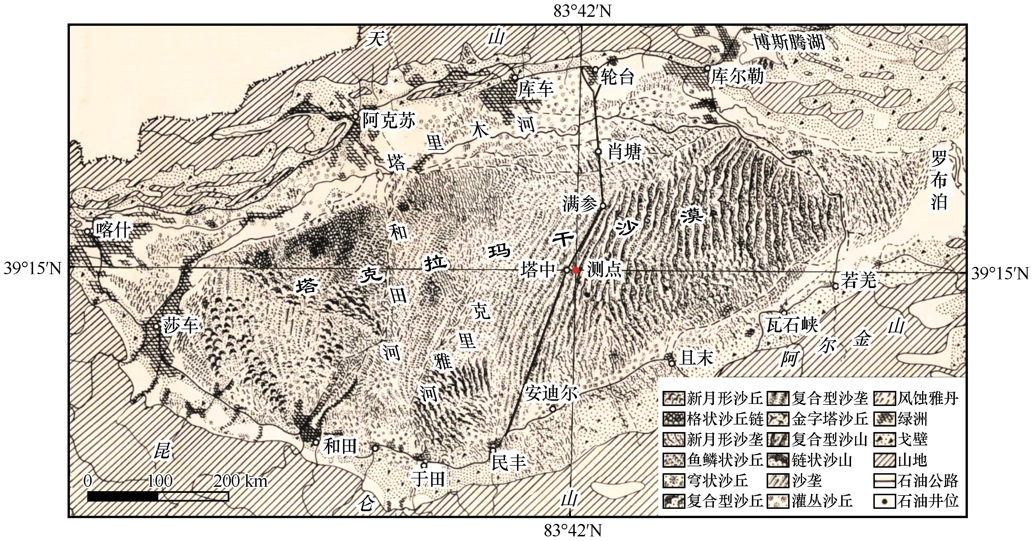
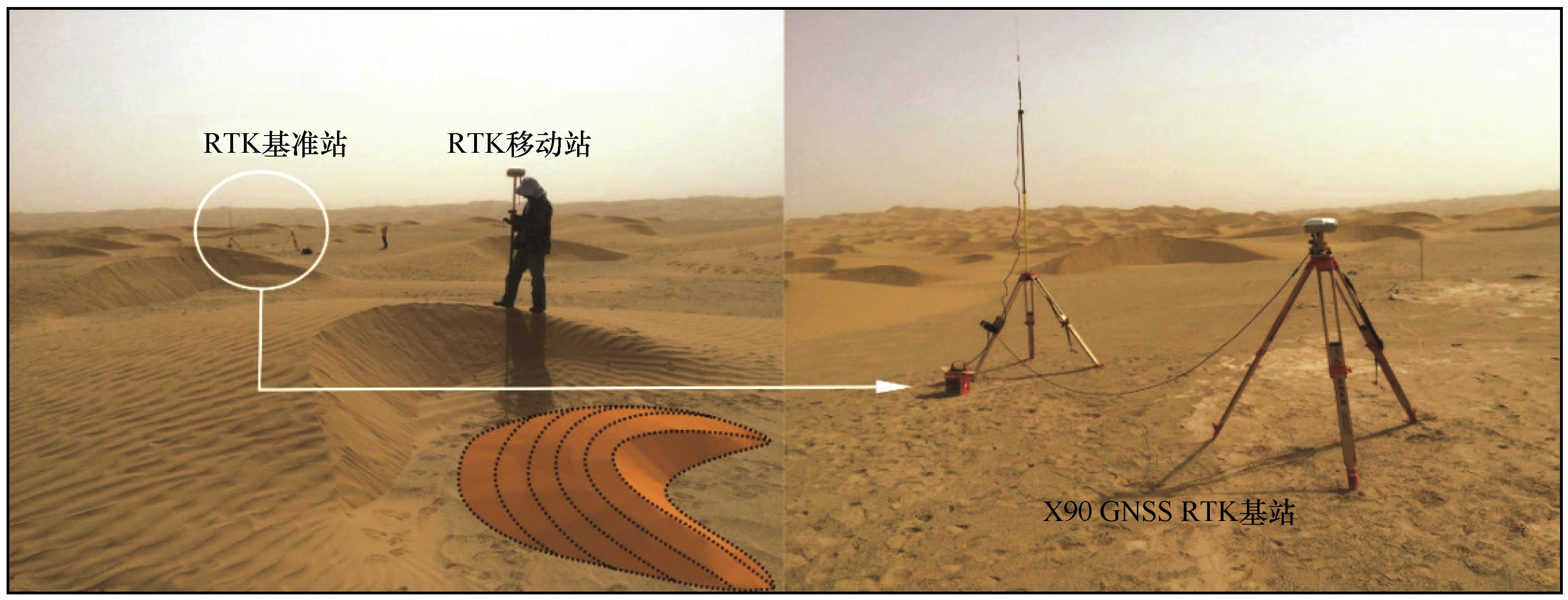
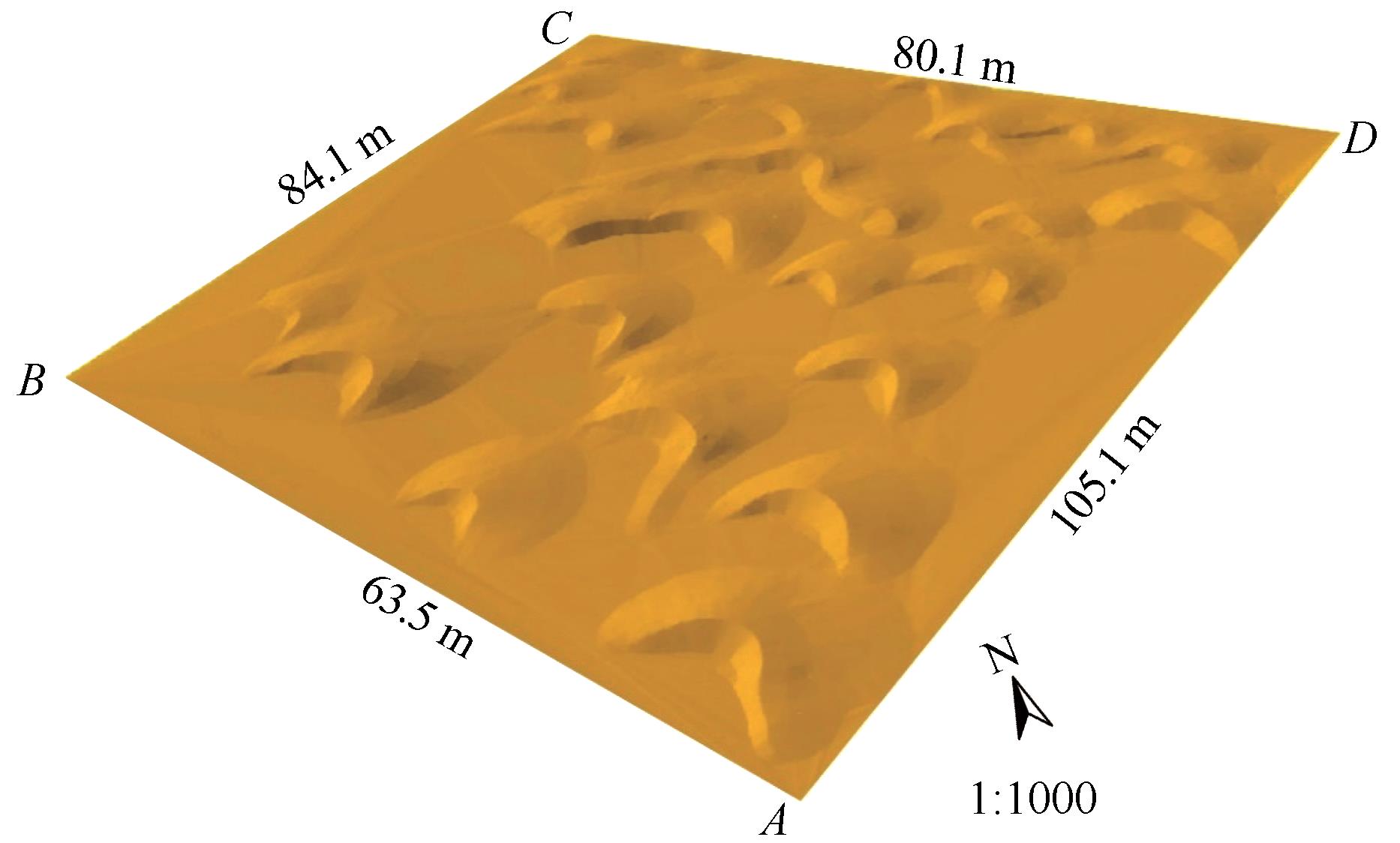
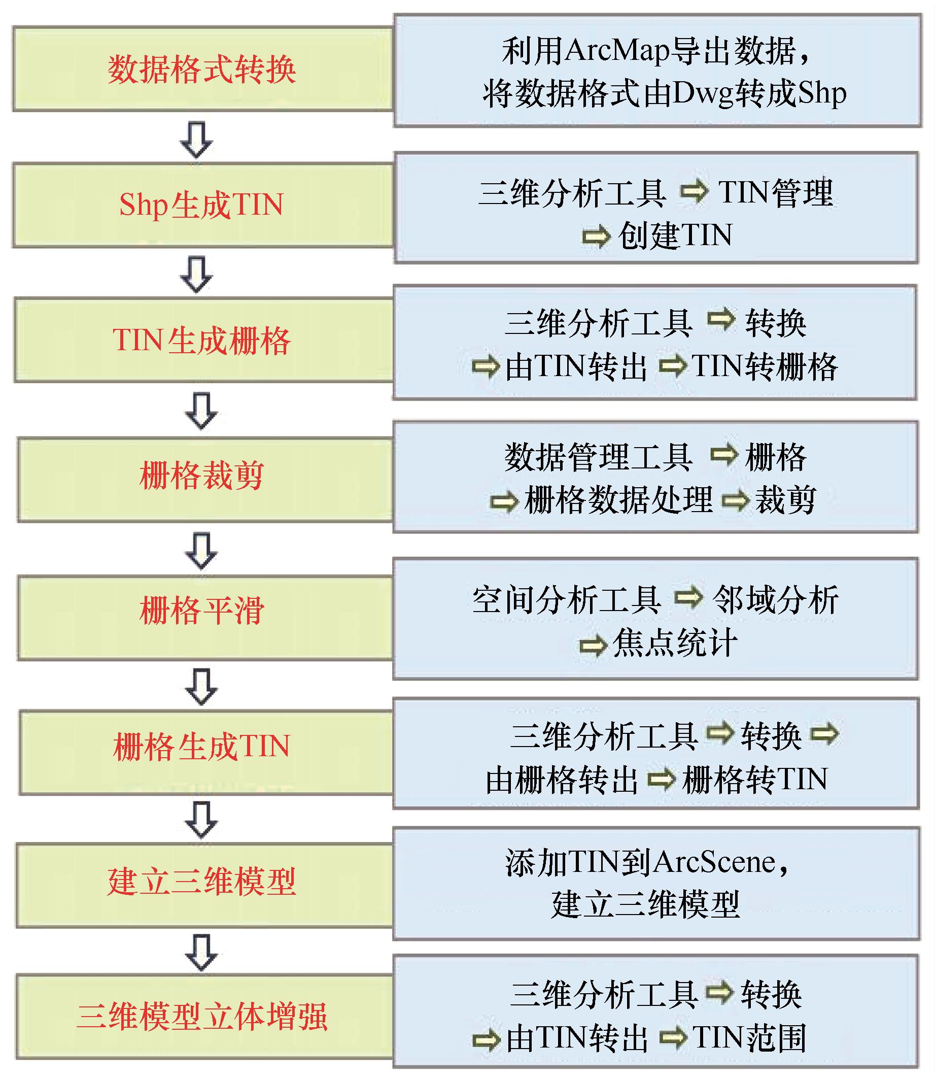
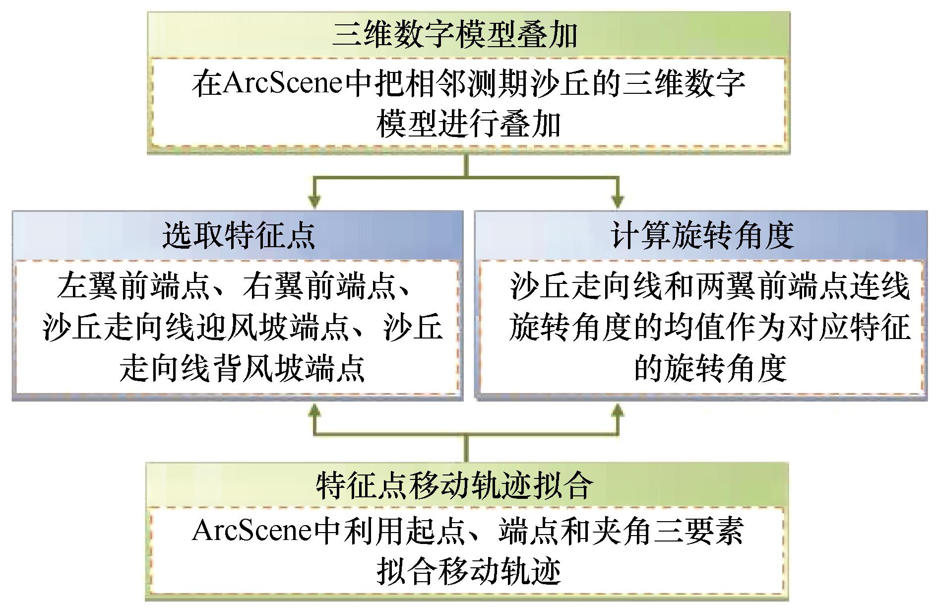
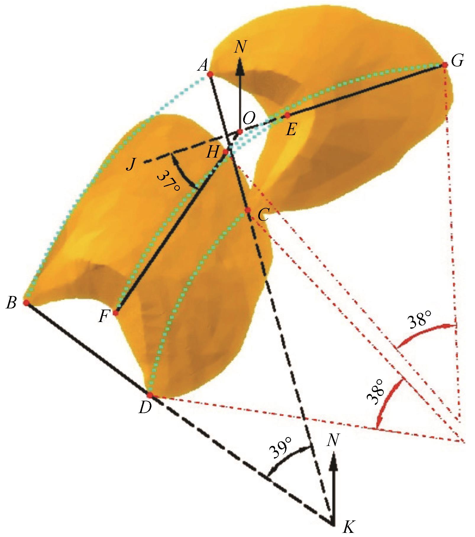
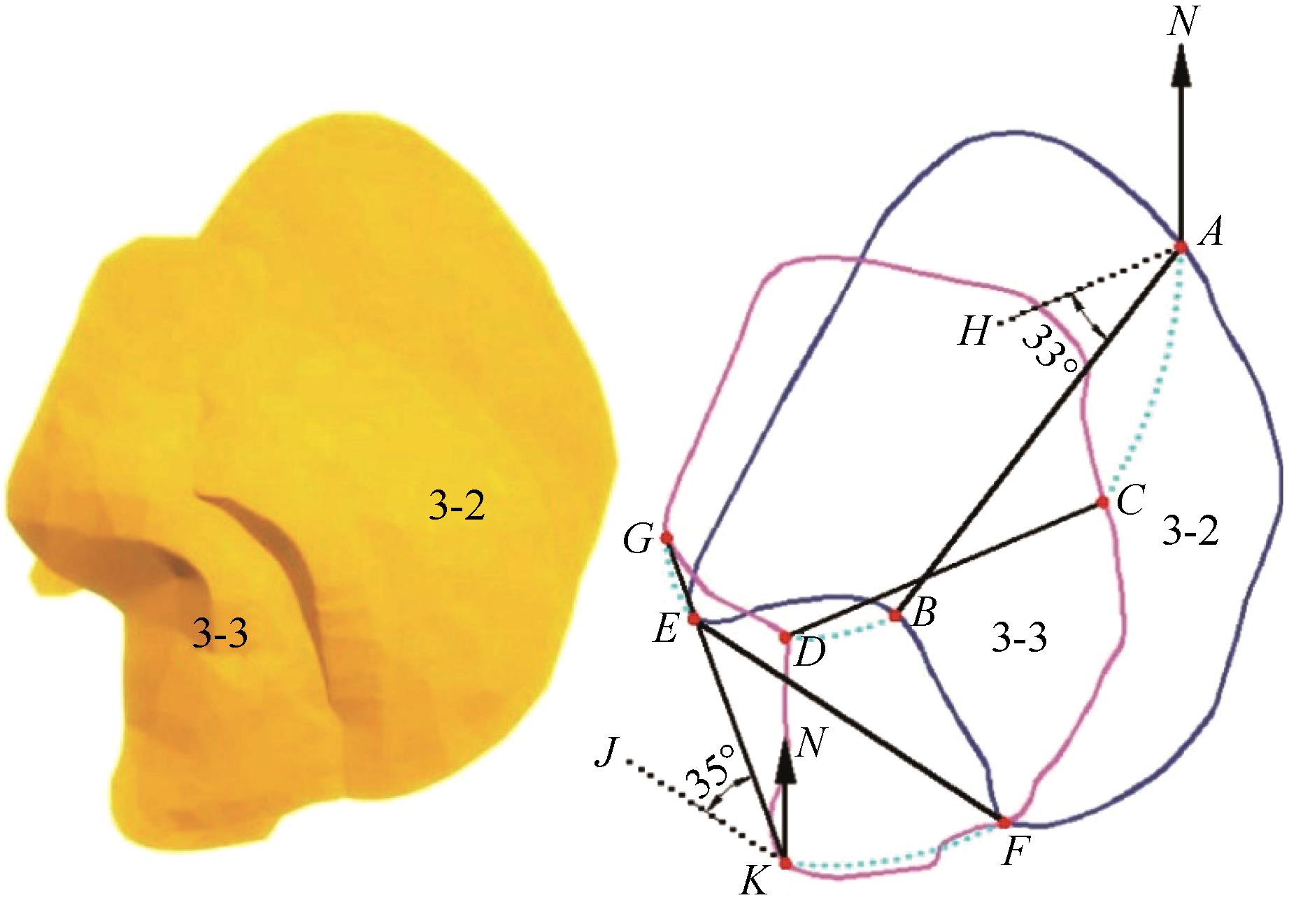
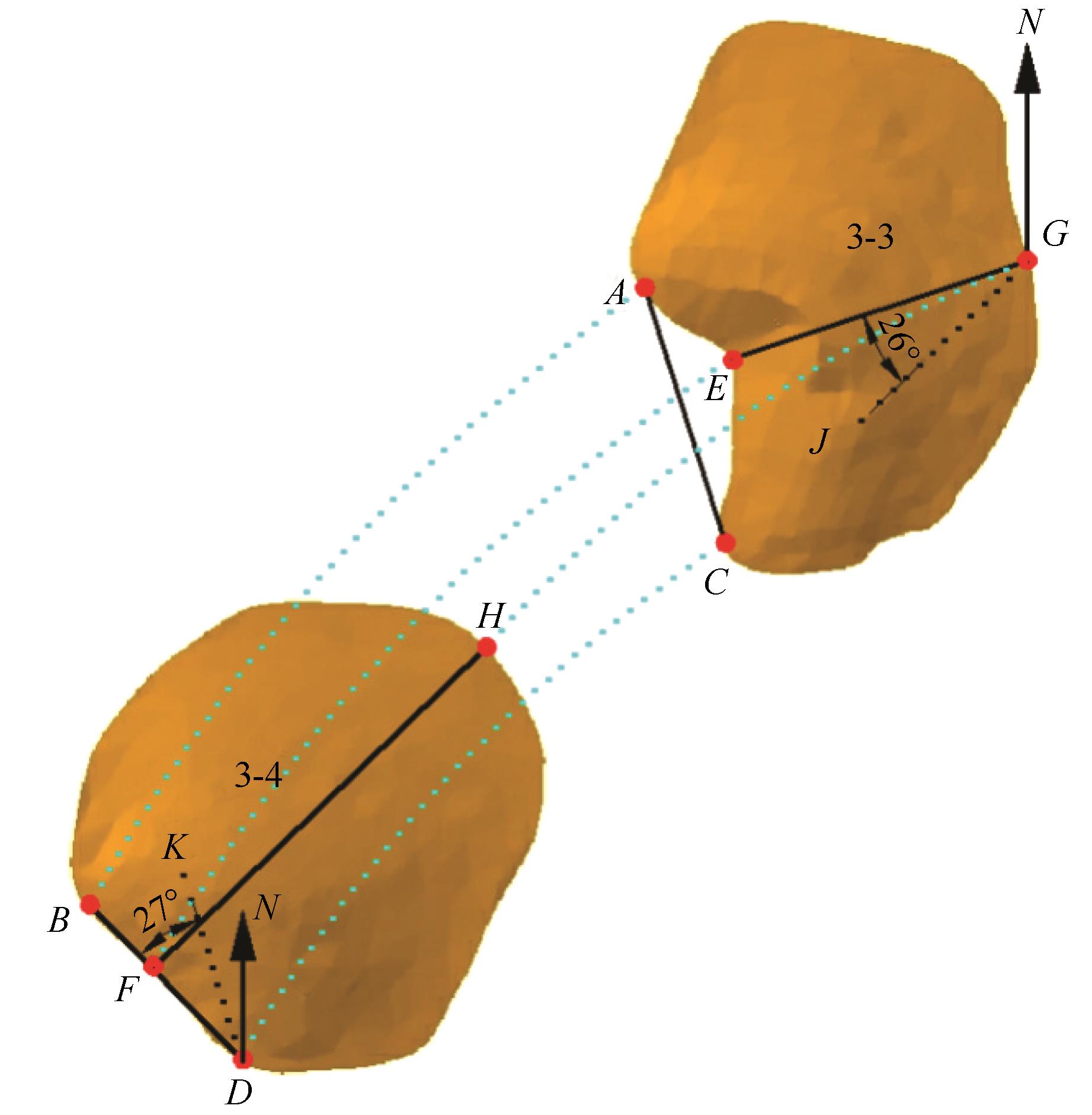
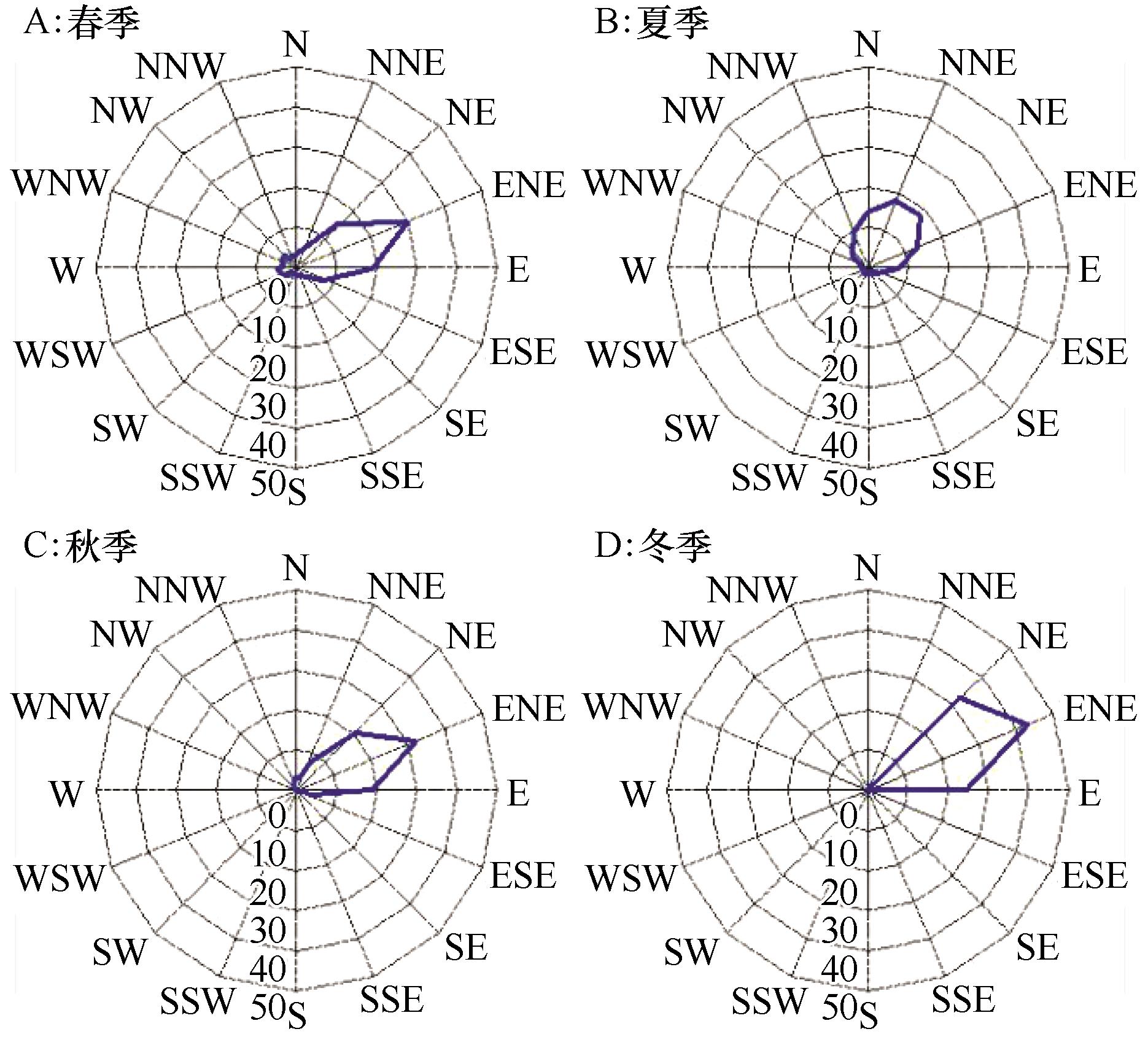
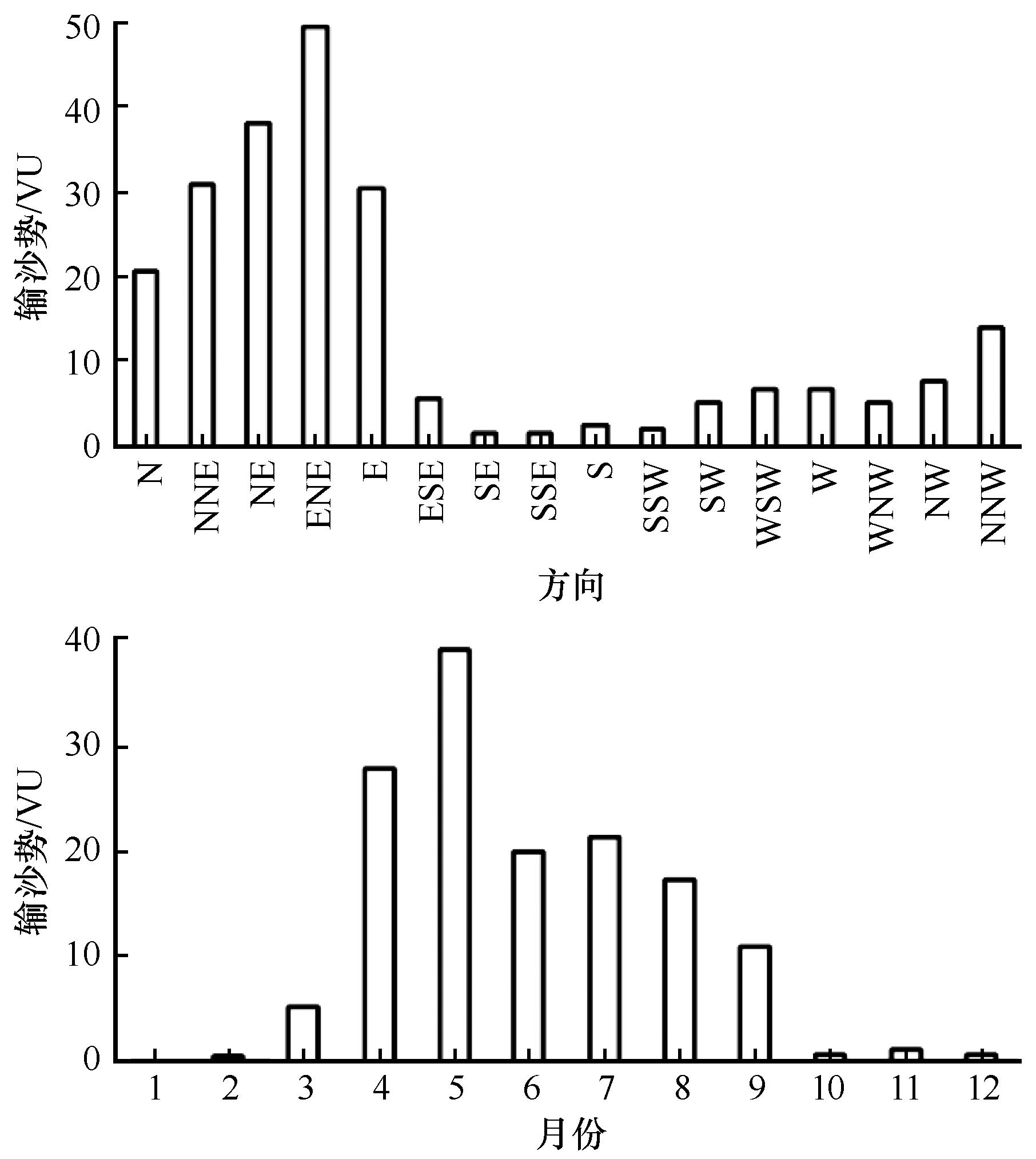
在塔克拉玛干沙漠腹地的新月形沙丘演变监测区,运用华测X90 GNSS接收机RTK工作模式,获取精度为毫米级的高时空分辨率三维坐标数据。利用CASS 9.0和ArcGIS 10.0建立沙丘三维数字模型并对相邻监测期的三维数字模型进行叠加,在AutoCAD 2010中利用起点、端点和夹角三要素,对8个典型沙丘对应特征点移动轨迹曲线进行拟合。结果表明:在第1、2和第3、4监测期间,沙丘逆时针旋转角度分别为33°~38°和25.5°~30°,移动轨迹均为自NE指向SW且凸向NW的曲线,长度较大;在第2、3监测期间,沙丘顺时针旋转角度为31°~37°,移动轨迹均为自NE指向SW且凸向SE或SW的曲线,方向不一,长度较小。测区NNE、N和NNW向有效起沙风与沙丘轴向线的北偏角>30°,E和ENE向有效起沙风与轴向线的南偏角>30°时,沙丘出现逆时针或顺时针旋转,说明测区沙丘移动轨迹应为曲线而非直线,拟合结果与沙丘实际移动轨迹更吻合。新月形沙丘移动轨迹的拟合可为其他流动性沙丘移动轨迹拟合和正确获取移动距离和速度等第一手研究数据资料提供技术和方法支持,并可为改进和完善流动性沙丘移动速度计算公式,深入研究流动性沙丘移动速度和移动方向相关的诸多问题奠定基础。

关键词: 塔克拉玛干沙漠, 新月形沙丘, 三维数字模型, 移动轨迹拟合

Abstract:

In the hinterlands of the Taklimakan Desert, we monitored barchan dune evolution with the Huace X90 GNSS in RTK working mode to obtain 3D coordinates of a dune with millimeter precision. Using these coordinates, a 3D digital model of the dune was built and the 3D digital models of adjacent monitoring periods were superimposed with CASS 9.0 and ArcGIS 10.0. AutoCAD 2010 was used to draw an arc with the three elements of starting point, end point and included angle and to fit the corresponding characteristic point trajectory curve of the eight selected typical dunes. Results of the fitting showed that the dunes rotated counterclockwise with ranges of 33°-38° and 25.5°-30° in the monitoring intervals between stages one and two and stages three and four, respectively. The moving trajectories were curves pointing from NE to SW and convex to NW, with long lengths. Between stages two and three, the dunes rotated clockwise with a range of 31°-37°, and the trajectories was curves pointing from NE to SW and convex to SE or SW, with varying direction and a short length. When the northward or southward angle between effective sand-driving wind and the axial direction was larger than 30°, the dune rotated clockwise or counterclockwise, respectively. This indicates that the moving trajectory should be a curve rather than a straight line, which would result in a better fit with the actual movement of the dune. Accurately fitting the moving trajectory of barchan dunes can assist in learning how to fit the movement of other mobile dunes as well as how to correct raw dune evolution data, such as moving distance and speed. It can also lay a foundation for the improvement of a formula for moving speed, which is important because many fields of research concern the moving speed and direction of mobile dunes.

Key words: Taklimakan Desert, barchan dune, 3D digital model, fitting moving trajectory

中图分类号: