img

官方微信

高级检索

中国沙漠 ›› 2026, Vol. 46 ›› Issue (4): 354-364.DOI: 10.7522/j.issn.1000-694X.2025.00271

• • 上一篇    下一篇

基于SNIC分割的干旱区光伏场植被响应识别

钟文1,2(), 王让会1(), 孙茂森1,3   

  1. 1.南京信息工程大学 生态与应用气象学院,江苏 南京 220001
    2.国家消防救援局南京训练总队,江苏 南京 220001
    3.江苏环保产业技术研究院,江苏 南京 220001
  • 收稿日期:2025-09-26 修回日期:2025-10-30 出版日期:2026-07-20 发布日期:2026-08-27
  • 通讯作者: 王让会
  • 作者简介:钟文(1983—),女,贵州贵阳人,博士研究生,高级工程师,主要研究方向为环境生态学、新能源事故处置等。E-mail: 17787703@qq.com
  • 基金资助:
    山水林田湖草沙一体化保护和修复工程关键问题和关键技术研究项目(AKSSSXM2022620)

Detecting photovoltaic expansion and vegetation responses in arid regions using SNIC-based segmentation

Wen Zhong1,2(), Ranghui Wang1(), Maosen Sun1,3   

  1. 1.School of Ecology and Applied Meteorology,Nanjing University of Information Science and Technology,Nanjing 220001,China
    2.Nanjing Training Corps,National Fire and Rescue Administration,Nanjing 220001,China
    3.Jiangsu Environmental Protection Industry Technology Research Institute,Nanjing 220001,China
  • Received:2025-09-26 Revised:2025-10-30 Online:2026-07-20 Published:2026-08-27
  • Contact: Ranghui Wang

摘要:

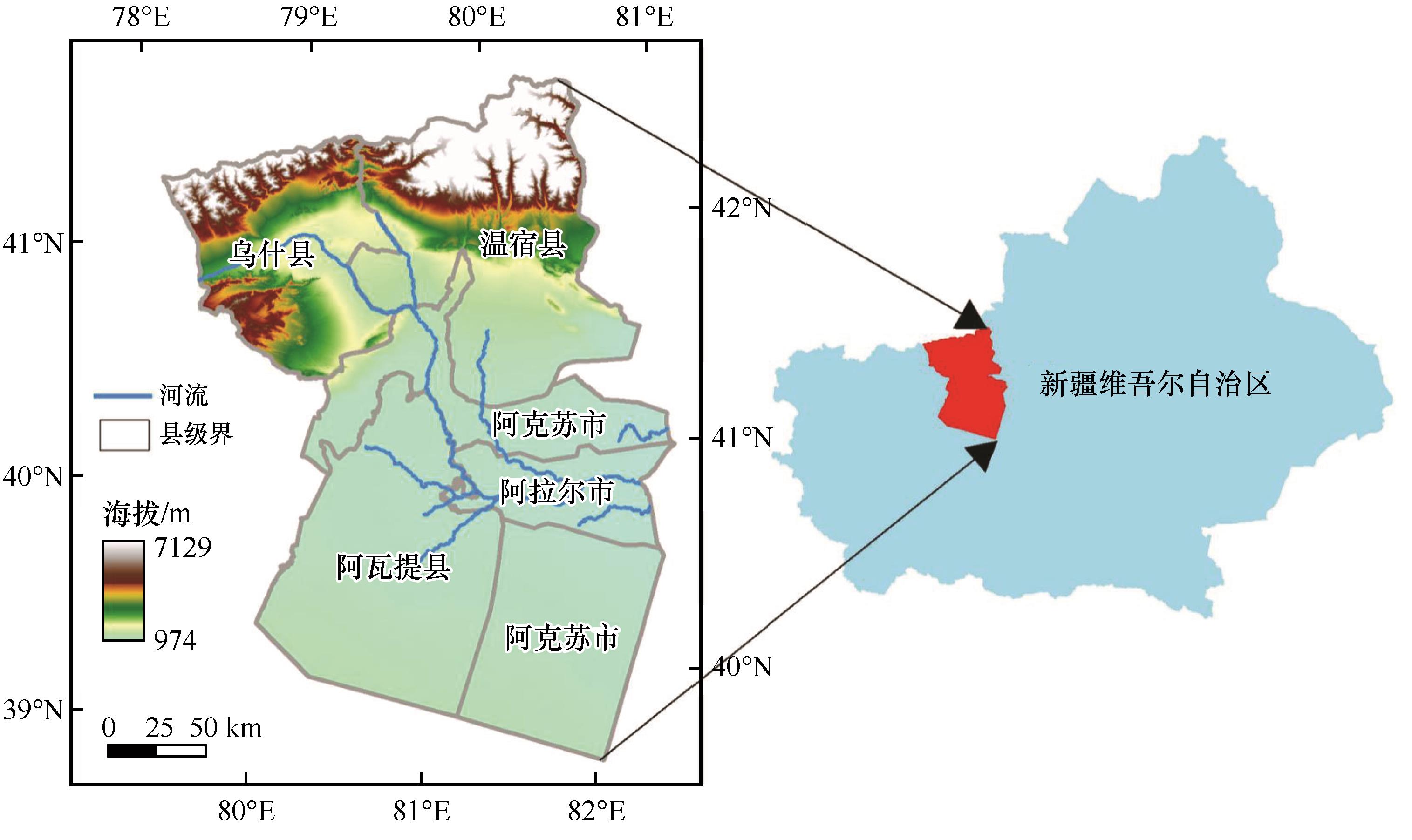
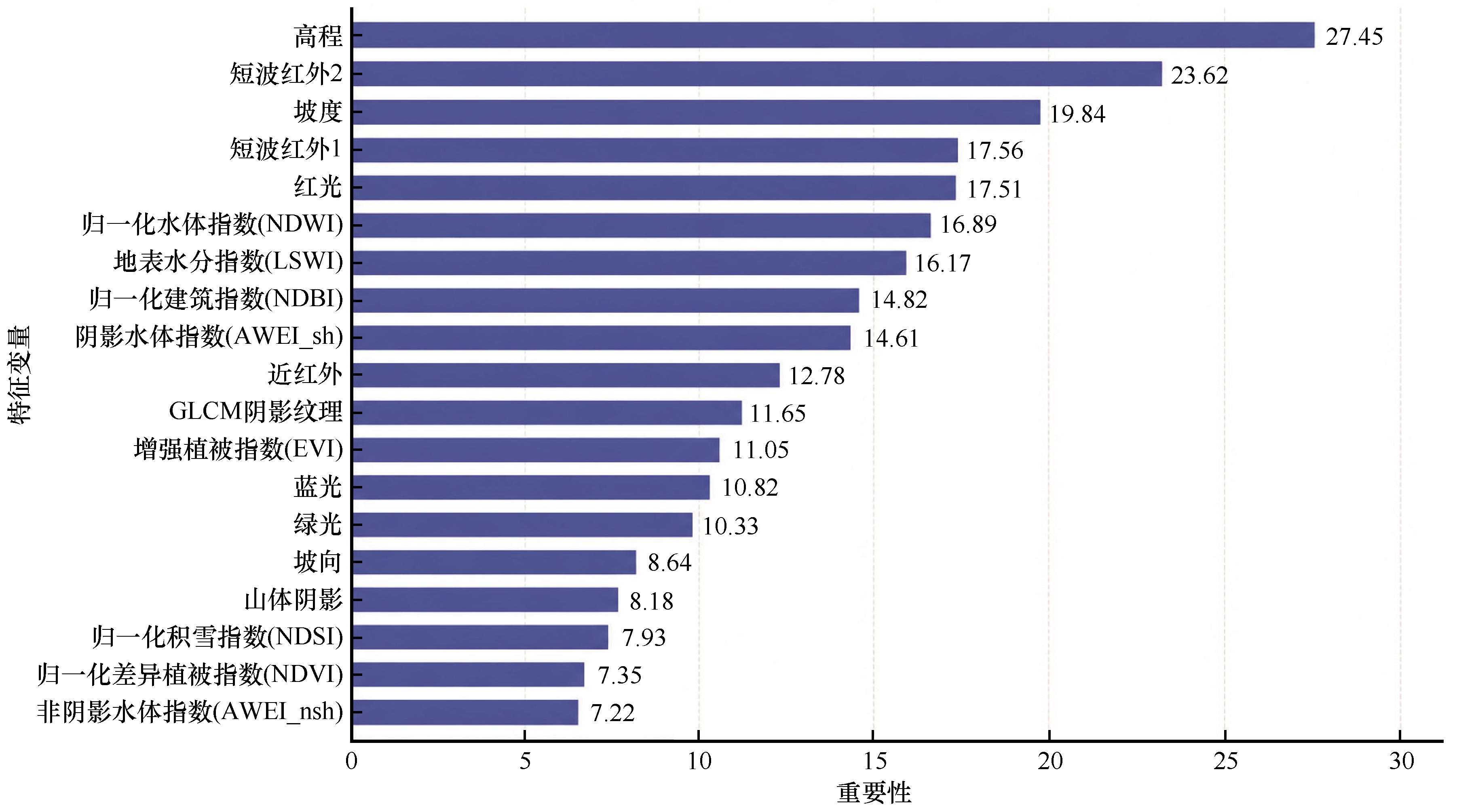
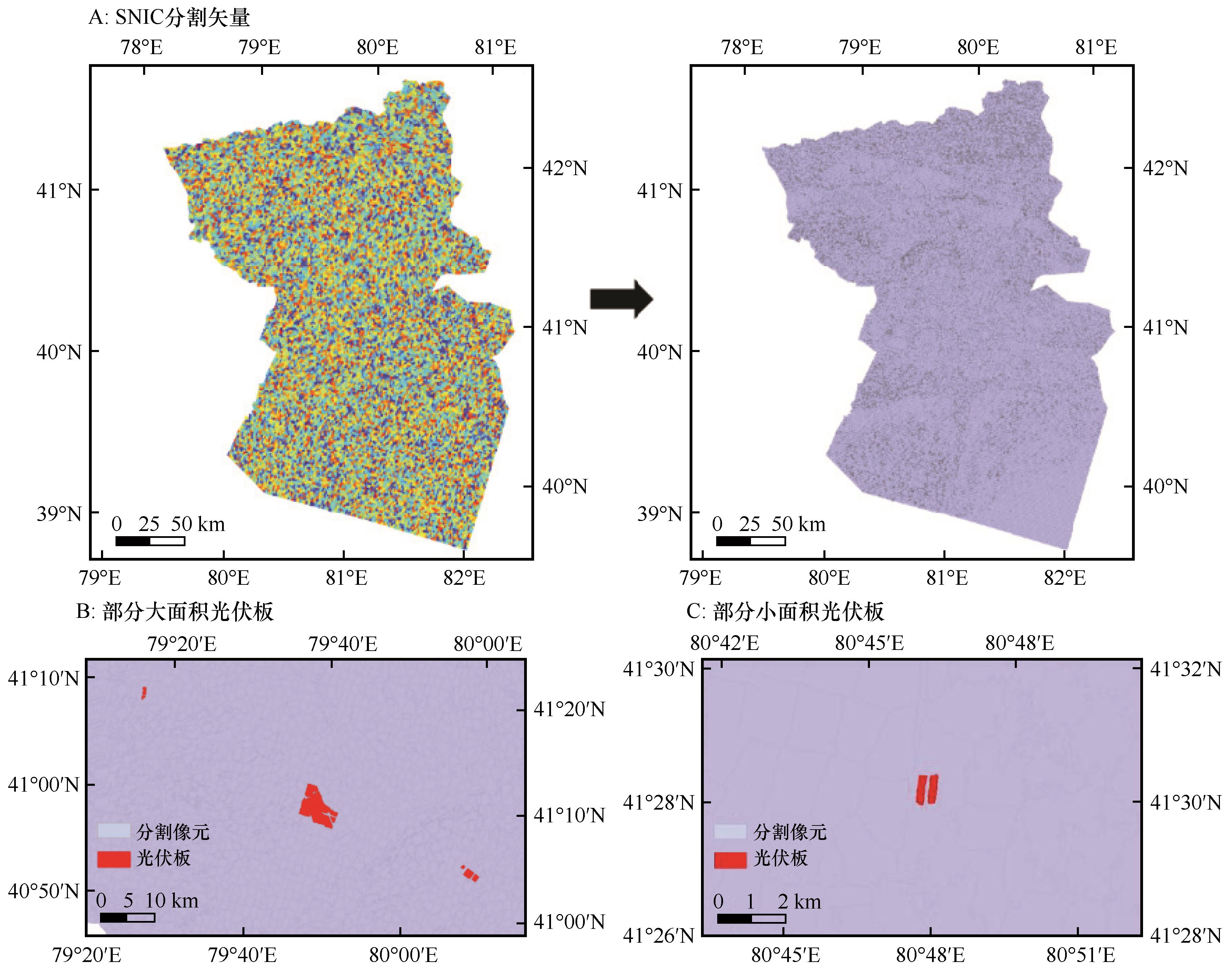
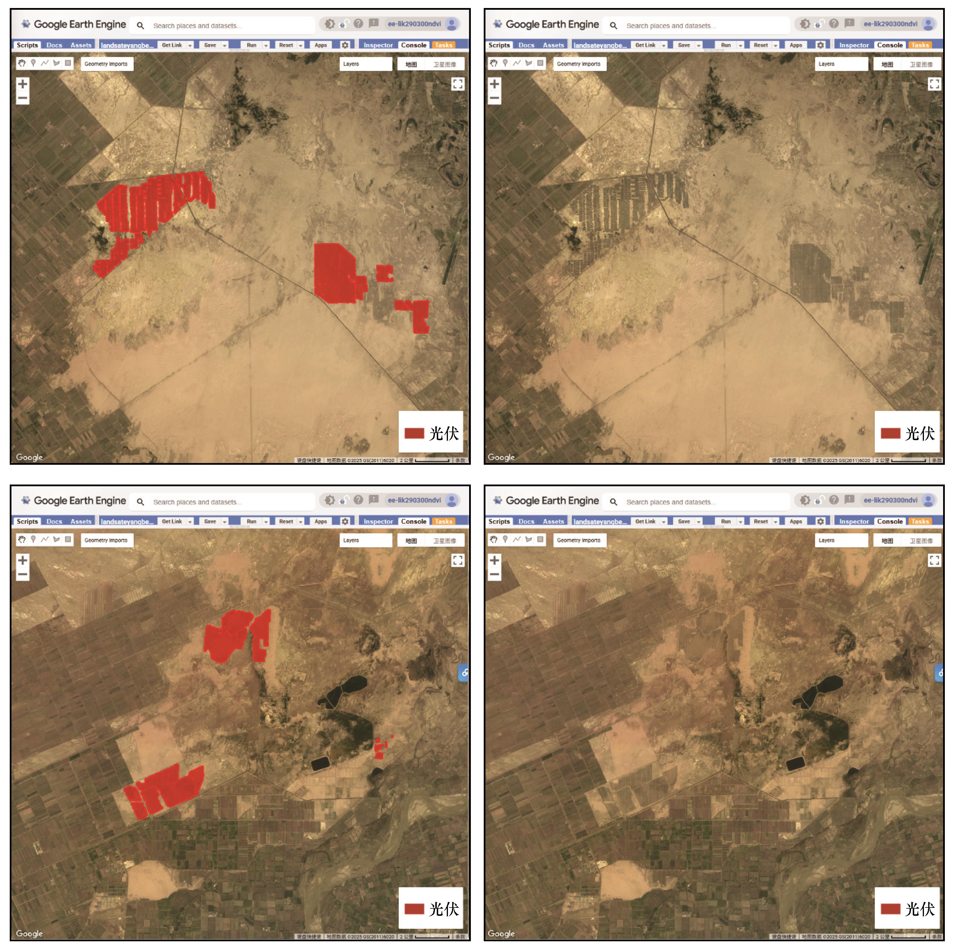
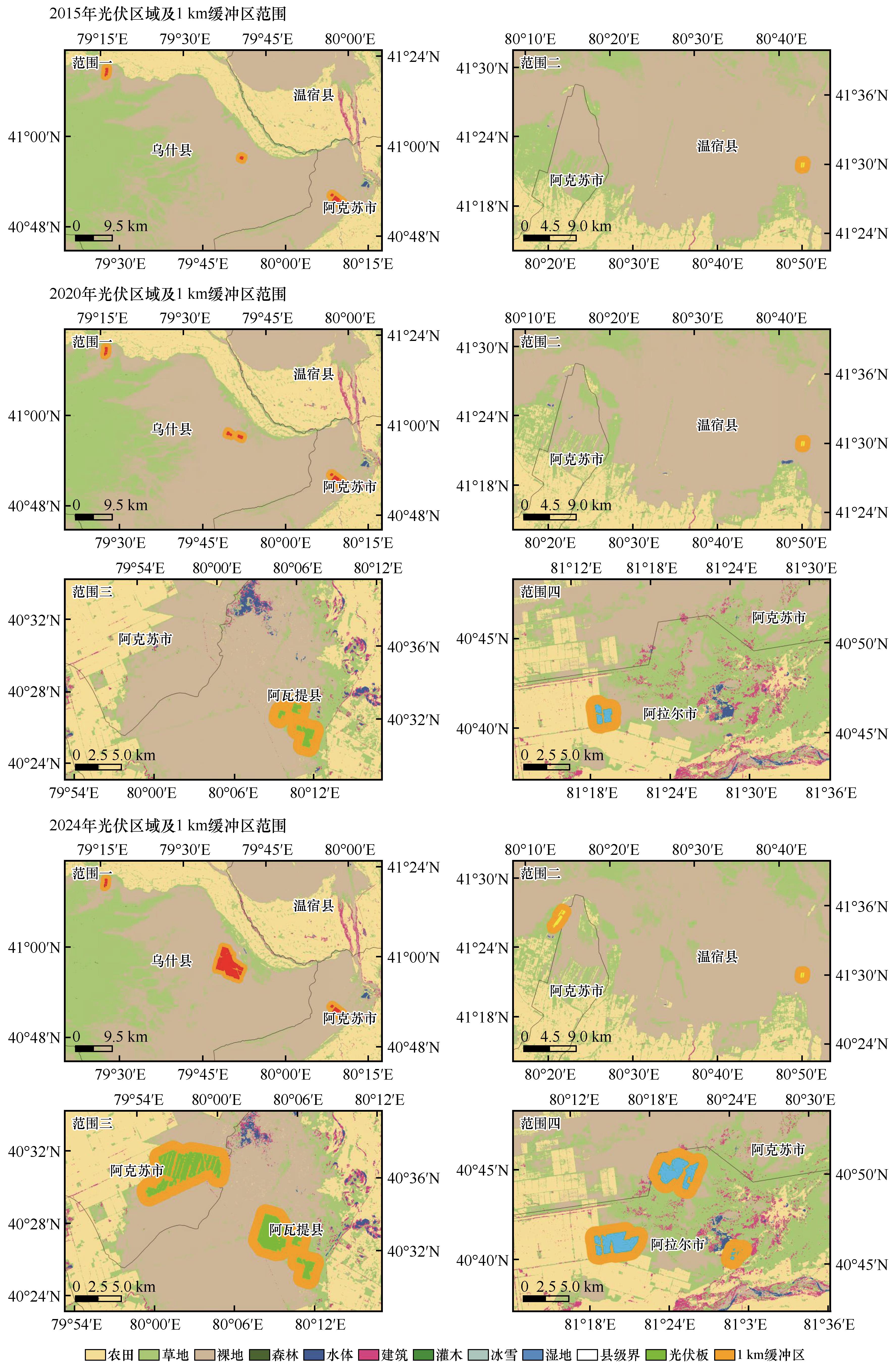
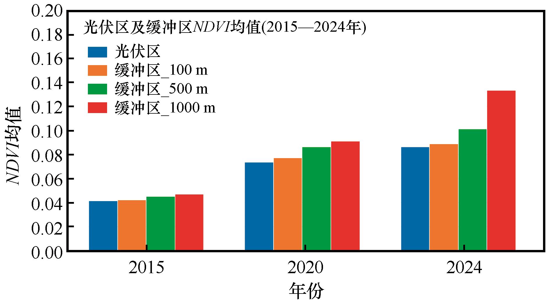
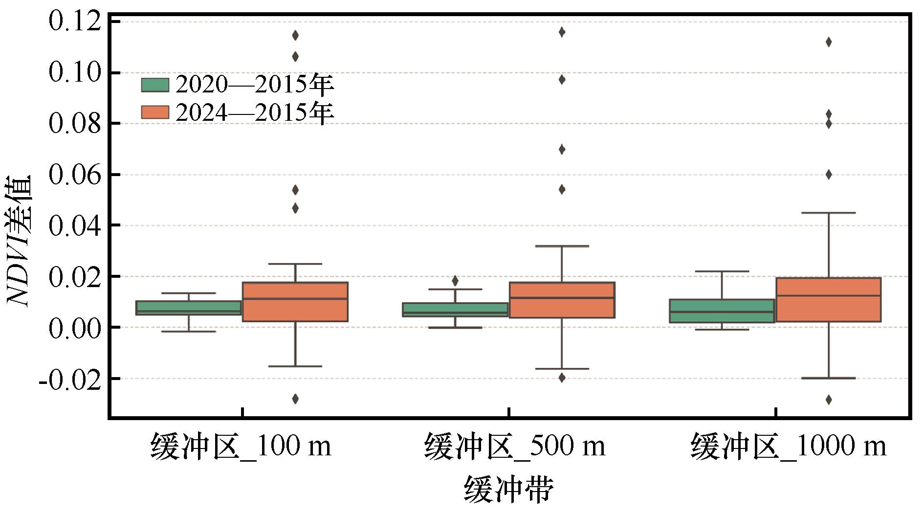
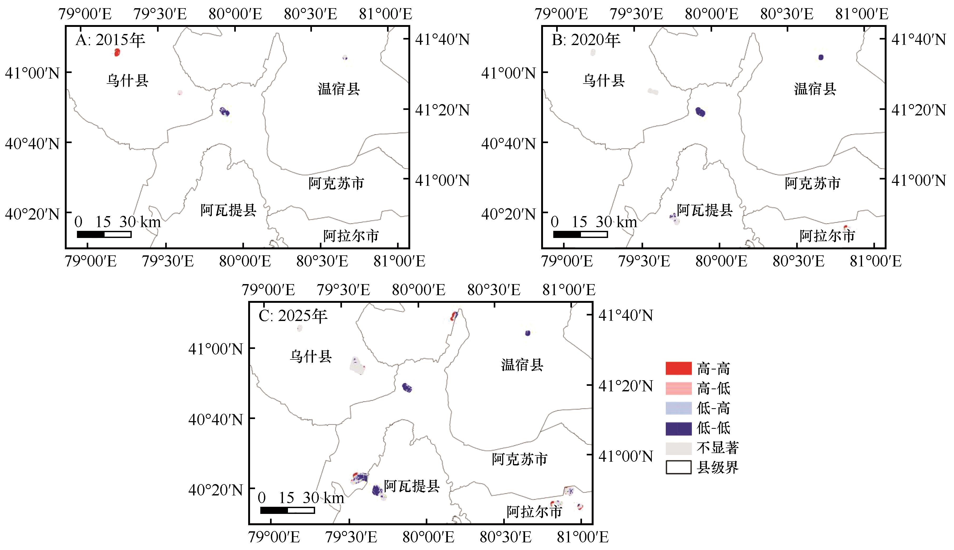
干旱区是光伏开发的重点区域,其生态系统脆弱,对外部扰动高度敏感。为深入评估光伏对区域植被生态格局的影响,本文以新疆阿克苏河流域为研究区,基于2015、2020、2024年Landsat 8多期遥感影像与SRTM地形数据,构建融合光谱、纹理与地形因子的多维特征体系,采用SNIC超像素分割与随机森林分类器开展光伏设施识别与时序变化提取,识别精度达92.6%。进一步基于NDVI生长季(3—9月)平均值,提取光伏区及其多级缓冲区(100、500、1 000 m)植被覆盖变化,并结合全局莫兰指数与LISA聚集分析方法,系统探讨光伏扩展对植被空间格局的动态影响。结果表明:(1)2015—2024年,研究区光伏面积增长超过12倍,呈现出依附交通干线、集中于低坡度沙地的带状—斑块状空间扩展特征;(2)光伏区及其周边缓冲带NDVI整体上升,特别是500 m与1 000 m区域增长显著,呈现中心扰动—边缘恢复的空间梯度格局;(3)NDVI差值分析显示2024年增幅普遍高于2020年,生态效应具有显著的时间滞后性;(4)Moran's I与LISA分析揭示光伏区NDVI具有较强空间正相关性,聚集区从初期的局地“高—高”扩展为片状分布,表明光伏设施在一定程度上具有“生态正外溢效应”;(5)面向对象分类方法结合多源特征在光伏识别中表现出良好适用性与稳定性。

关键词: 光伏识别, NDVI, 干旱区, SNIC分割, 随机森林, 莫兰指数, LISA, 生态响应

Abstract:

Arid regions are key areas for photovoltaic (PV) development, yet their ecosystems are fragile and highly sensitive to external disturbances. This study investigates the spatiotemporal dynamics of PV expansion and its ecological impacts on vegetation in the Aksu River Basin, Xinjiang, China. Using multi-temporal Landsat 8 imagery from 2015, 2020, and 2024, combined with SRTM DEM data, a multi-dimensional feature set integrating spectral, texture, and topographic variables was constructed. Object-oriented classification based on SNIC superpixel segmentation and Random Forest algorithm was applied for accurate PV facility identification, achieving an overall accuracy of 92.6%. Based on NDVI annual maxima, vegetation changes within PV areas and their 100 m, 500 m, and 1000 m buffer zones were extracted. Global Moran's I and LISA statistics were employed to assess spatial clustering and ecological responses. The results show: (1) From 2015 to 2024, PV area expanded more than 12-fold, with a "belt-patch" spatial pattern concentrated along transportation routes and low-slope sandy lands; (2) NDVI increased across all buffer zones, especially in the 500 m and 1000 m zones, forming a spatial gradient of “central disturbance-peripheral restoration”; (3) NDVI differences in 2024 were significantly higher than in 2020, indicating a clear time-lagged ecological effect; (4) Spatial autocorrelation analysis revealed strong positive clustering of NDVI, with High-High (HH) clusters expanding from local patches to regional scales, suggesting a potential “positive ecological spillover effect” of PV development; (5) The object-based approach integrating multi-source features demonstrated high accuracy and robustness in PV mapping. This study provides technical references and scientific support for ecological assessment and sustainable planning of PV deployment in arid regions.

Key words: PV detection, NDVI, arid regions, SNIC segmentation, random forest, Moran's I, LISA, ecological response

中图分类号: