img

官方微信

高级检索

中国沙漠 ›› 2021, Vol. 41 ›› Issue (5): 210-218.DOI: 10.7522/j.issn.1000-694X.2021.00073

• • 上一篇    下一篇

河套绿洲土地覆盖类型变化特征及驱动因素

刘立平1(), 刘良旭2,4(), 连杰3, 卢建男2, 王国林5   

  1. 1.河套学院,内蒙古 巴彦淖尔 015000
    2.中国科学院西北生态环境资源研究院,乌拉特荒漠草原研究站,甘肃 兰州 730000
    3.中国科学院西北生态环境资源研究院,奈曼沙漠化研究站,甘肃 兰州 730000
    4.中国科学院地球环境研究所 黄土与第四纪地质国家重点实验室,陕西 西安 710000
    5.乌拉特梭梭林蒙古野驴国家级自然保护区乌拉特后旗管理站,内蒙古 巴彦淖尔 015000
  • 收稿日期:2021-03-16 修回日期:2021-05-24 出版日期:2021-09-20 发布日期:2021-09-23
  • 通讯作者: 刘良旭
  • 作者简介:刘良旭(E-mail: lxliu@lzb.ac.cn
    刘立平(1965—),男,内蒙古临河人,副教授,主要研究方向为大数据、自动化、计算机绘图。E-mail: 601970200@qq.com
  • 基金资助:
    国家科技基础资源调查专项(Y71ZD42001);黄土与第四纪地质国家重点实验室开放基金项目(SKLLQG1915);中国科学院西北生态环境资源研究院青年人才成长基金(Y851D01)

Land cover type change characteristics and driving factors in Hetao oasis

Liping Liu1(), Liangxu Liu2,4(), Jie Lian3, Jiannan Lu2, Guolin Wang5   

  1. 1.Hetao University,Bayannur 015000,Inner Mongolia,China
    2.Urat Desert-grassland Research Station /, Northwest Institute of Eco-Environment and Resources,Chinese Acdemy of Sciences,Lanzhou 730000,China
    3.Naiman Desertification Research Station, Northwest Institute of Eco-Environment and Resources,Chinese Acdemy of Sciences,Lanzhou 730000,China
    4.State Key Laboratory of Loess and Quaternary Geology,Institute of Earth Environment,Urad Rear Banner,Xi’an 710000,China
    5.National Nature Reserve Management Station of Haloxylon Forest and Mongolia Wild Donkey in Urad Rear Banner,Bayannur 015000,Inner Mongolia,China
  • Received:2021-03-16 Revised:2021-05-24 Online:2021-09-20 Published:2021-09-23
  • Contact: Liangxu Liu

摘要:

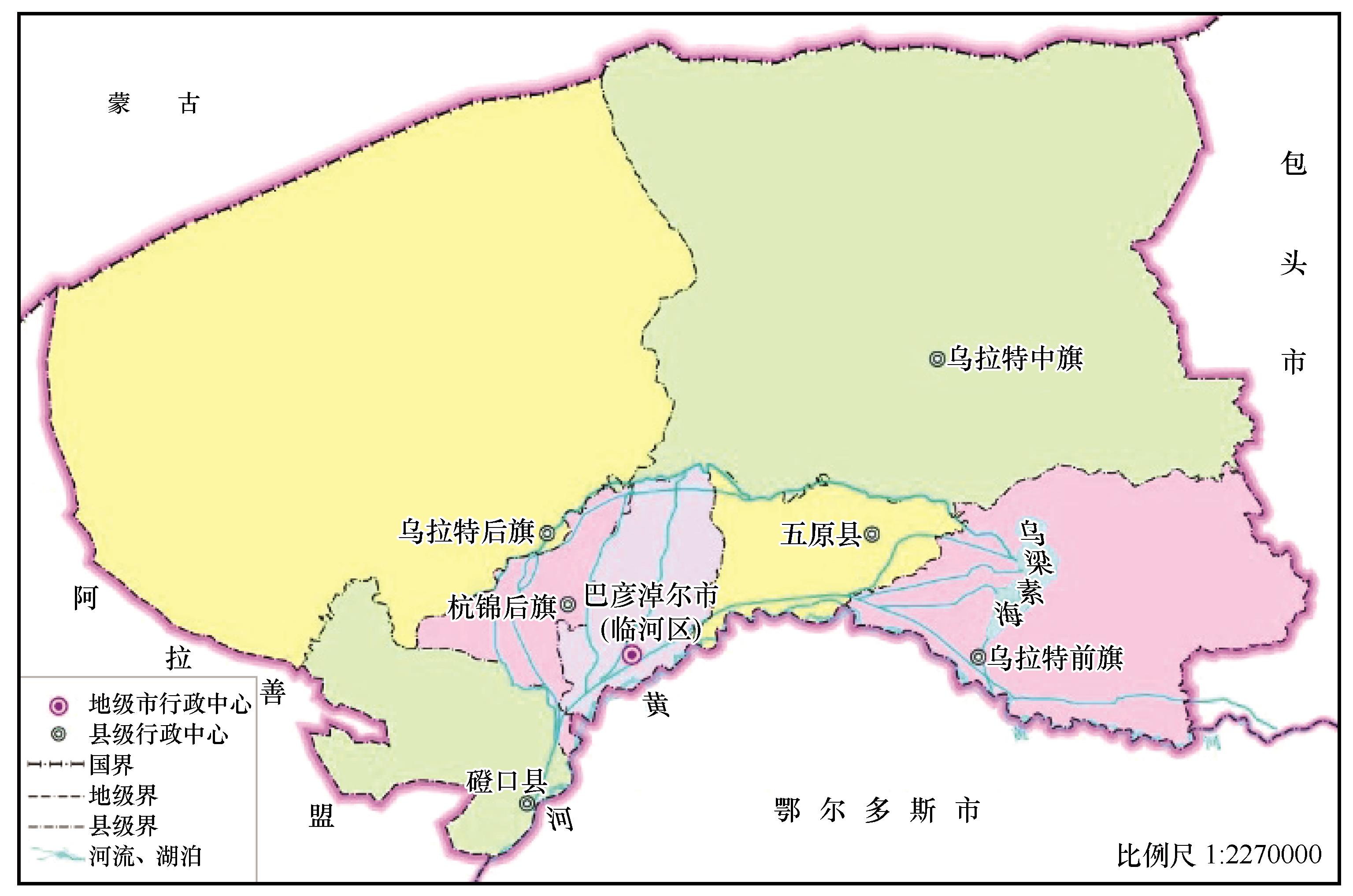
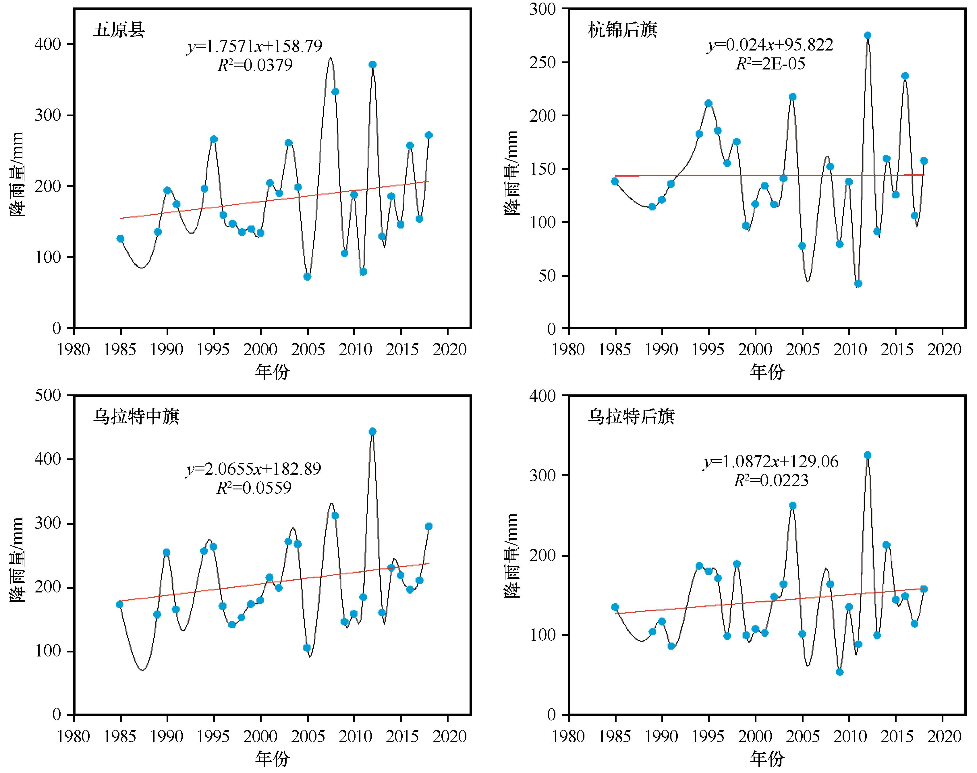
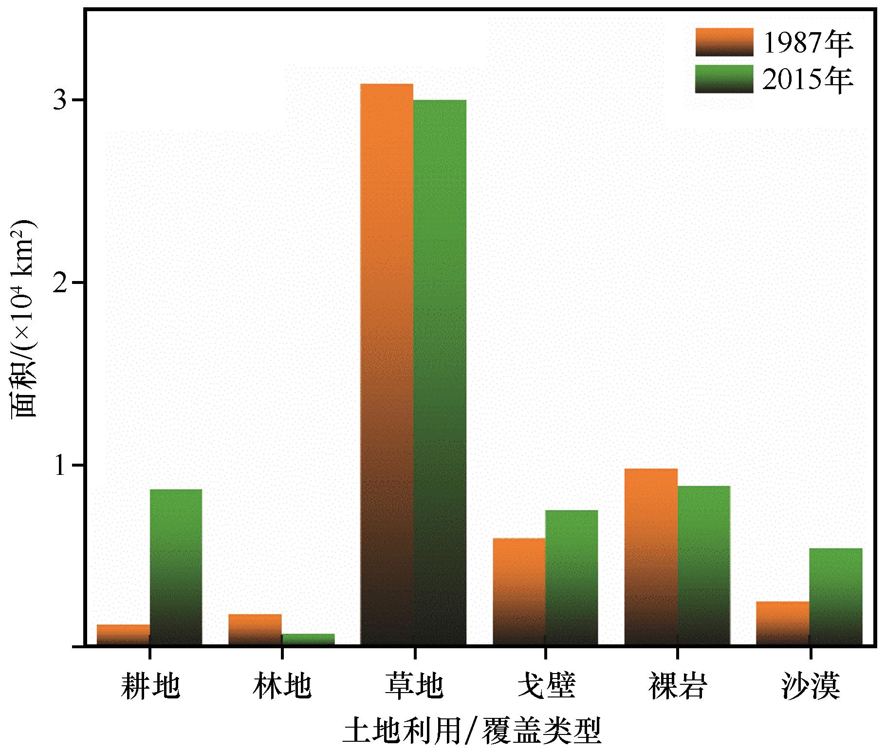
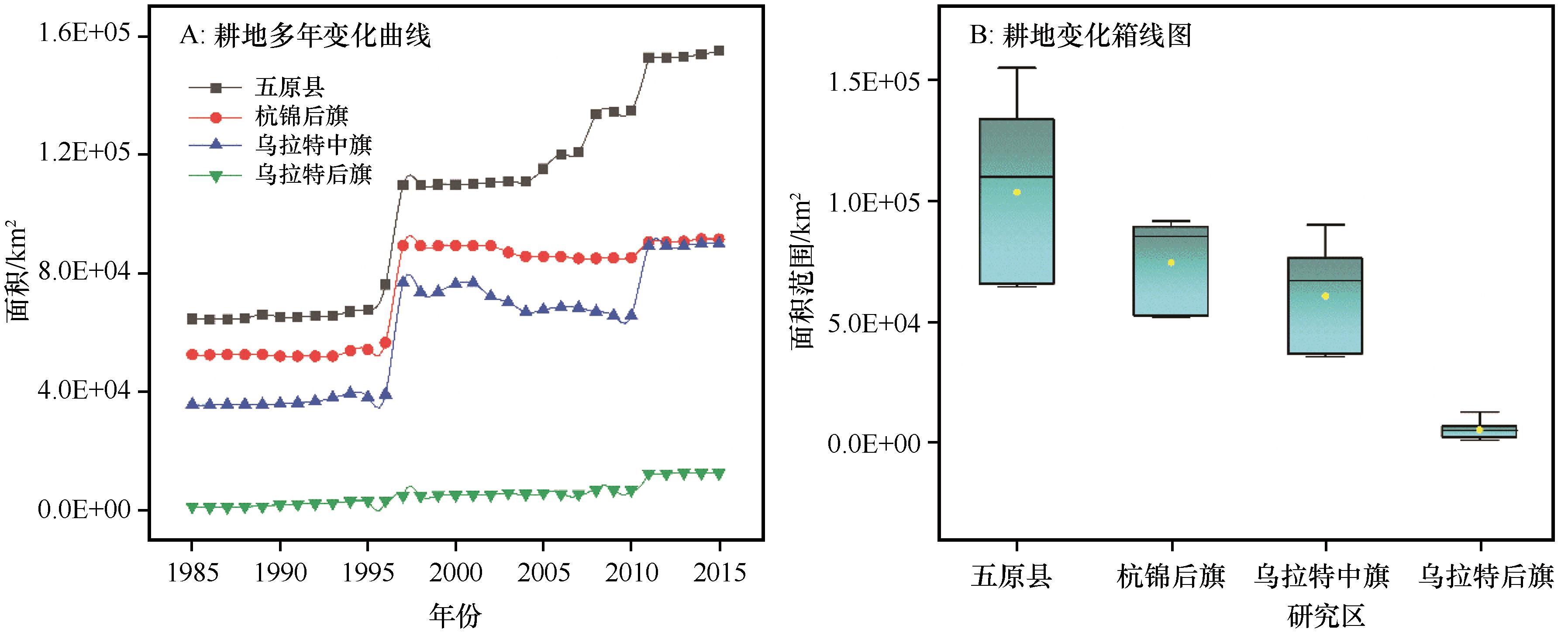
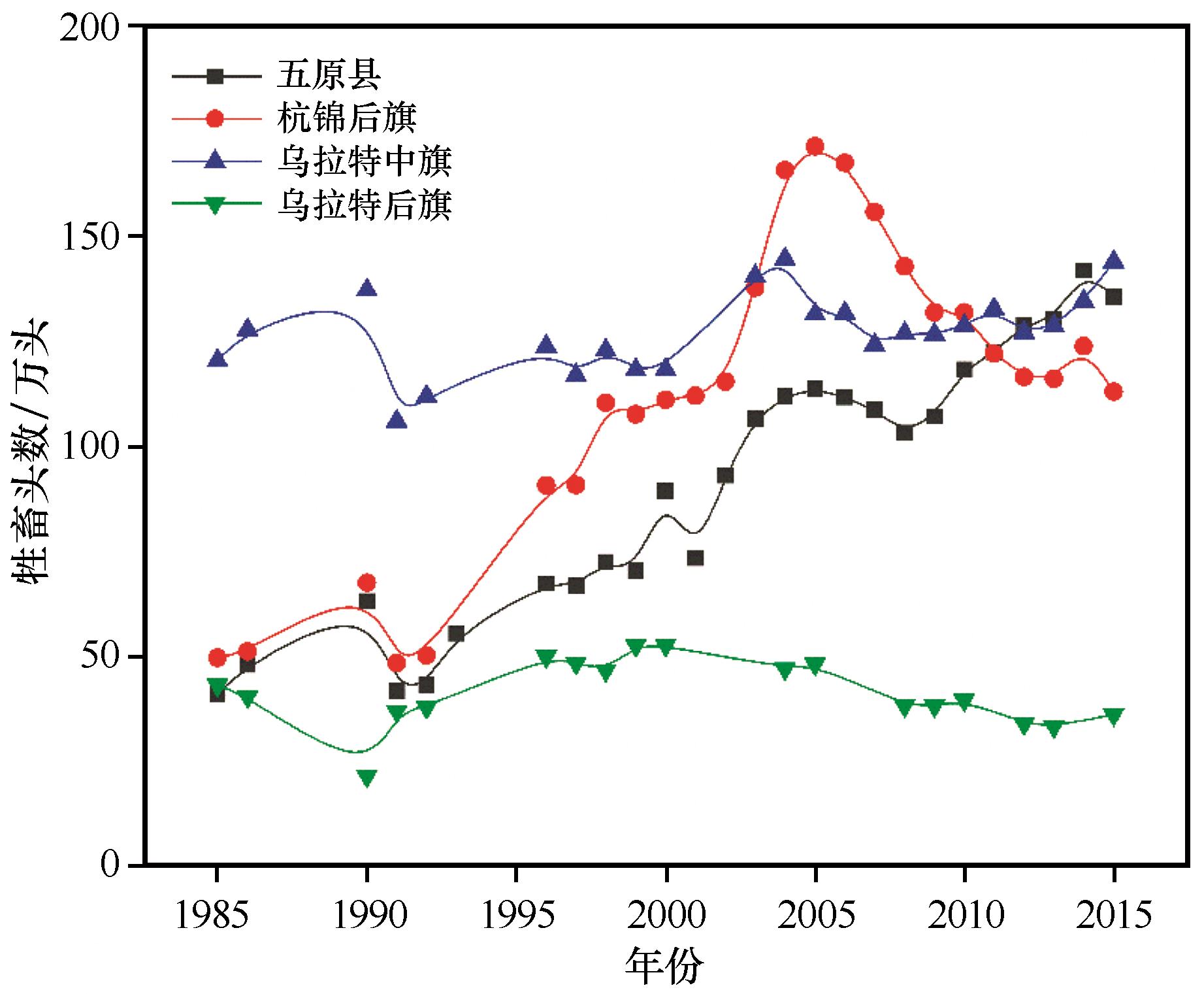
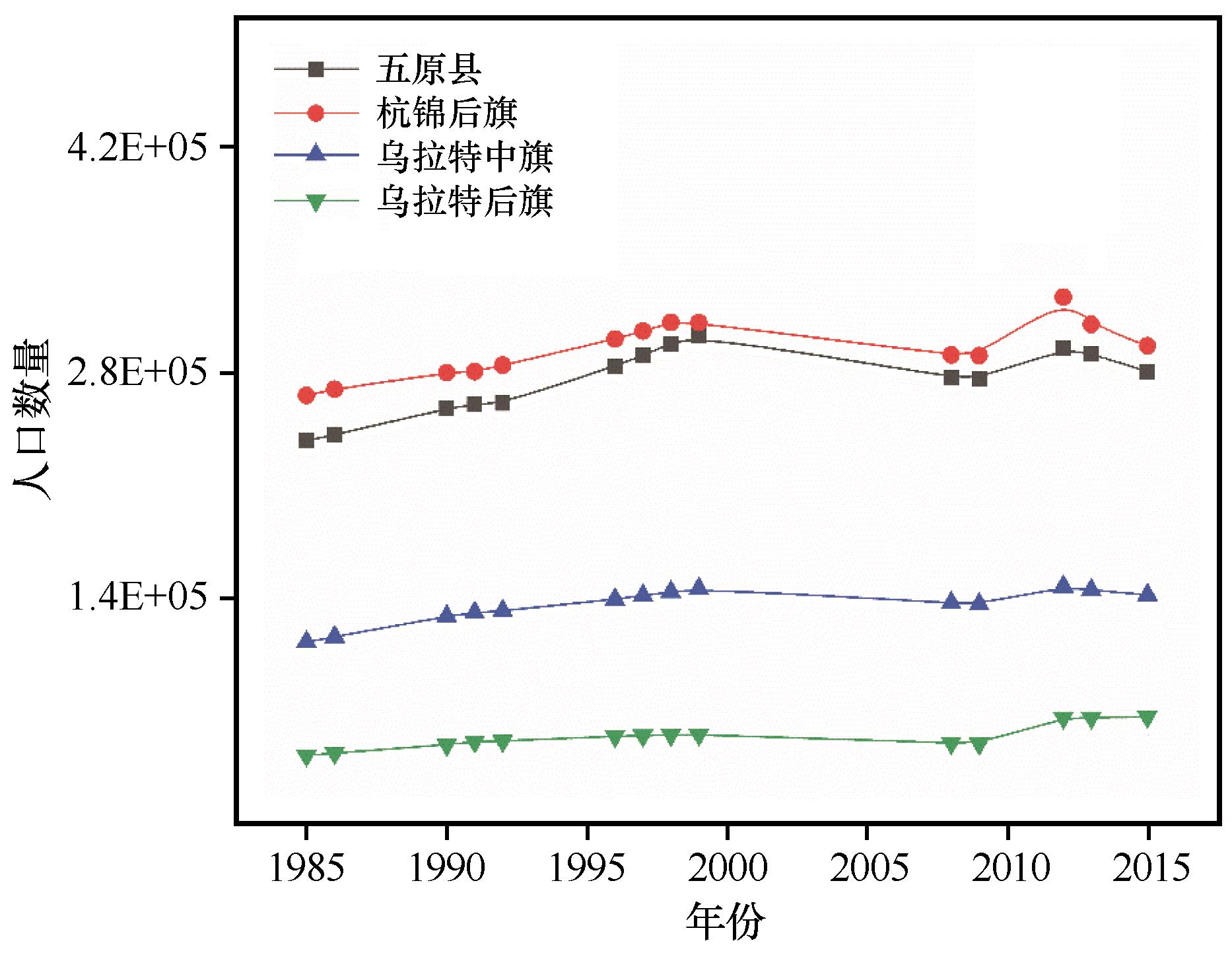
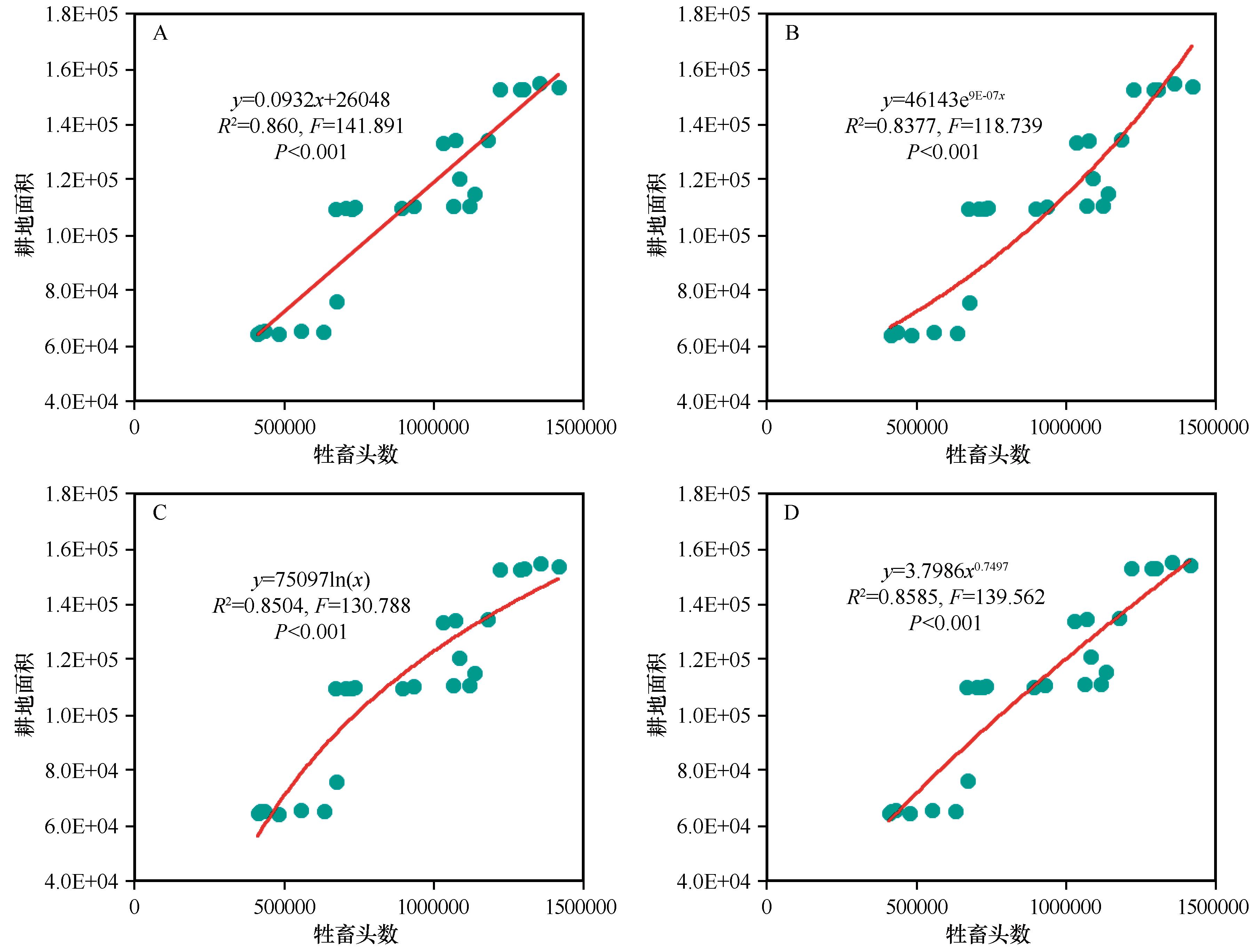
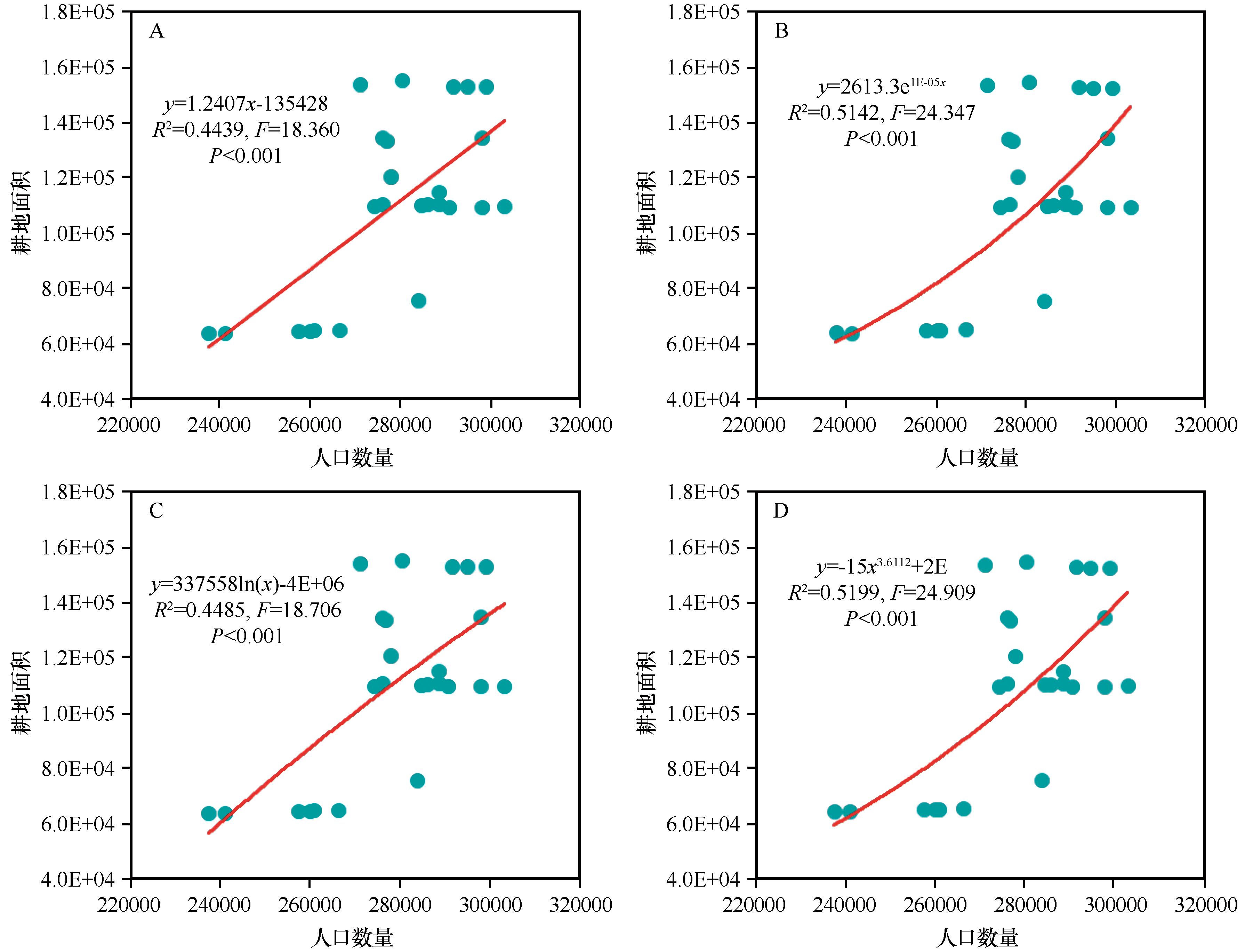
土地覆盖类型变化对生态系统的结构和功能具有深远影响。以巴彦淖尔市阴山北麓的乌拉特后旗和乌拉特中旗、阴山南麓河套绿洲的五原县和杭锦后旗为研究区,以区域内统计资料(1985—2018年)为主要数据源,结合1987全国土壤调查和2015年卫星遥感数据解译获得的土地覆盖数据,分析了研究区土地覆盖类型变化特征以及年降水量、人口数量、家畜数量和主要土地覆盖类型之间拟合关系。结果显示:耕地面积和人工林地面积持续增加,而草地面积出现减小。耕地面积与人口数量和家畜数量显著正相关,而与年降水量关系不显著,最优拟合方程分别为y=1.2407x-235428和y=2613.3e1E-05x

关键词: 土地利用, 河套平原, 耕地变化, 曲线拟合

Abstract:

Land use change is one of the driving forces of land cover change and has an important impact on the structure and function of the desert-oasis ecosystems. Taking Urad Rear Banner and Urad Middle Banner (two counties) located in the northern part of Yin Mountain as well as Wuyuan county and Hanggin Rear Banner right to the south of Yin mountains as research region, and the statistical data in this region, the relation among the annual precipitation, population, livestock number, and land use cover have been analyzed, with the interpretation data of the satellite images in 1987 and 2015. The results showed that cropland was increased, grassland decreased, and the planted woodland decreased too and there are significant relationships between population and livestock number and cropland, and the relationship between the three before with annual precipitation is not significant, the best fitting equations are respectively y=1.2407x-235428 and y=2613.3e1E-05x. This research could supply a solid data and theoretical support to the sustainable land use and high-quality development of the Hetao section of the Yellow River in Inner-Mongolia.

Key words: land use, Hetao Plain, cultivated land change, curve fitting

中图分类号: