img

官方微信

高级检索

中国沙漠 ›› 2026, Vol. 46 ›› Issue (2): 312-322.DOI: 10.7522/j.issn.1000-694X.2026.00020

• • 上一篇    

东北典型风蚀区不同土地利用方式下的风沙活动强度特征

赵馨茹1(), 韩雪晴1, 梁羽石1,2(), 张瑜3, 王大中4, 李庆5, 郭中领6, 沈海鸥1,2   

  1. 1.吉林农业大学,资源与环境学院,吉林 长春 130118
    2.吉林农业大学,秸秆综合利用与黑土地保护教育部重点实验室,吉林 长春 130118
    3.吉林省水利科学研究院,吉林 长春 130022
    4.吉林省水土保持科学研究院,吉林 长春 130000
    5.河北省科学院 地理科学研究所/河北省地理信息开发应用工程技术研究中心,河北 石家庄 050021
    6.河北师范大学 地理科学学院,河北 石家庄 050024
  • 收稿日期:2025-12-21 修回日期:2026-02-08 出版日期:2026-03-20 发布日期:2026-04-13
  • 通讯作者: 梁羽石
  • 作者简介:赵馨茹(2003—),女,吉林白城人,硕士研究生,主要从事土壤风蚀过程研究。E-mail: zhaoxinru@mails.jlau.edu.cn
  • 基金资助:
    国家自然科学基金项目(42401007);吉林省自然科学基金-自由探索项目(YDZJ202501ZYTS488)

Characteristics of aeolian sand activity intensity under different land-use types in a typical wind erosion region of Northeast China

Xinru Zhao1(), Xueqing Han1, Yushi Liang1,2(), Yu Zhang3, Dazhong Wang4, Qing Li5, Zhongling Guo6, Haiou Shen1,2   

  1. 1.College of Resources and Environment /, Jilin Agricultural University,Changchun 130118,China
    2.Ministry of Education Key Laboratory of Straw Comprehensive Utilization and Black Soil Conservation, Jilin Agricultural University,Changchun 130118,China
    3.Jilin Province Water Resources Research Institute,Changchun 130022,China
    4.Institute of Soil and Water Conversation of Jilin Province,Changchun 130000,China
    5.Institute of Geographical Sciences / Hebei Engineering Research Center for Geographic Information Application,Hebei Academy of Sciences,Shijiazhuang 050021,China
    6.School of Geographical Sciences,Hebei Normal University,Shijiazhuang 050024,China
  • Received:2025-12-21 Revised:2026-02-08 Online:2026-03-20 Published:2026-04-13
  • Contact: Yushi Liang

摘要:

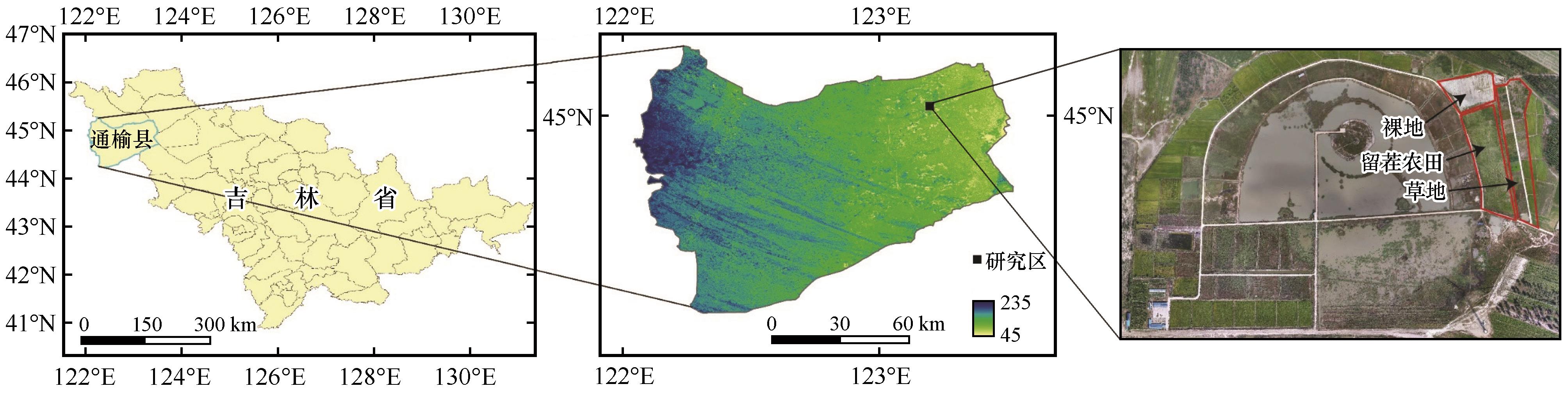
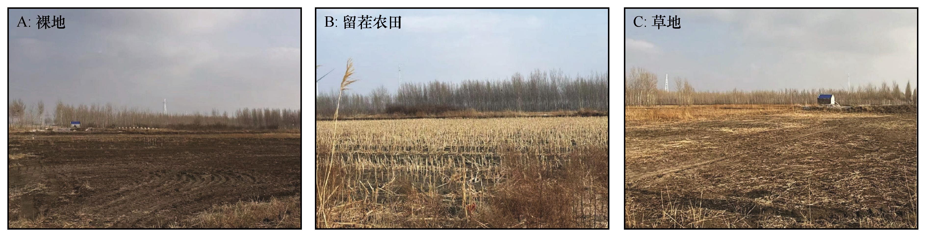
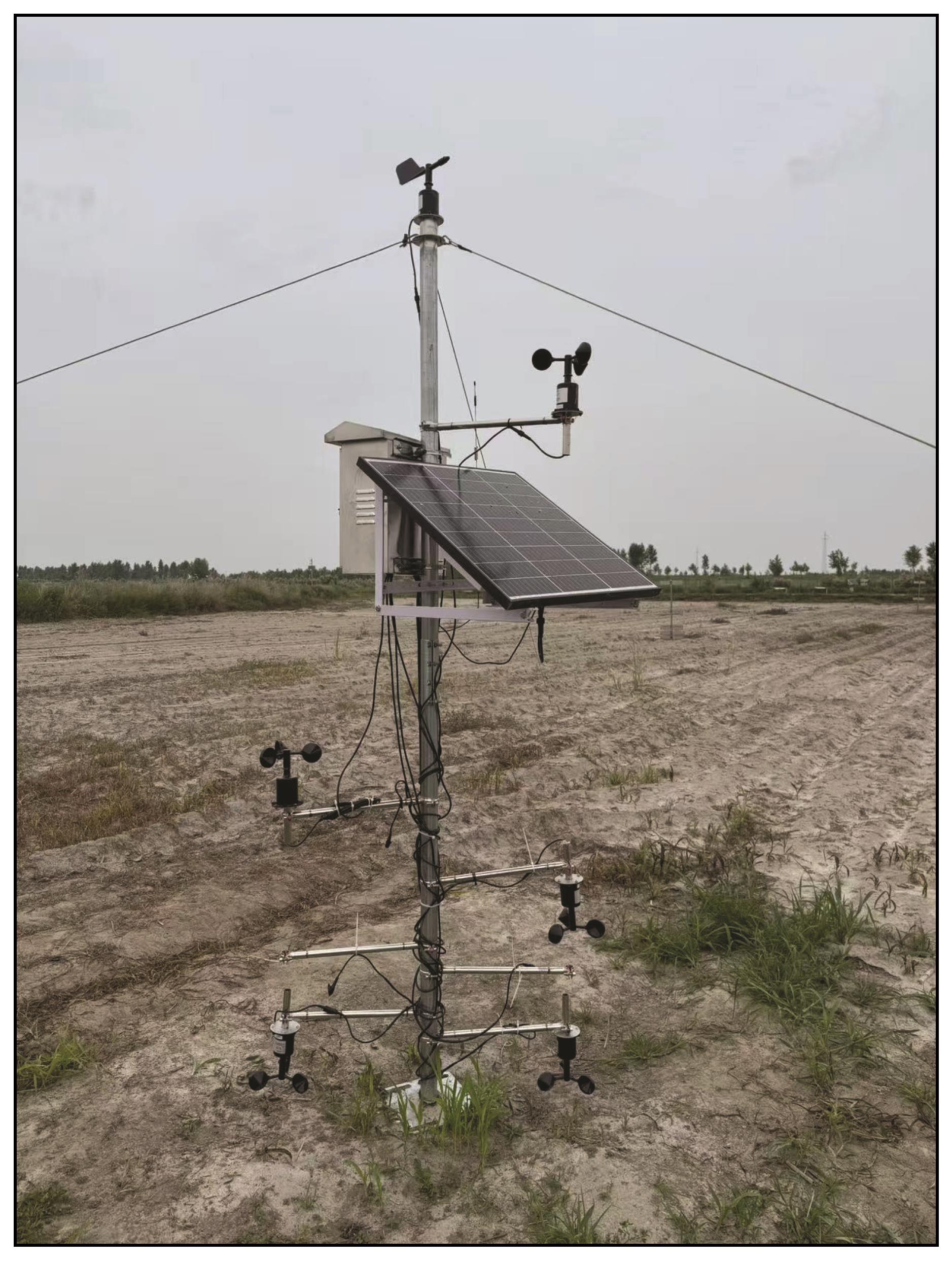
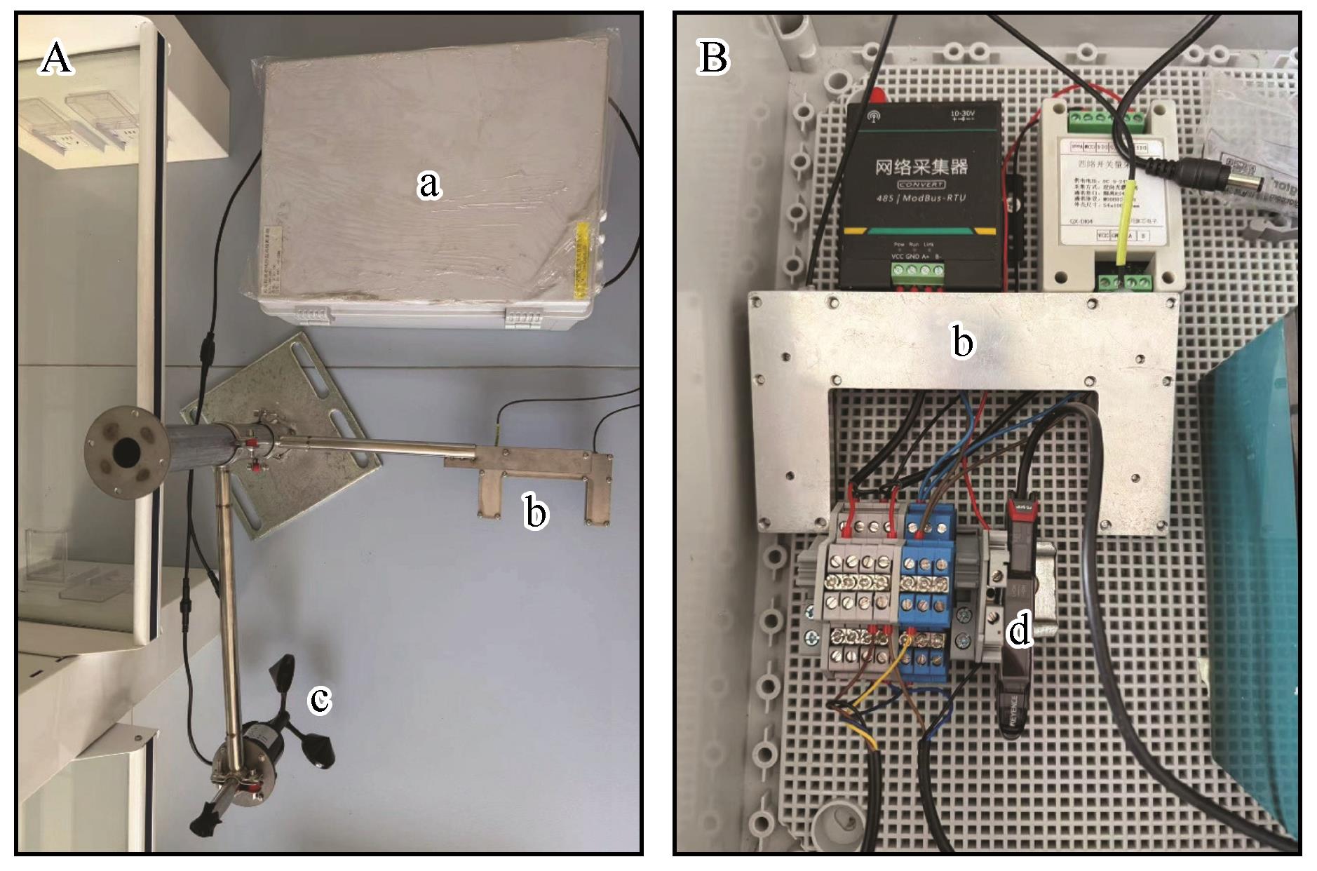
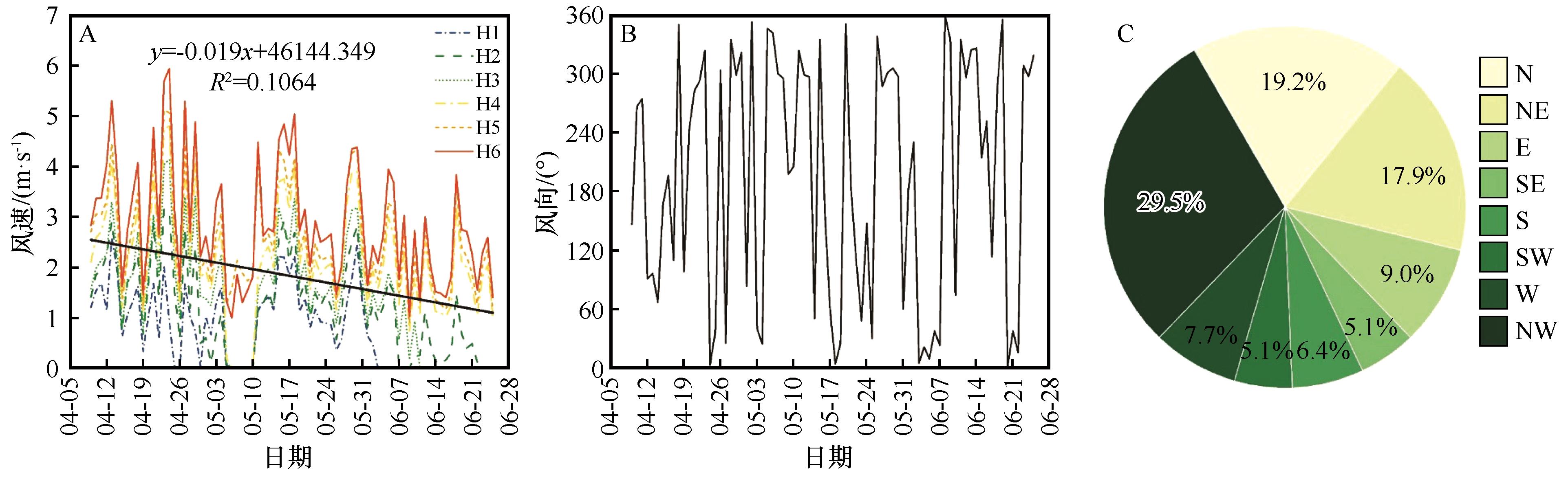
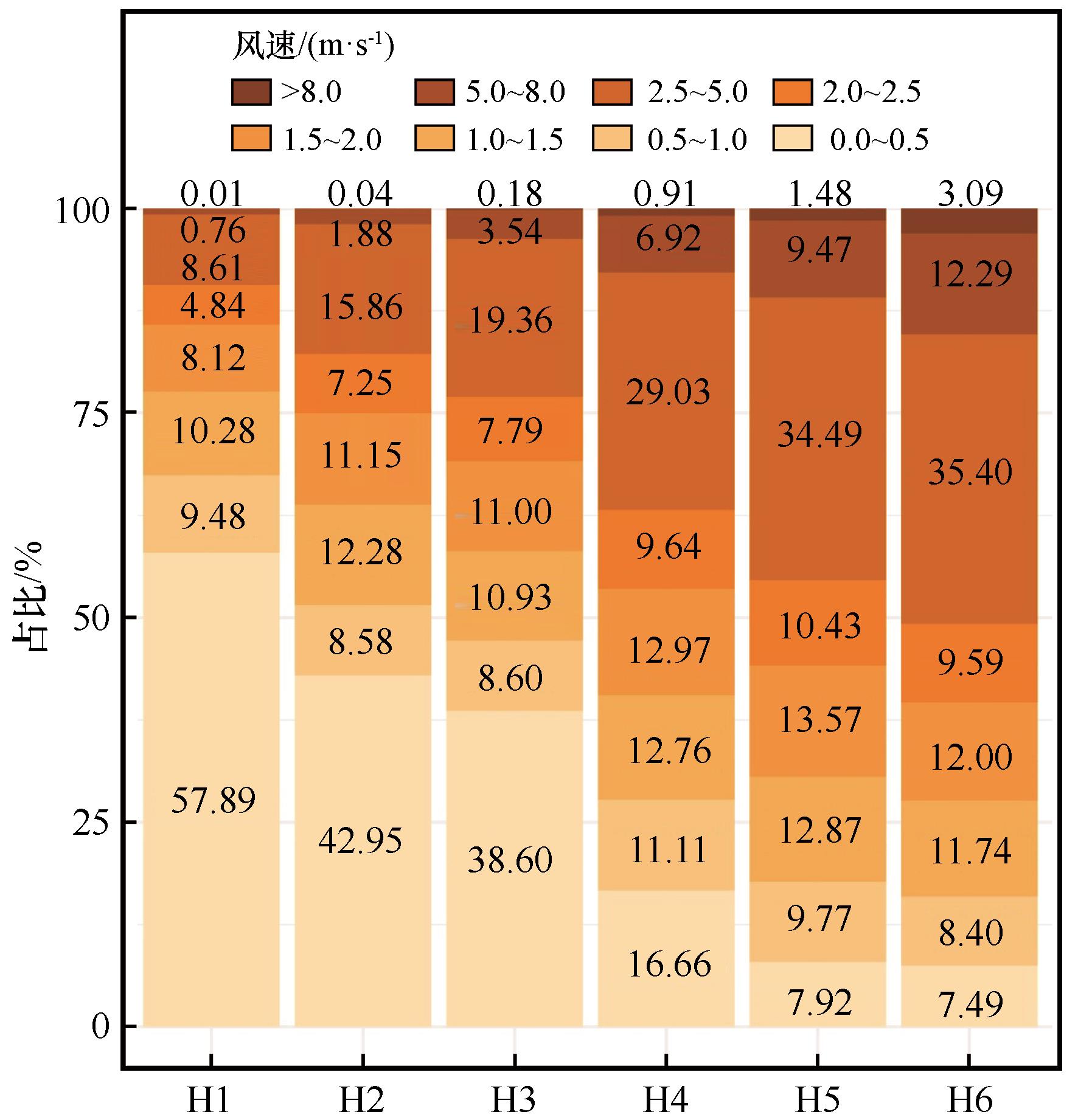
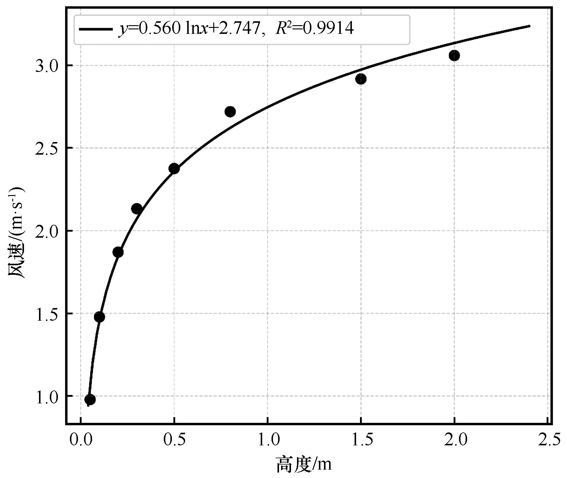
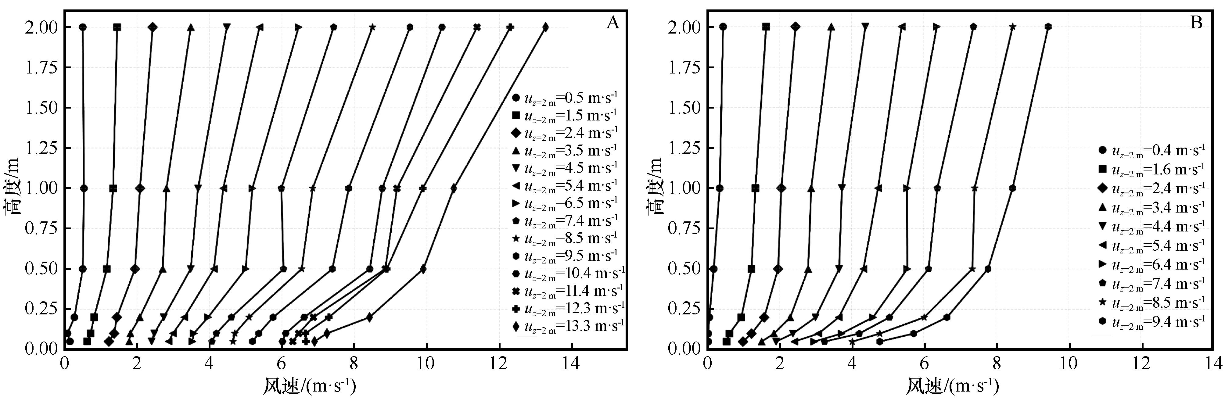
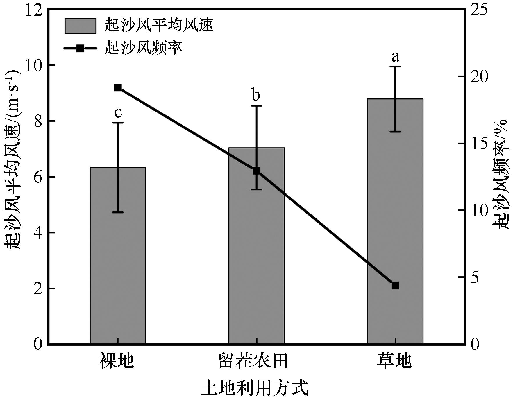
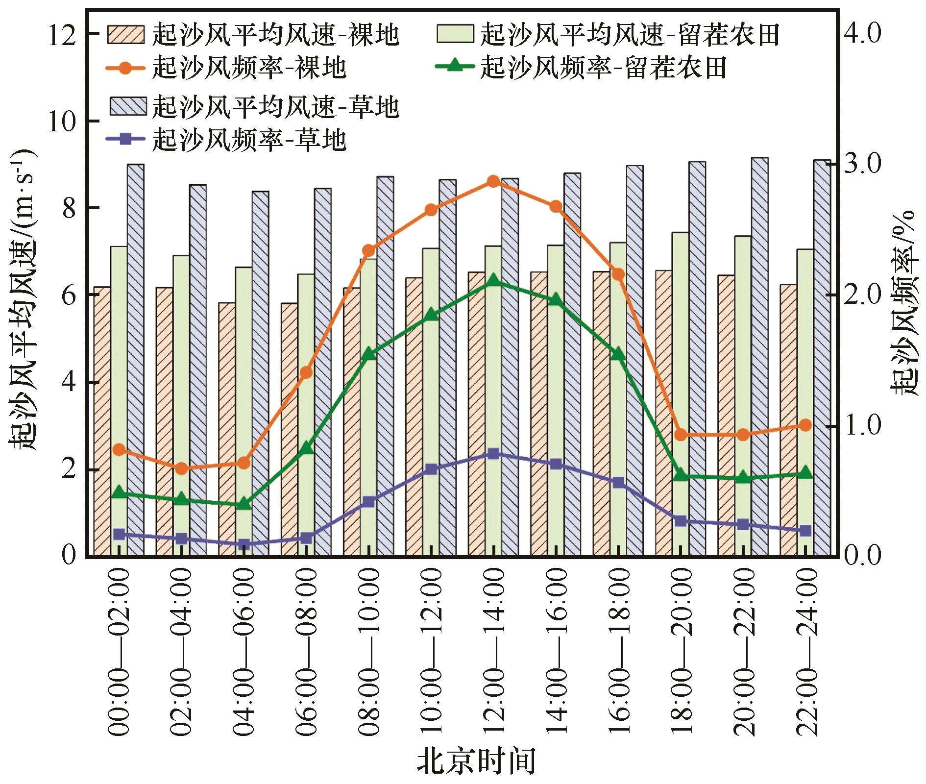
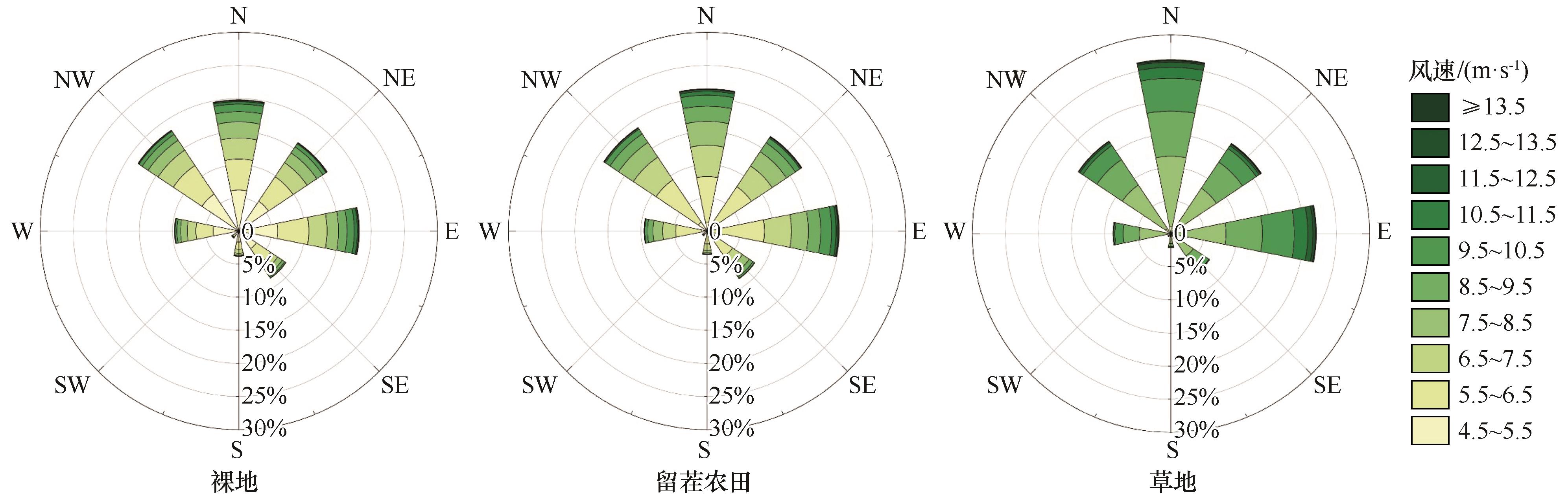
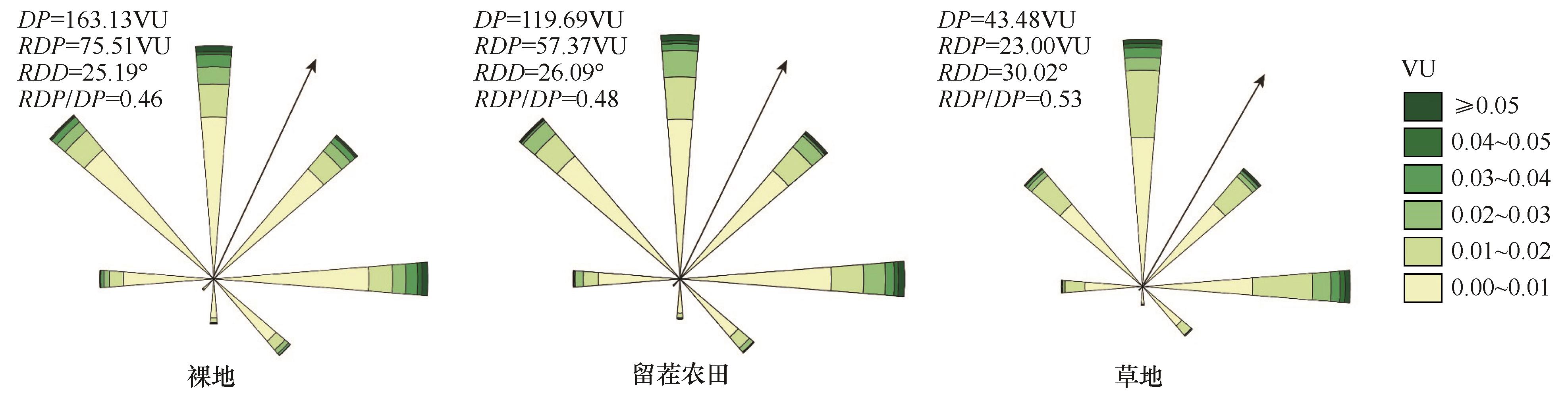
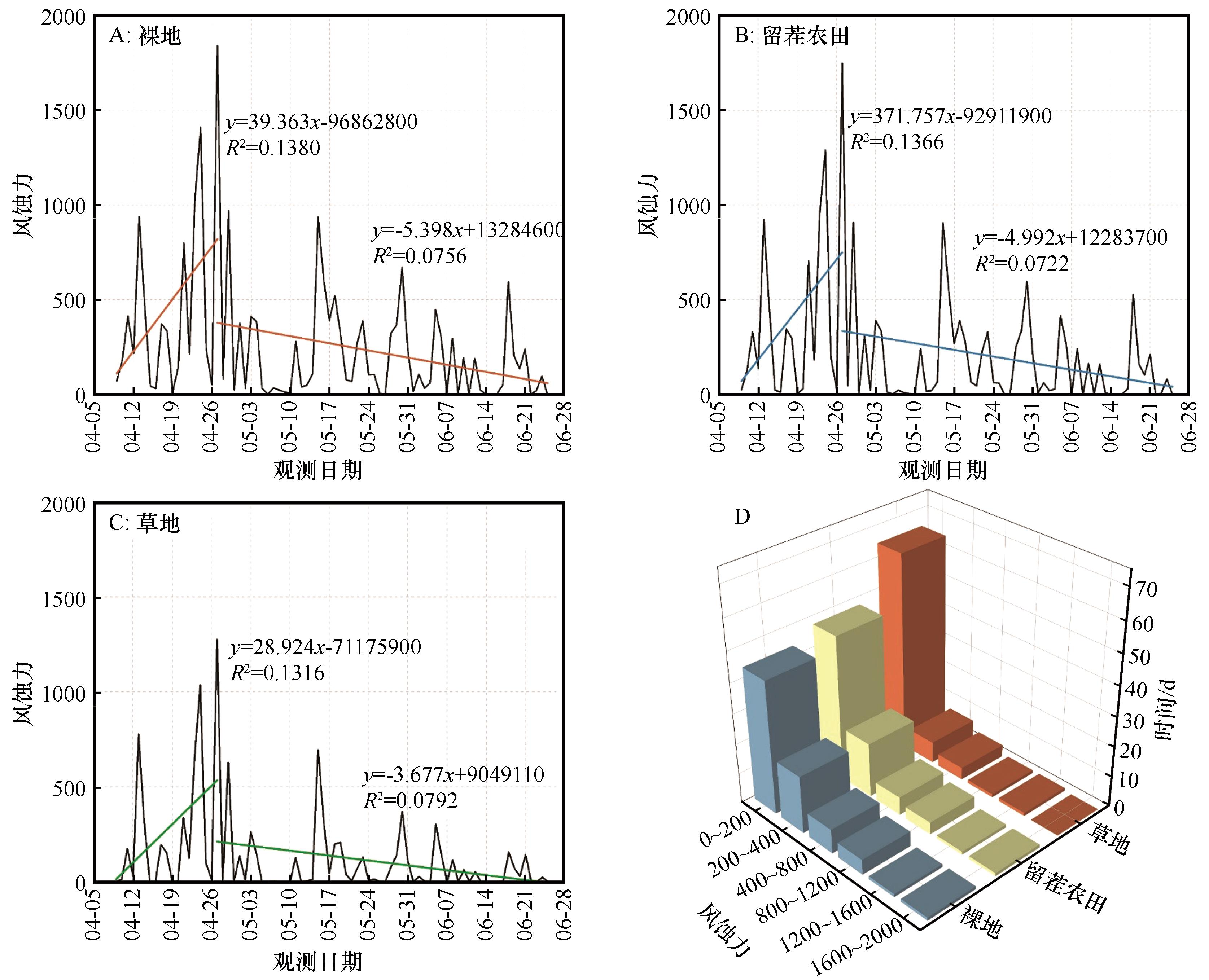
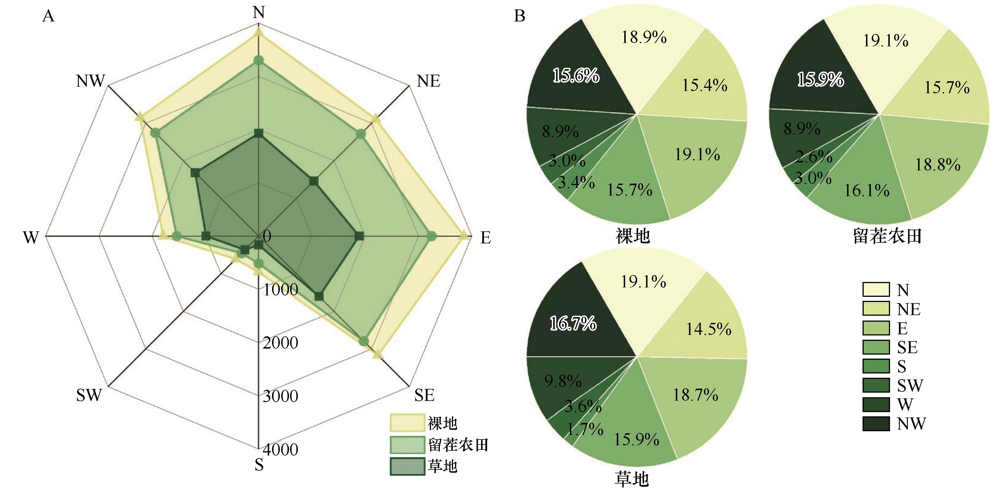
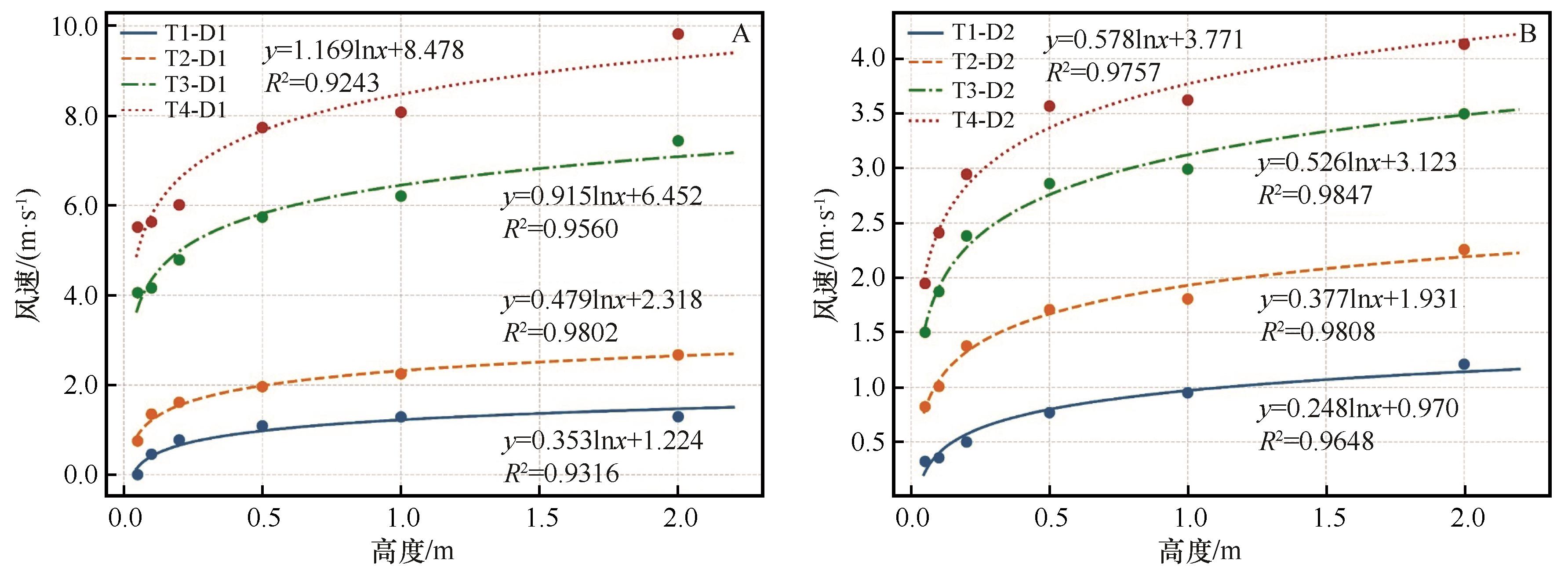
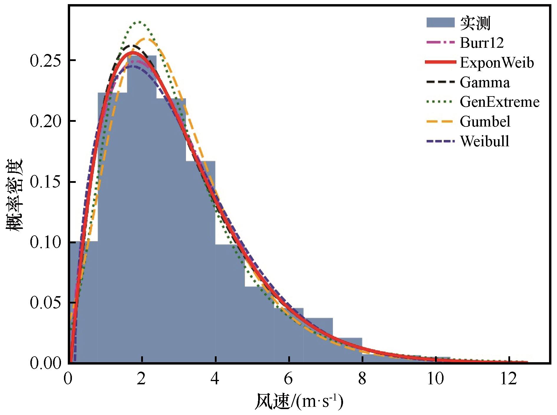
东北地区土壤风蚀活动日趋频繁,对农业生产和生态安全造成严重威胁。为揭示东北地区风沙活动强度特征,选取东北典型风蚀区裸地、留茬农田和草地在春耕期内开展定位观测,系统分析了起沙风、输沙势及风蚀力特征。结果表明:(1)观测期间内2 m高度的平均风速为2.89 m·s-1,且不同高度的风速均呈波动下降趋势,盛行风向为NW方向。(2)观测期间裸地、留茬农田、草地的起沙风平均风速分别为6.33、7.04、8.78 m·s-1,对应起沙风频率分别为19.15%、12.94%、4.39%。起沙风风向均主要集中在E至NW方向。(3)观测期间研究区属于低风能环境,3种土地利用方式下均属于中风向变率,风况均对应为钝双峰风况,合成输沙方向均为NE方向。输沙势和风蚀力均表现为裸地>留茬农田>草地。研究结果可为防风固沙工程实施与土地资源保护利用提供科学依据。

关键词: 东北地区, 风沙活动强度, 起沙风, 输沙势, 风蚀力

Abstract:

Soil wind erosion activities have become increasingly frequent in Northeast China, posing serious threats to agricultural production and ecological security. To reveal the characteristics of aeolian sand activity intensity in Northeast China, fixed-point observations were carried out during the spring tillage period on bare land, stubble farmland, and grassland in a typical wind erosion region of Northeast China. The characteristics of sand-driving winds, drift potential, and wind erosion force were systematically analyzed. The results showed that: (1) During the observation period, the mean wind speed at a height of 2 m was 2.89 m·s-1, and wind speeds at different heights exhibited a fluctuating decreasing trend, with the prevailing wind direction being NW. (2) The mean sand-driving wind speeds on bare land, stubble farmland, and grassland were 6.33 m·s-1, 7.04 m·s-1, and 8.78 m·s-1, respectively, while the corresponding sand-driving wind frequencies were 19.15%, 12.94%, and 4.39%. The sand-driving wind directions were mainly concentrated between E and NW. (3) During the observation period, the study area was characterized by a low wind energy environment. All three land-use types exhibited moderate directional variability, corresponding to a blunt bimodal wind regime, and the resultant drift direction was NE. Both drift potential and wind erosion force followed the order: bare land > stubble farmland > grassland. These results provide a scientific basis for the implementation of wind erosion control projects and the protection and sustainable utilization of land resources.

Key words: Northeast China, aeolian sand activity intensity, sand-driving wind, drift potential, wind erosion force

中图分类号: