img

官方微信

高级检索

中国沙漠 ›› 2022, Vol. 42 ›› Issue (2): 62-68.DOI: 10.7522/j.issn.1000-694X.2021.00122

• • 上一篇    下一篇

无定河上游河道对沙漠化的阻截效应

颜明1(), 张应华2(), 贺莉2, 程维明3, 王随继2, 许炯心2   

  1. 1.中国科学院地理科学与资源研究所,《资源科学》编辑部,北京 100101
    2.中国科学院地理科学与资源研究所,中国科学院陆地水循环及地表过程重点实验室,北京 100101
    3.中国科学院地理科学与资源研究所,资源与环境信息系统国家重点实验室,北京 100101
  • 收稿日期:2021-08-19 修回日期:2021-09-19 出版日期:2022-03-20 发布日期:2022-03-30
  • 通讯作者: 张应华
  • 作者简介:张应华(E-mail: zhangyinghua@igsnrr.ac.cn
    颜明(1977-),男,四川内江人,博士,编辑,主要从事河流地貌与环境研究。E-mail: yanming@igsnrr.ac.cn
  • 基金资助:
    国家自然科学基金项目(51979264)

Blocking effect of upper reaches of Wuding River on desertification

Ming Yan1(), Yinghua Zhang2(), Li He2, Weiming Cheng3, Suiji Wang2, Jiongxin Xu2   

  1. 1.Editorial Office of Resources Science /, Institute of Geographic Sciences and Natural Resources Research,Chinese Academy of Sciences,Beijing 100101,China
    2.Key Laboratory of Water Cycle and Related Land Surface Processes /, Institute of Geographic Sciences and Natural Resources Research,Chinese Academy of Sciences,Beijing 100101,China
    3.State Key Laboratory of Resources and Environmental Information System, Institute of Geographic Sciences and Natural Resources Research,Chinese Academy of Sciences,Beijing 100101,China
  • Received:2021-08-19 Revised:2021-09-19 Online:2022-03-20 Published:2022-03-30
  • Contact: Yinghua Zhang

摘要:

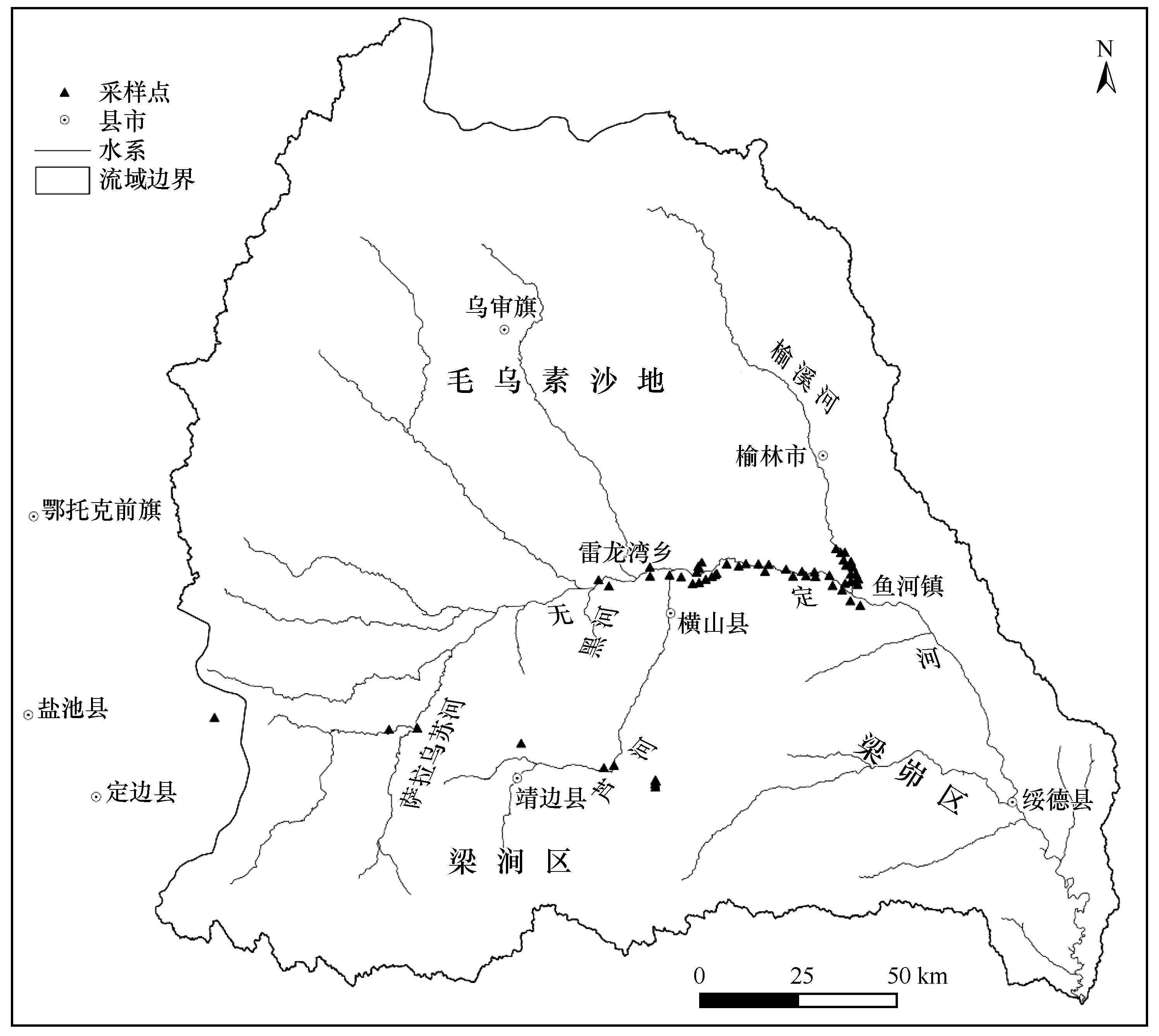
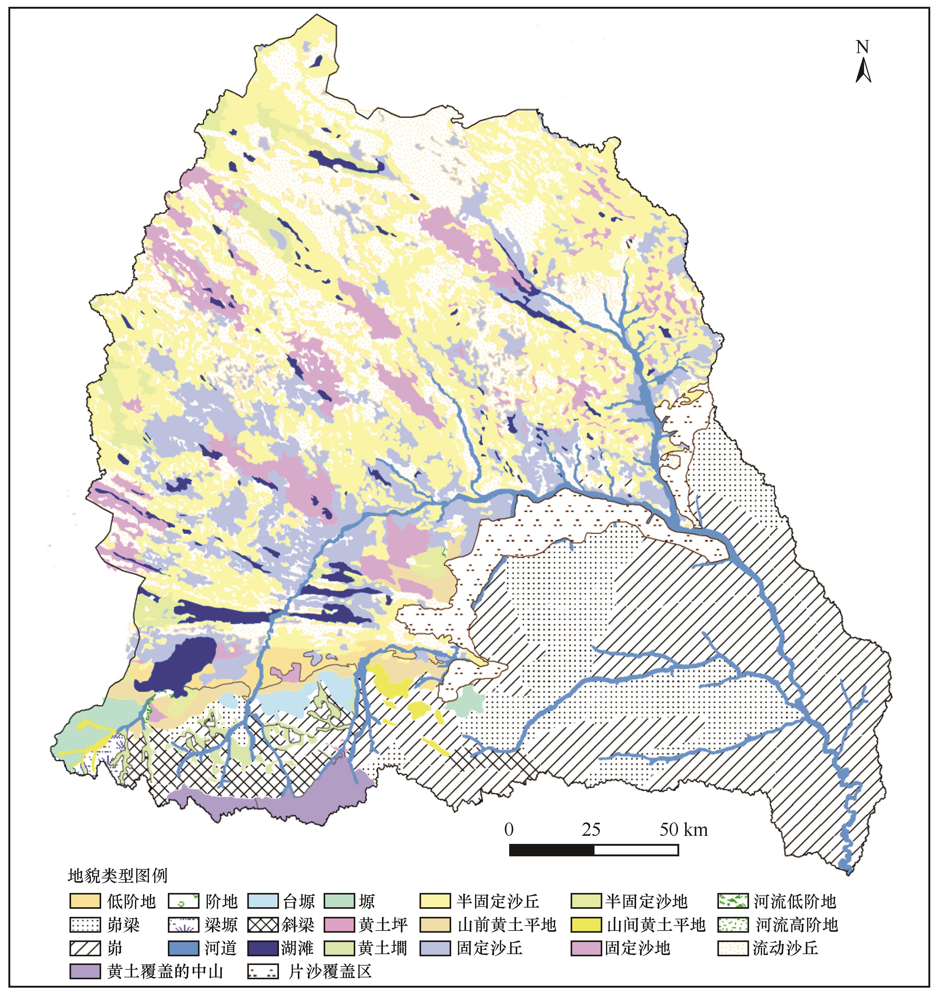
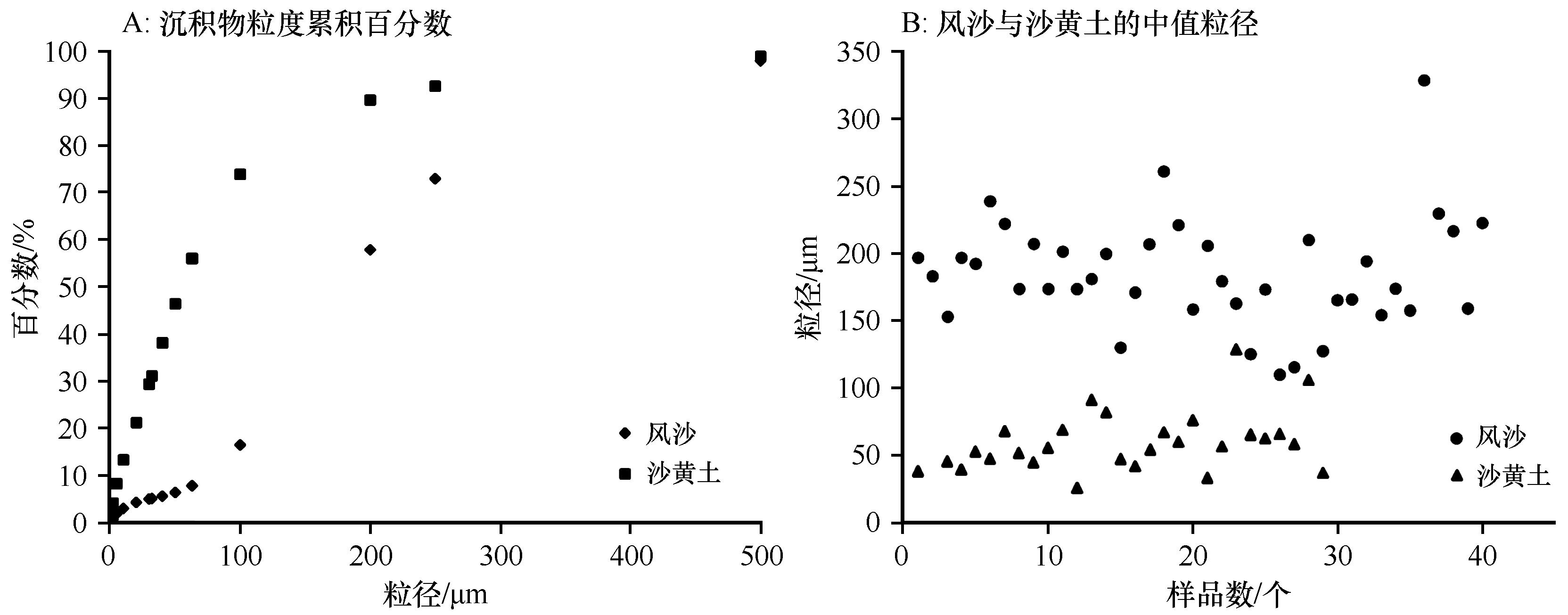
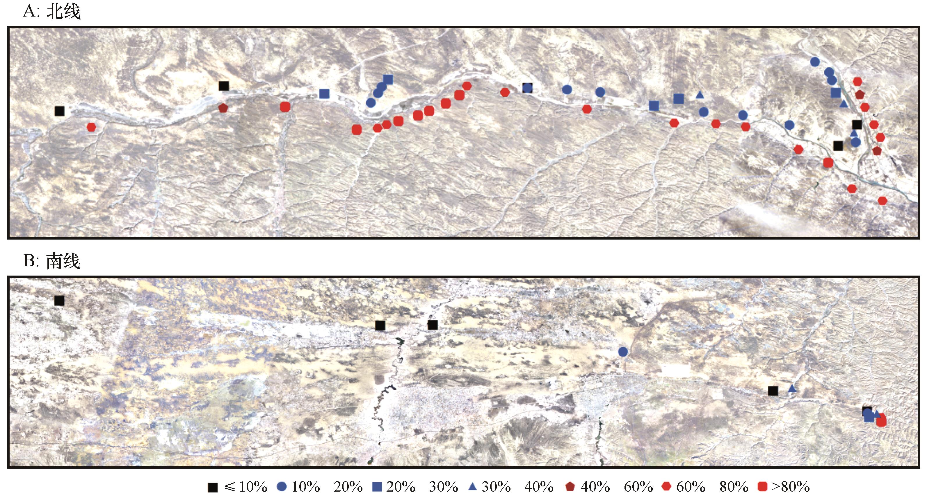
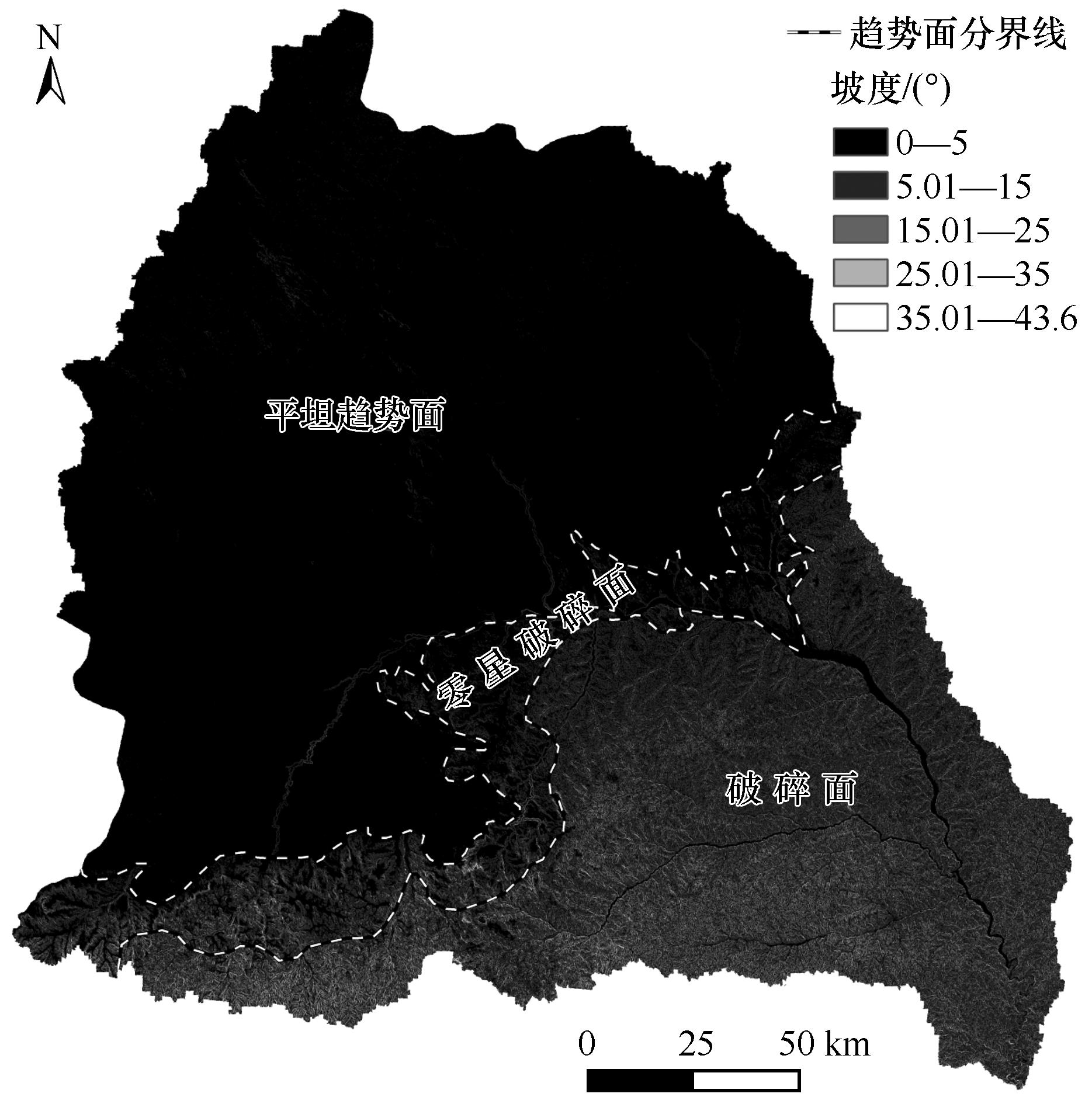
干旱向湿润转变的过渡区受到风力与水力的交互作用,交互作用形成的风水复合地貌显著区别于单一风力或水力形成的地貌,探究风力与水力的交互作用有助于对干旱-湿润过渡区地貌过程的理解。基于野外考察、遥感影像解译和沉积物粒度分析等手段,分析了无定河上游河道对毛乌素沙地东进的阻截效应,结果表明:(1)无定河上游河道的西侧以流动、半流动沙丘和固定沙地为主,河道东侧靠近河道区域有部分覆沙区,再向东转换为沙黄土和黄土为主的丘陵区。(2)沙地和河道西侧的表层样品粒径以100—200 μm的沙粒为主,河道东侧样品的粒径以<100 μm为主,说明粗颗粒风沙很难飞跃有一定宽度的河道,阻截了沙漠向东继续延伸。(3)无定河上游部分干流和支流河道对风沙的东进起到了显著的阻截效应,发生阻截的河段主要分布在干流的雷龙湾乡至鱼河镇之间,以及上游支流芦河。这一现象的形成是风力与水力在研究区长期作用的结果,发生的大背景是干旱向湿润转变,不仅有地理学成因,也有风沙动力学成因。

关键词: 河道, 毛乌素沙地, 粒度特征, 风水两相作用, 阻截效应, 无定河

Abstract:

The transition zone from drought to wetness is affected by the interaction of wind and water. The interaction forms a wind-water composite landform which is significantly different from wind and water. Exploring the interaction of wind and water is helpful to understand the geomorphic process of arid-humid transition zone. By means of field investigation, remote sensing image interpretation and sediment particle size analysis, the blocking effect of the upper reaches of Wuding River on the eastward advance of Mu Us Sandy Land is analyzed. The results show that: (1) The geomorphic map of remote sensing image interpretation shows that the west side of the river is mainly mobile and semi mobile sand dunes and fixed sandy land, and the east side of the river is close to the river, with some sand covered areas, Then eastward, it is transformed into hilly area dominated by sand loess and loess. (2) The particle size analysis of surface samples collected on both sides of the river shows that the particle size of samples on the west side of the river is 100-200 μm, and the particle size of the sample on the east side of the river is less than 100 μm, indicating that it is difficult for coarse-grained aeolian sand to leap over the river channel with a certain width, blocking the continuous extension of the desert to the east. (3) Some main streams and tributaries in the upper reaches of Wuding River have a significant blocking effect on the eastward advance of wind sand. The blocked river sections are mainly distributed between Leilongwan Town and Yuhe Town in the main stream and Luhe River, an upstream tributary. The formation of this phenomenon is the result of the long-term action of wind and water power in the study area. The background is the transformation from drought to wetness, which has not only geographical causes, but also aeolian sand dynamics causes. The demonstration of this phenomenon has enlightenment significance for the understanding of landform in the transition area.

Key words: river channel, Mu Us Sandy Land, grain size characteristics, wind-water interaction, blocking effect, Wuding River

中图分类号: