img

官方微信

高级检索

中国沙漠 ›› 2025, Vol. 45 ›› Issue (4): 285-294.DOI: 10.7522/j.issn.1000-694X.2025.00181

• • 上一篇    

科尔沁沙地典型坨甸相间区景观格局变化及其驱动因子

方海富1,2(), 李玉霖1(), 李衍青2,3, 莫雨茵3, 詹瑾4, 罗志佳3   

  1. 1.中国科学院西北生态环境资源研究院 干旱区生态安全与可持续发展全国重点实验室/奈曼沙漠化研究站,甘肃 兰州 730000
    2.中国科学院大学,北京 100049
    3.广西师范大学 环境与资源学院,广西 桂林 541004
    4.甘肃省治沙研究所,甘肃 兰州 730070
  • 收稿日期:2025-05-18 修回日期:2025-06-30 出版日期:2025-07-20 发布日期:2025-08-18
  • 通讯作者: 李玉霖
  • 作者简介:方海富(1994—),男,甘肃庆阳人,博士研究生,主要从事景观生态学研究。E-mail: haifufang@126.com
  • 基金资助:
    内蒙古自治区防沙治沙科技创新重大示范工程“揭榜挂帅”项目(2024JBGS0005-2)

Changes in landscape patterns and their driving factors of the typical dune alternated with meadow area in the Horqin Sandy Land

Haifu Fang1,2(), Yulin Li1(), Yanqing Li2,3, Yuyin Mo3, Jin Zhan4, Zhijia Luo3   

  1. 1.State Key Laboratory of Ecological Safety and Sustainable Development in Arid Lands / Naiman Desertification Research Station,Northwest Institute of Eco-Environment and Resource,Chinese Academy of Sciences,Lanzhou 730000,China
    2.University of Chinese Academy of Sciences,Beijing 100049,China
    3.College of Environment and Resource,Guangxi Normal University,Guilin 541004,Guangxi,China
    4.Gansu Desert Control Research Institute,Lanzhou 730070,China
  • Received:2025-05-18 Revised:2025-06-30 Online:2025-07-20 Published:2025-08-18
  • Contact: Yulin Li

摘要:

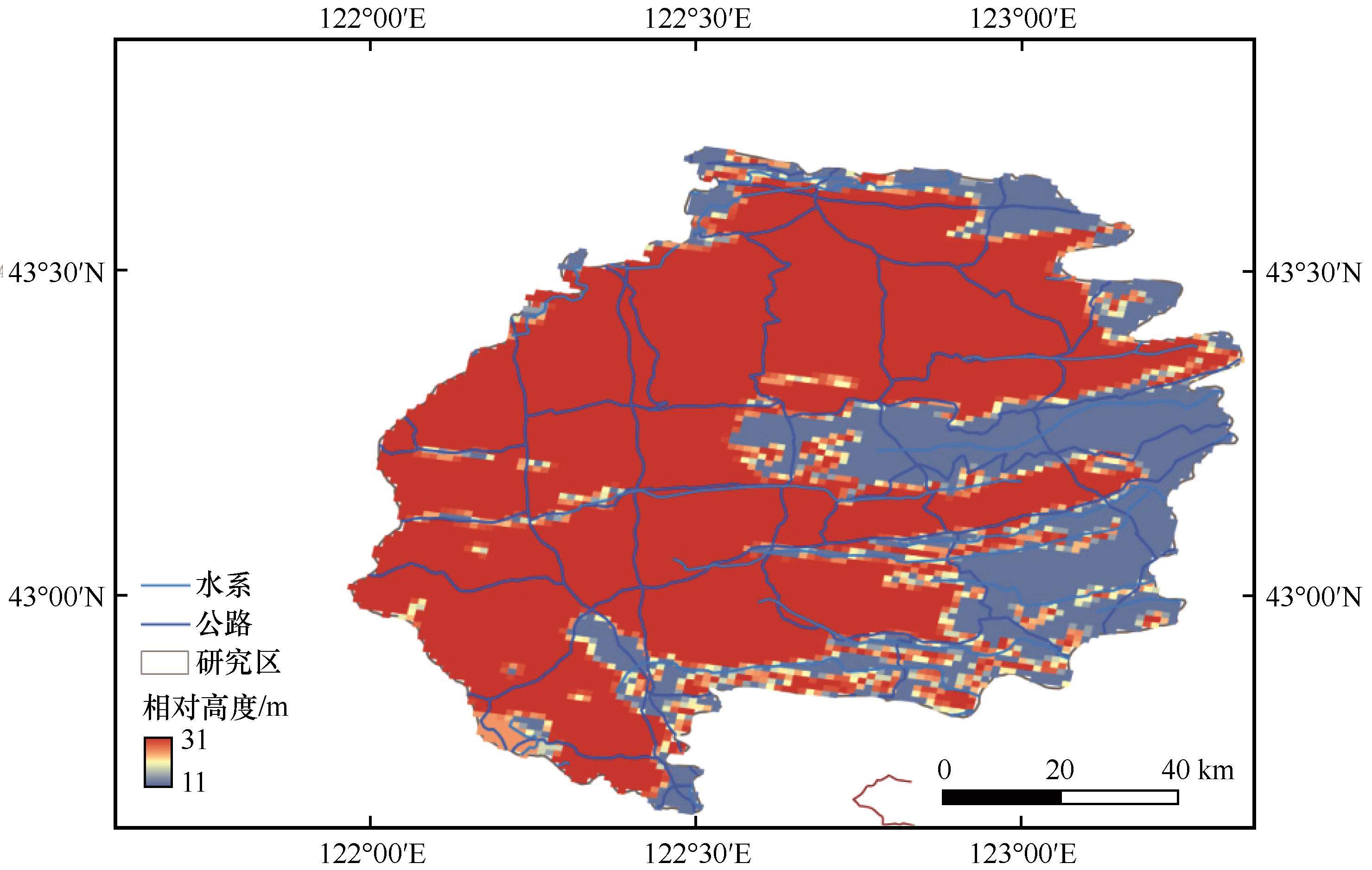
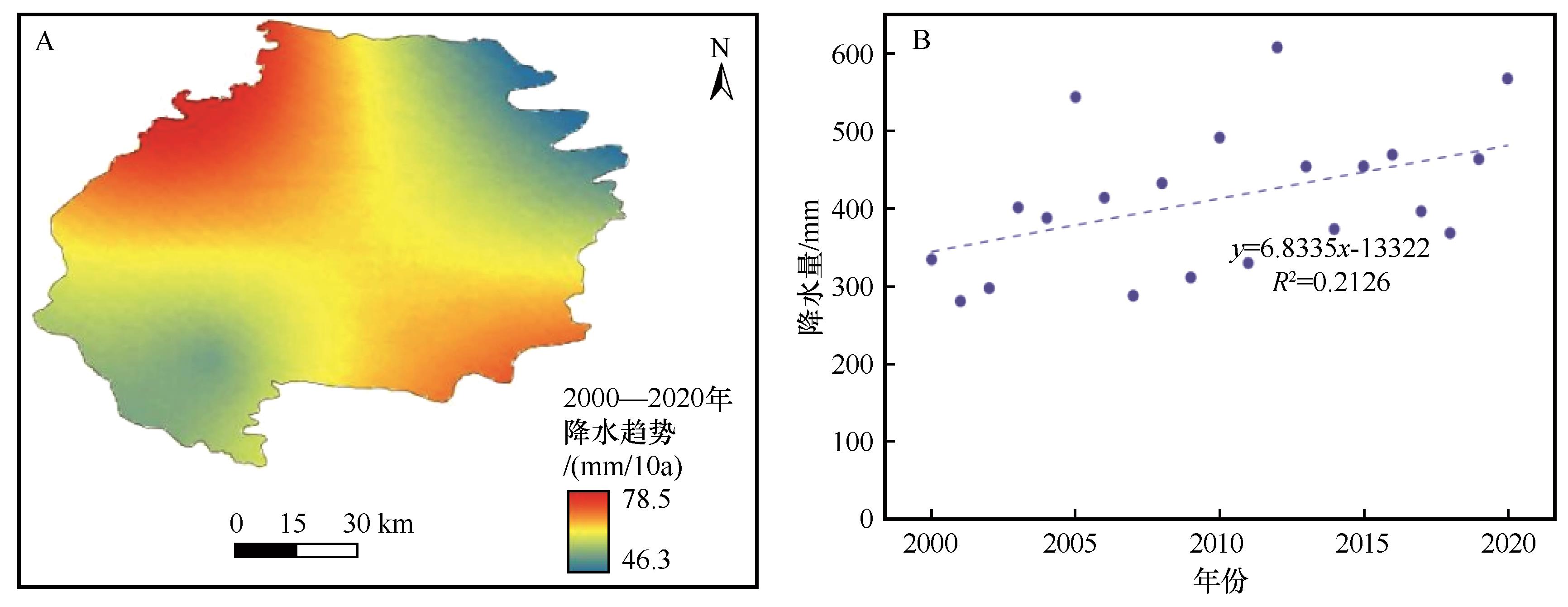
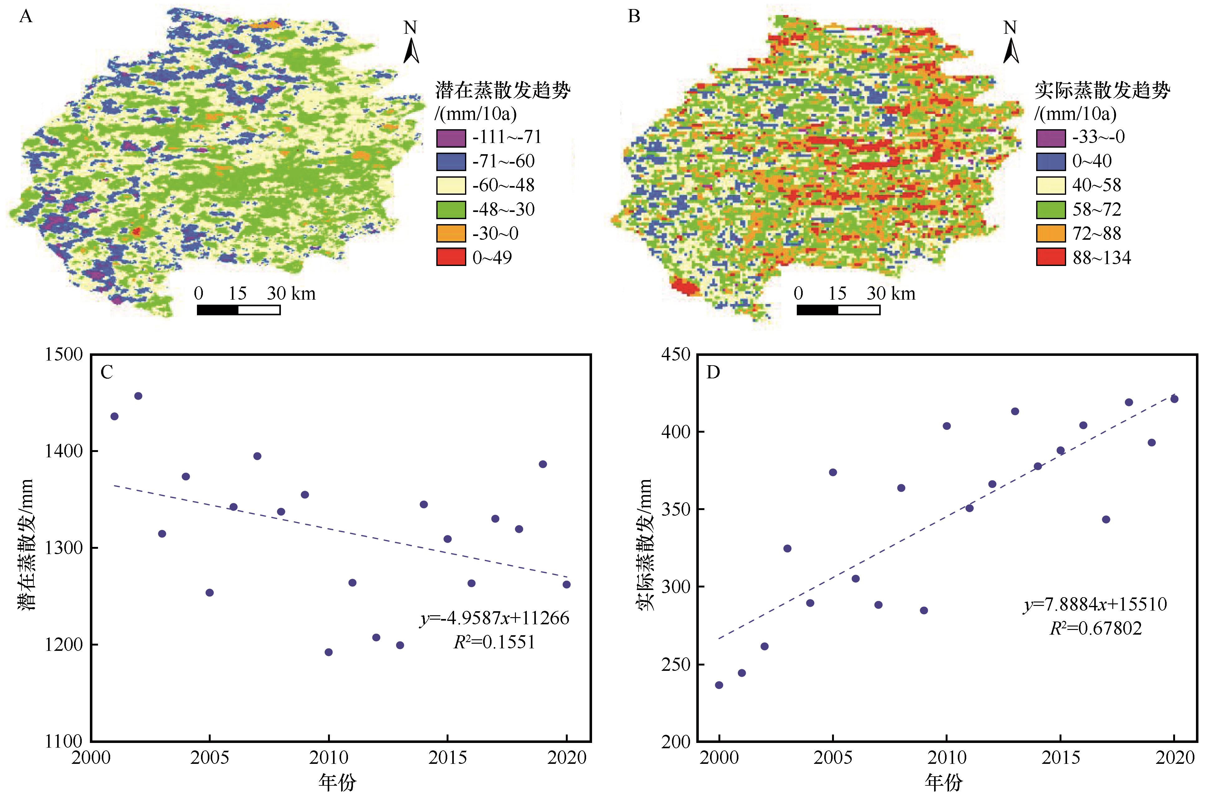
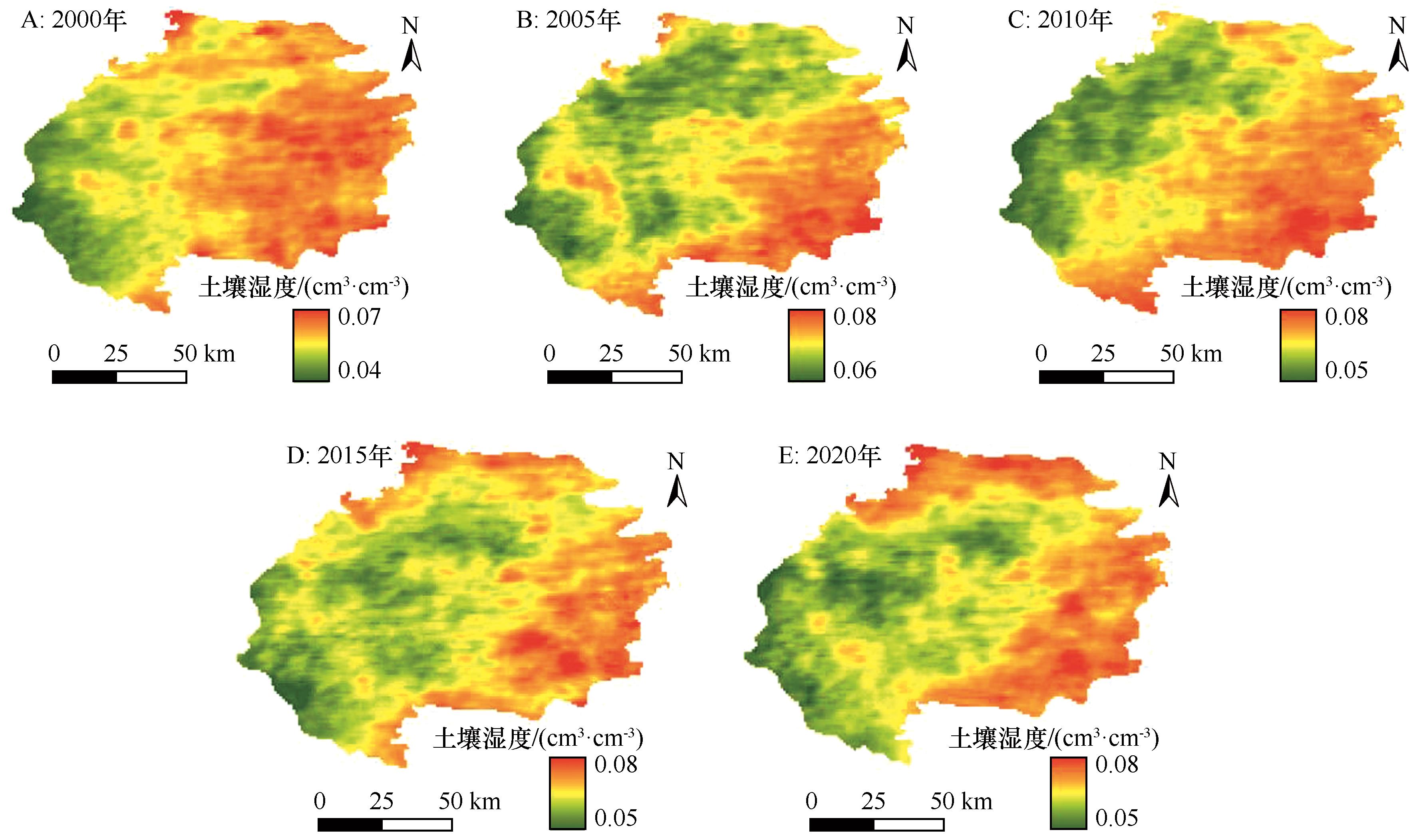
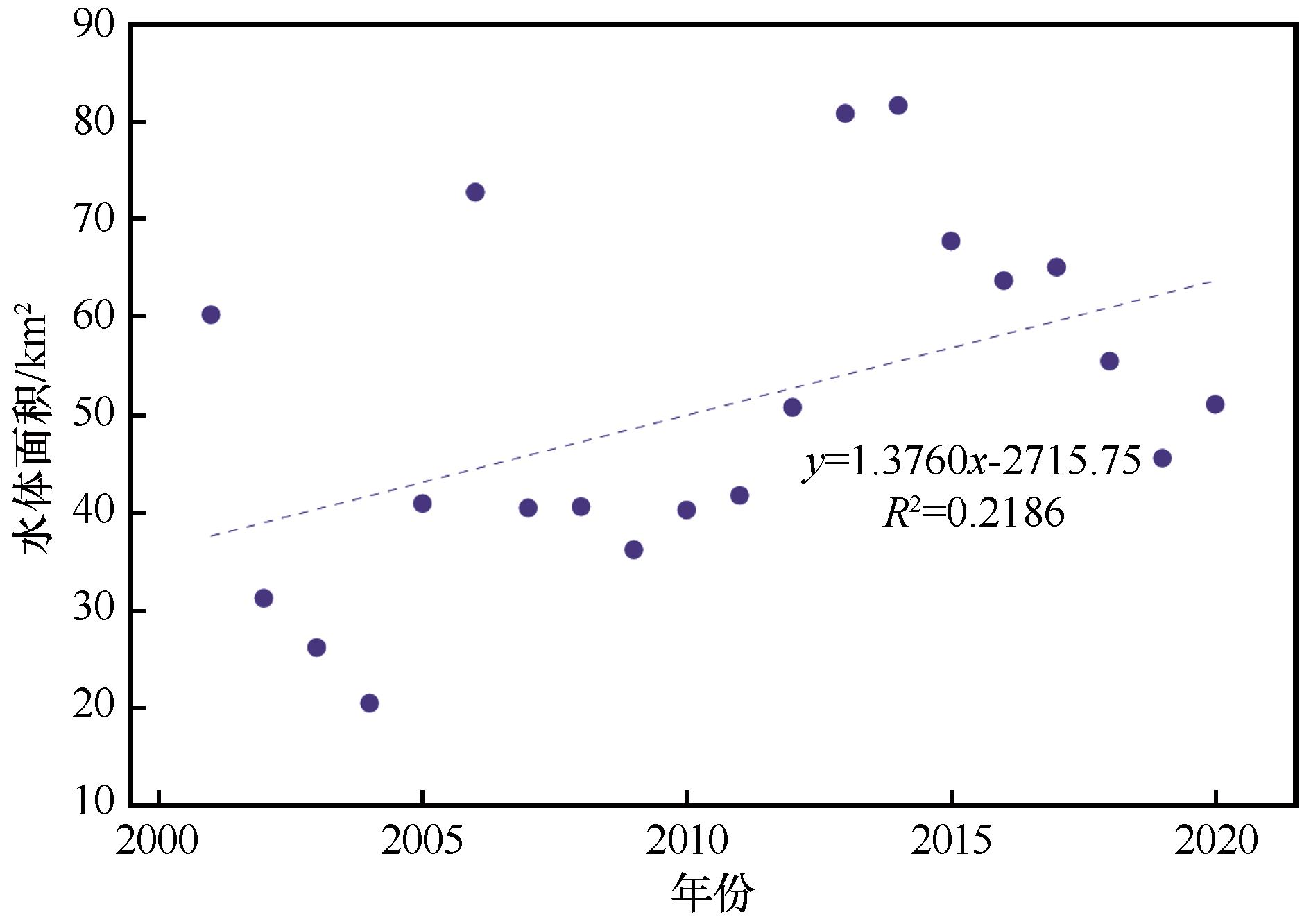
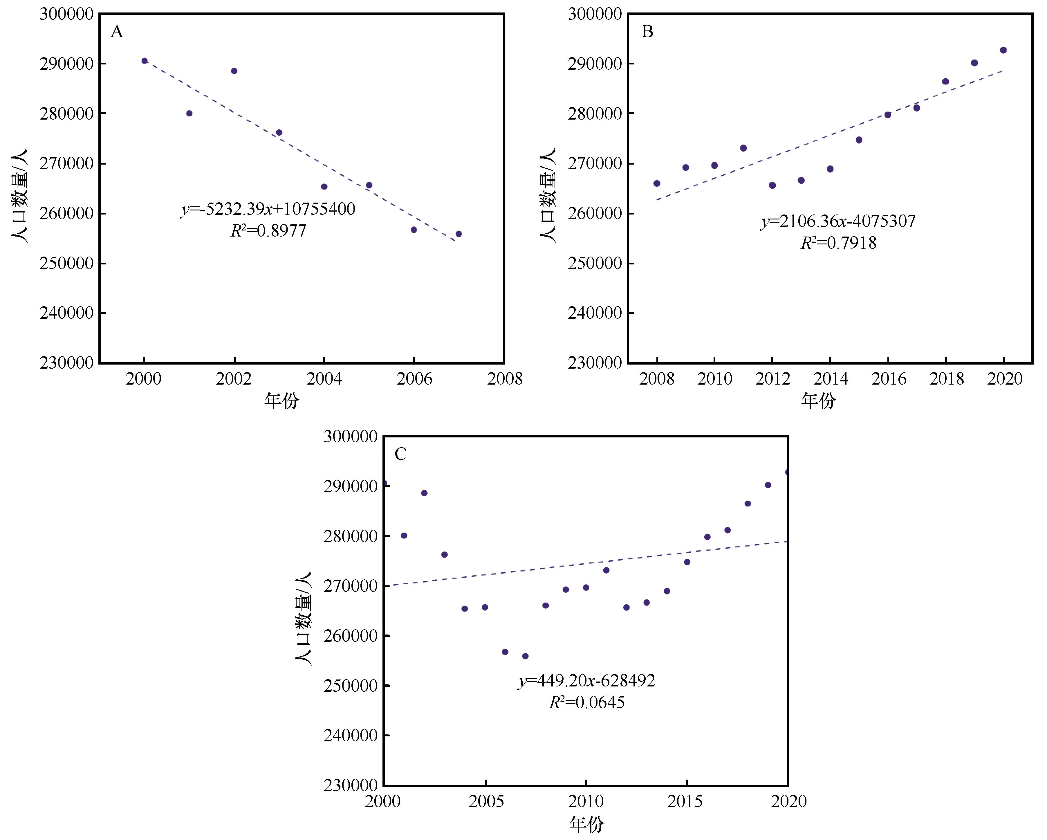
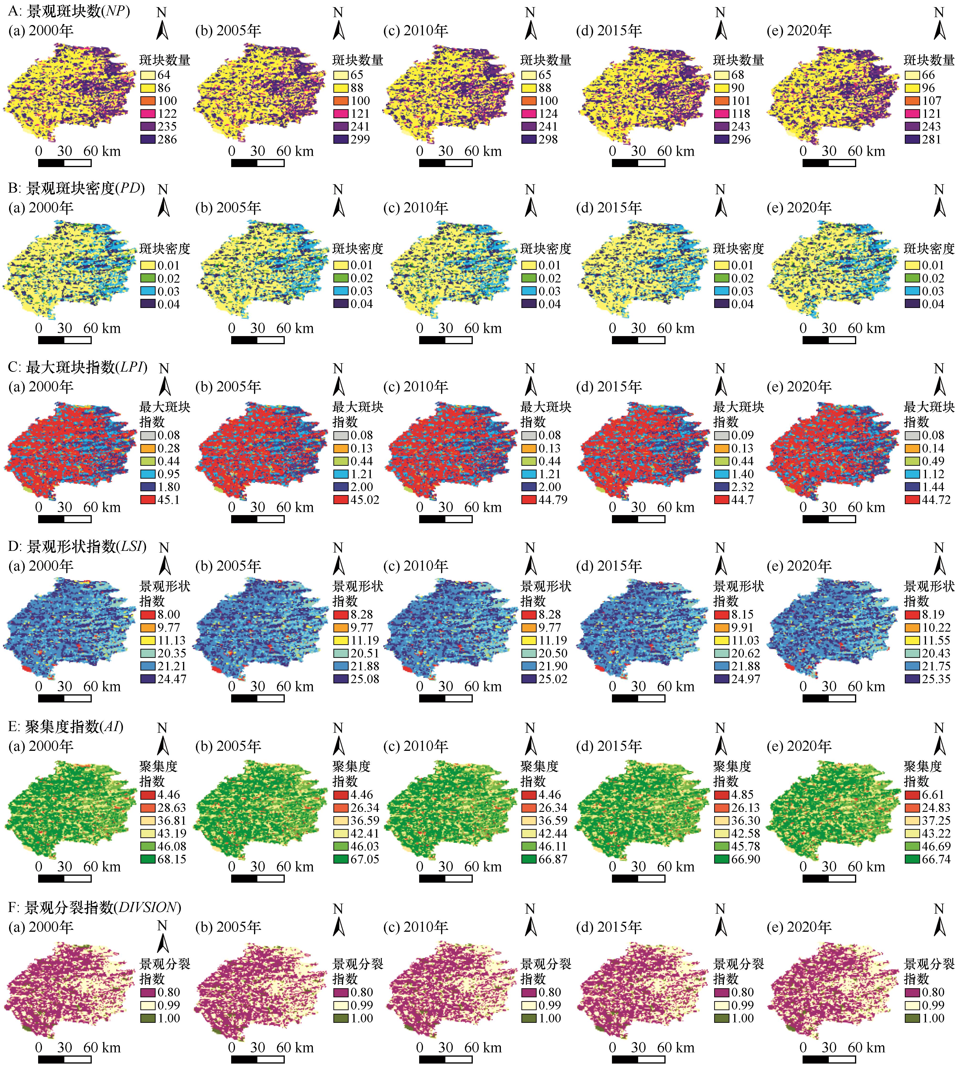
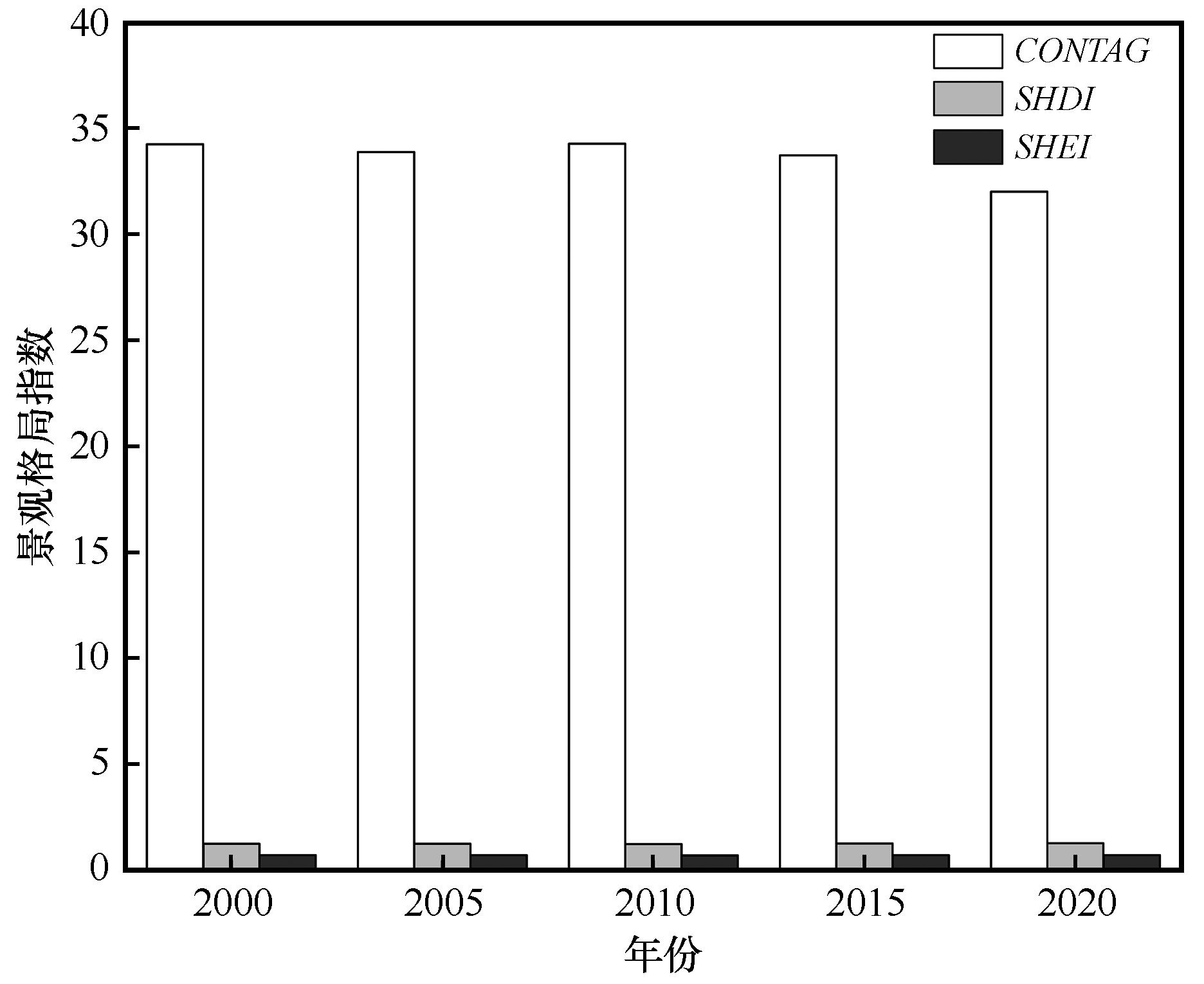
科尔沁沙地典型坨甸相间区作为主要生态脆弱区,其景观格局变化直接反映人类活动与气候变化的交互作用。本研究基于2000—2020年土地利用数据集,以降雨、蒸散发、土壤湿度、水体面积和人口数量为驱动因子,利用ArcGIS和Fragstats软件,分析2000—2020年该研究区的景观格局时空动态特征和驱动因素。结果表明:草地、未利用土地和耕地是科尔沁沙地典型坨甸相间地区的主要景观类型;草地和水域的面积逐渐降低,景观破碎化增加,连通性降低,形状相对复杂化,景观异质性呈现下降趋势;气候变化可改变研究区植被覆盖的空间配置,促使沙地景观从连续基质向破碎化模式的转型;人口变化可通过土地利用多元化增加了景观类型的丰富度。因此,气候和人口变化可共同驱动景观格局的转型,明晰研究区的时空差异,优化景观格局,为该区域防沙治沙生态战略决策提供技术支撑。

关键词: 科尔沁沙地, 驱动因子, 景观格局, 土地利用, 时空变化

Abstract:

As a major ecologically fragile area, the landscape pattern changes in the typical dune alternated with meadow area in Horqin sand directly reflect the interaction between human activities and climate change. Based on the 2000-2020 land use dataset, this study extracted and analyzed the spatial and temporal dynamic characteristics and driving factors of the landscape pattern in the study area from 2000 to 2020, using rainfall, evapotranspiration, soil moisture, Water body area and population size as the driving factors, and using the ArcGIS and Fragstats software. The results show that grassland, unused or other land and cropland were the main landscape types(>93%)in the interspersed areas of dune alternated with meadow area in Horqin sand, the area of grassland and water area gradually decrease, landscape fragmentation increases, connectivity decreases, shape is relatively complex, and landscape heterogeneity shows a decreasing trend. climate change can change the spatial configuration of vegetation cover in the study area, which can lead to the transition of sandy landscapes from a continuous matrix to a fragmentation pattern; and demographic changes can increase the richness of landscape types through land-use diversification. Therefore, climate change and population change can jointly drive the transformation of the landscape pattern, clarify the spatial and temporal differences in the study area, optimize the landscape pattern, and provide technical support for the ecological strategy of sand control and prevention in the region.

Key words: Horqin Sandy Land, driving factor, landscape pattern, land use, spatial and temporal variation

中图分类号: