img

官方微信

高级检索

中国沙漠 ›› 2024, Vol. 44 ›› Issue (3): 31-41.DOI: 10.7522/j.issn.1000-694X.2023.00132

• • 上一篇    下一篇

毛乌素沙地无定河上游河岸沙丘地貌格局及风水交互作用

王佳琪1(), 李小妹1(), 刘小槺1, 董苗2   

  1. 1.陕西师范大学 地理科学与旅游学院,陕西 西安 710119
    2.太原师范学院 地理科学学院,山西 晋中 030619
  • 收稿日期:2023-08-24 修回日期:2023-09-30 出版日期:2024-05-20 发布日期:2024-06-11
  • 通讯作者: 李小妹
  • 作者简介:李小妹(E-mail: lixiaomei8477@sina.com
    王佳琪(2001—),女,陕西宝鸡人,硕士研究生,研究方向为干旱区地貌。E-mail: wangjq2300@163.com
  • 基金资助:
    陕西省社科联与陕西省林业科学研究院重点课题(2022HZ1794);陕西省科技厅项目(2021JCW-17);陕西省科技厅面上项目(2023-JC-YB-264);中央高校项目(GK202301003);国家自然科学基金项目(42101013);山西省高等学校科技创新项目(2020L0502)

Landscape pattern and variation of riparian dunes and the aeolian-fluvial interaction in the upper reaches of Wuding River in Mu Us Sandy Land

Jiaqi Wang1(), Xiaomei Li1(), Xiaokang Liu1, Miao Dong2   

  1. 1.School of Geography and Tourism,Shaanxi Normal University,Xi'an 710119,China
    2.School of Geography Science,Taiyuan Normal University,Jinzhong 030619,Shanxi,China
  • Received:2023-08-24 Revised:2023-09-30 Online:2024-05-20 Published:2024-06-11
  • Contact: Xiaomei Li

摘要:

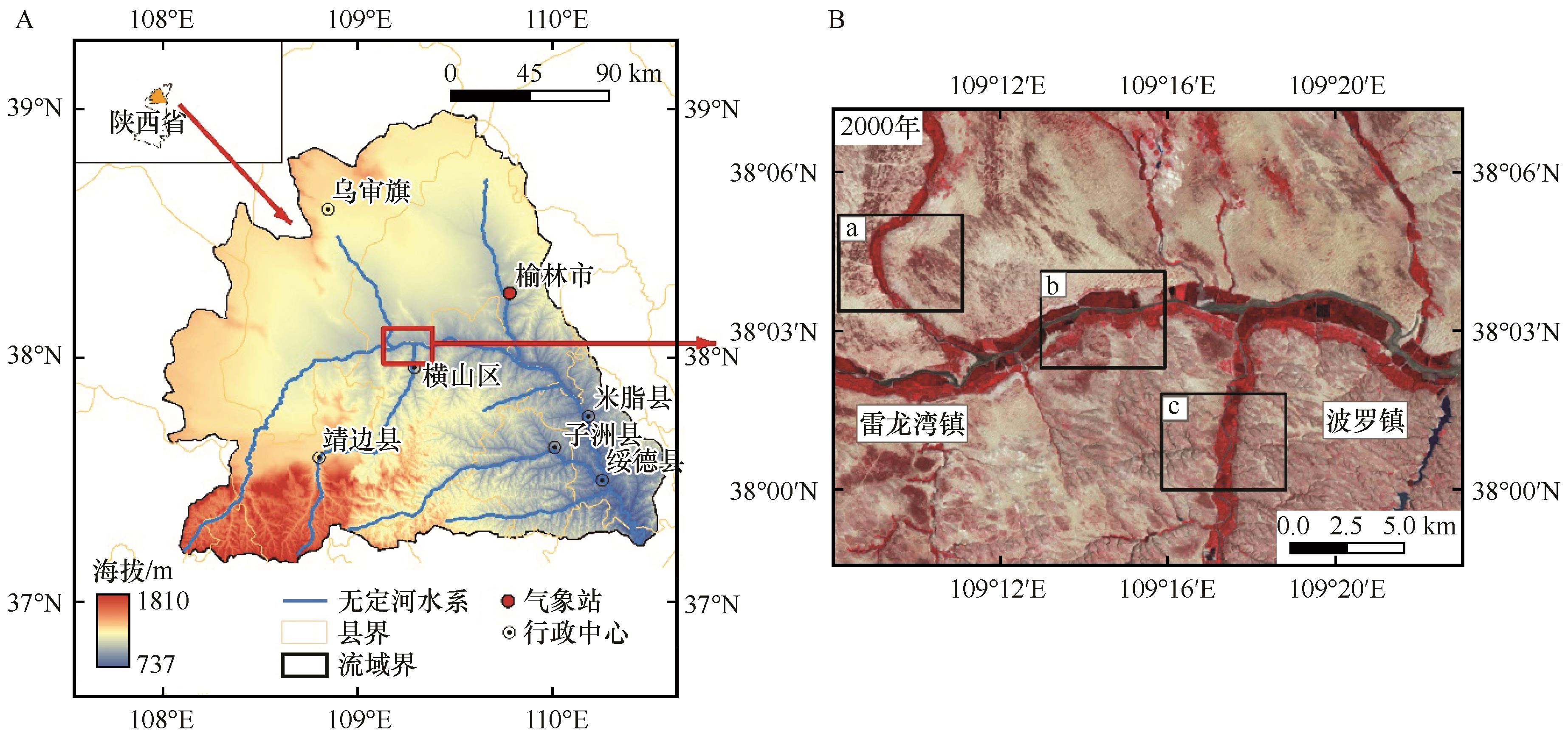
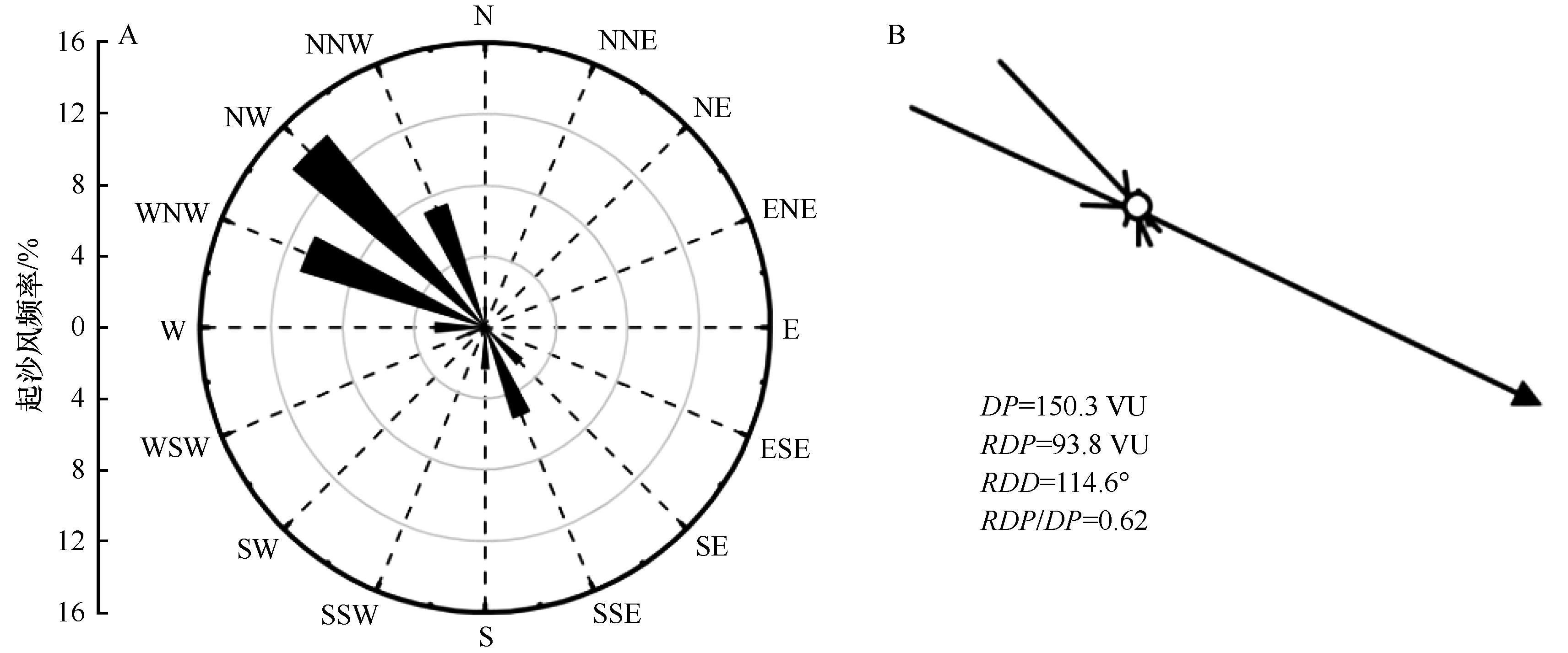
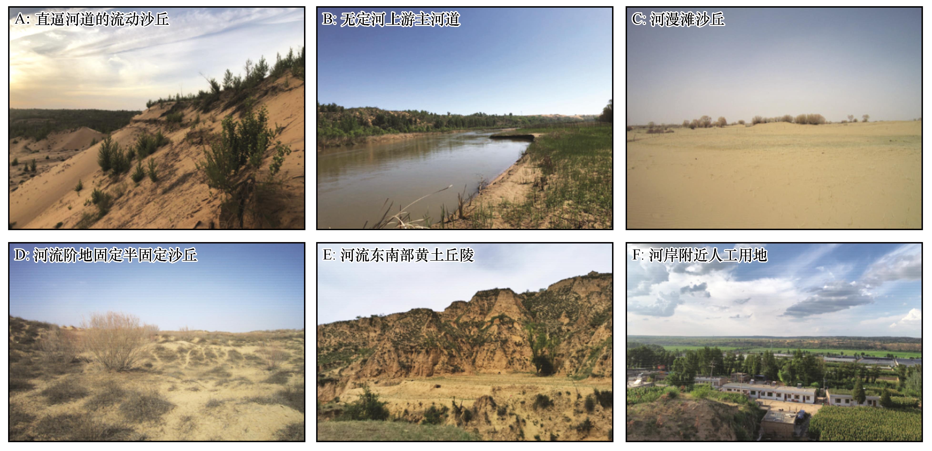
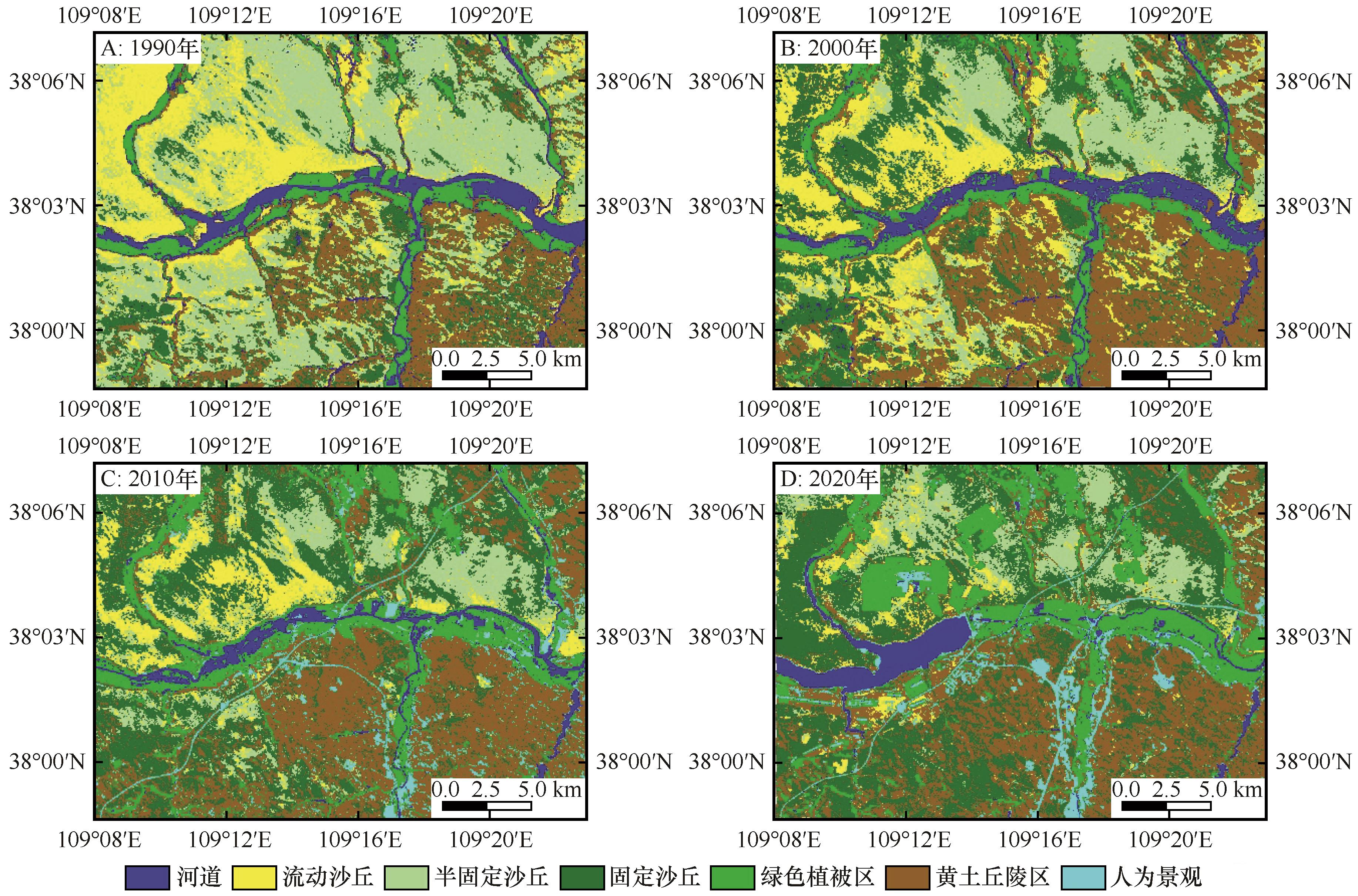
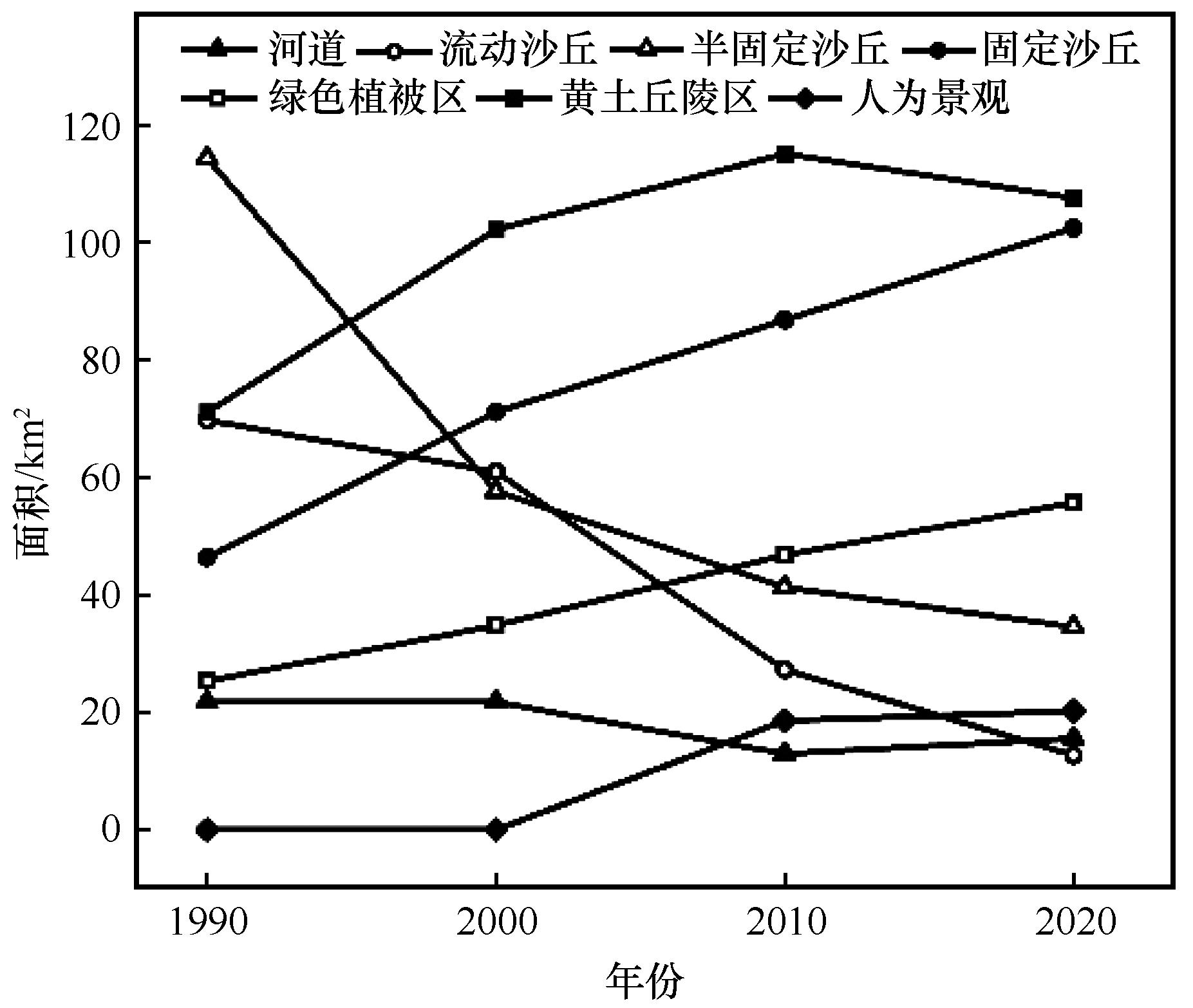
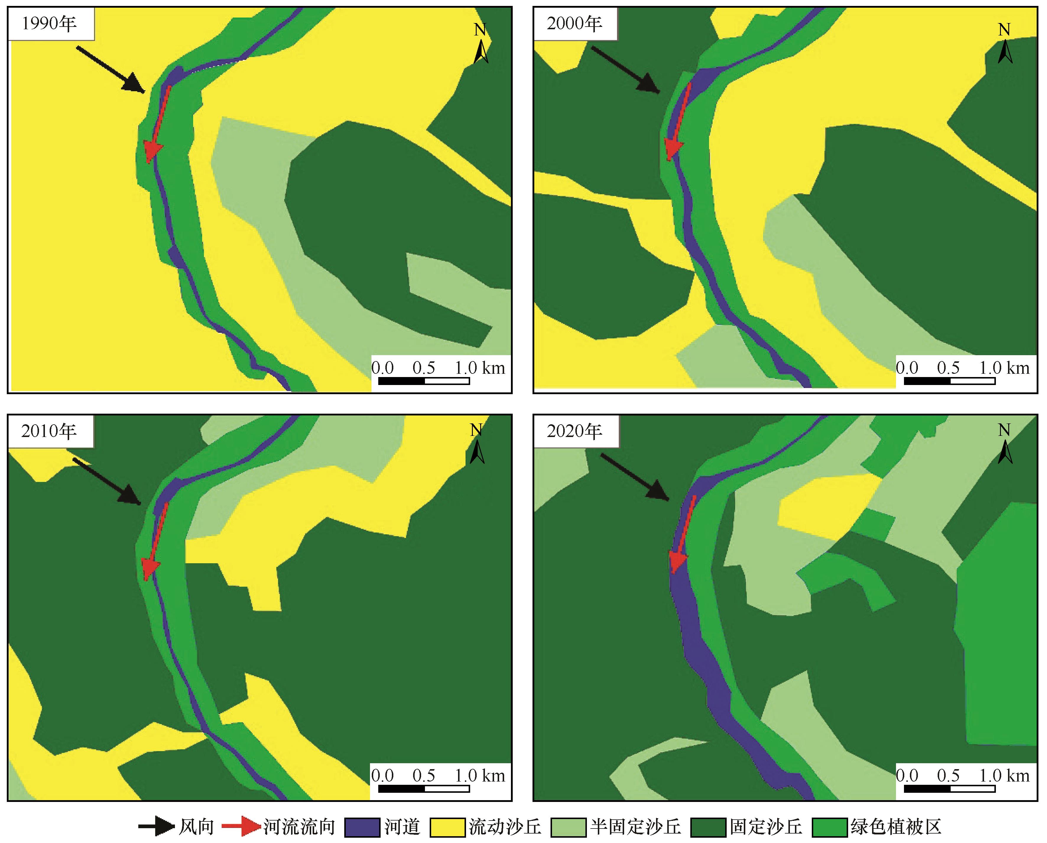
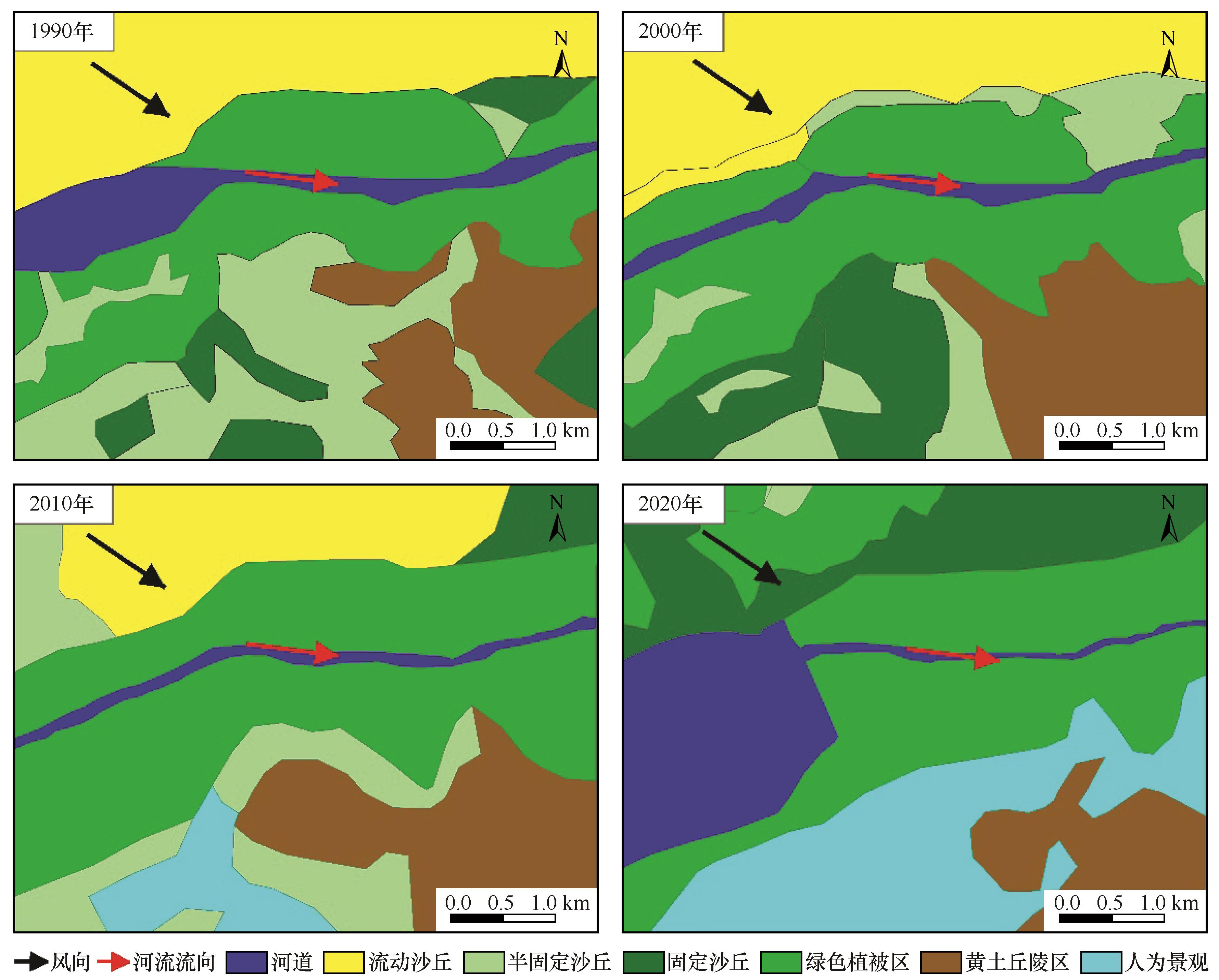
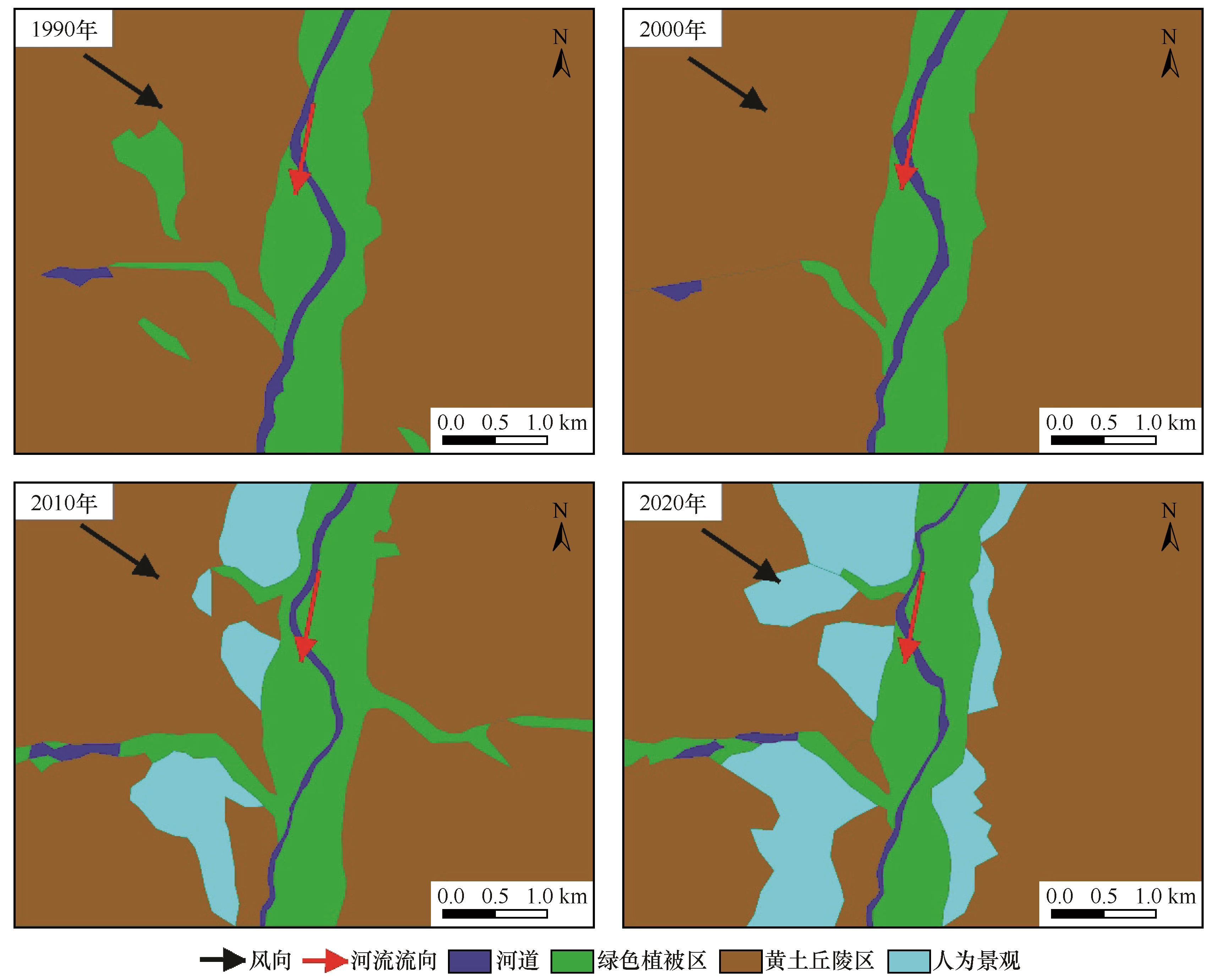
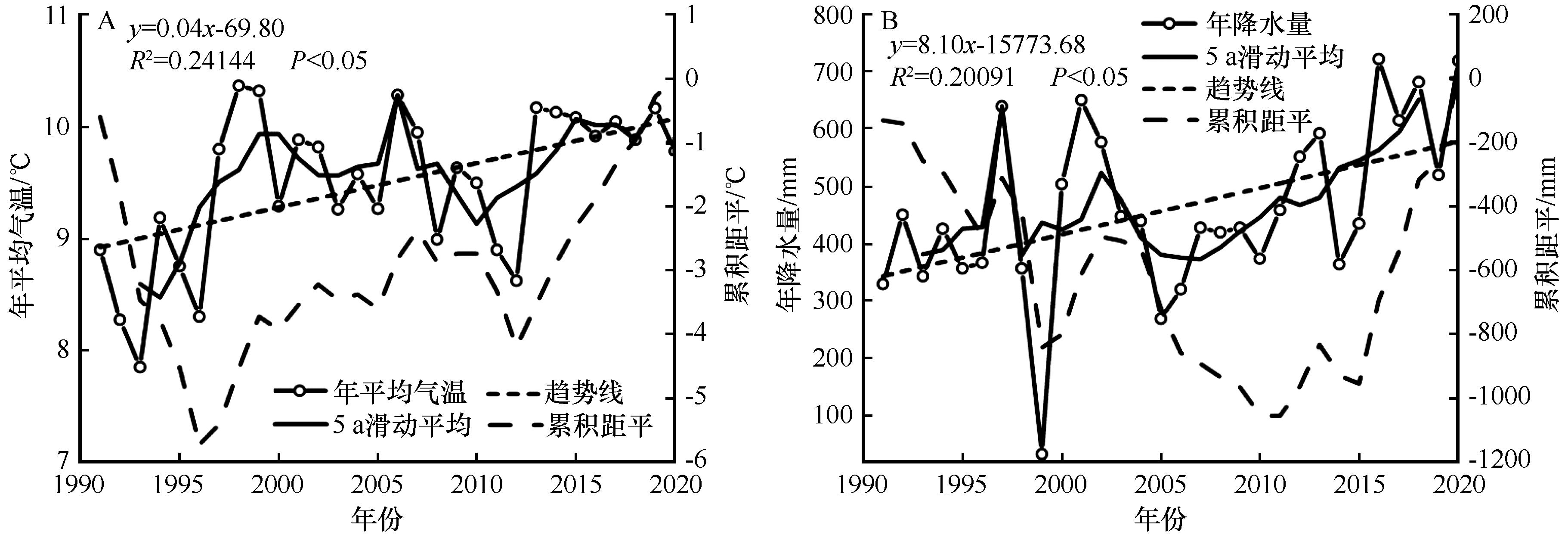
风水交互作用是干旱半干旱地区常见的地貌现象和重要的地表过程。河岸沙丘是风水交互作用下形成的典型沙丘地貌景观。以毛乌素沙地的无定河流域为研究区,基于遥感影像解译等方法,探明河道与沙丘相互作用的地貌动态变化过程。结果表明:(1)1990—2020年,无定河上游的植被覆盖得到良好恢复,河道两侧流动沙丘逐渐固化,流动沙丘向半固定沙丘转化,半固定沙丘向固定沙丘转化。(2)河道影响了沙丘分布的连续性,使其破碎化,也阻挡了沙丘移动和部分粗粒径沙粒的传输,河流成为一道天然防沙屏障。(3)典型河段河岸沙丘地貌格局呈以河道为中心的带状分布,随着远离河道,依次分布着流动沙丘、半固定沙丘、固定沙丘。风向和河流流向的夹角通过影响风水交互作用的方式和强度,进而影响河岸沙丘的形成与分布。(4)半干旱区河岸沙丘地貌系统与河流水文系统通过水源补给关系保持动态平衡状态,但过度的人类活动可能会打破其阈值,引起沙化程度加大以及河流水文状况的恶化。

关键词: 风水交互作用, 河岸沙丘, 毛乌素沙地, 无定河

Abstract:

Aeolian-fluvial interaction is an important geomorphic process in arid and semi-arid areas. The interaction between wind and water power is causal and promoting and has significant spatio-temporal variation characteristics. Under its action, a unique landform landscape, riparian dune, is formed, which is different from the dune landform formed by a single wind accumulation. Taking Wudinghe River Basin in Mu Us Sandy Land as a research area, based on remote sensing image interpretation and other methods, the dynamic geomorphological changes of the interaction between river channels and dunes are studied. The results show that: (1) The vegetation coverage in the Wudinghe River Basin in the Mu Us Sandy Land has recovered well during 1990-2020, and the riparian dunes have gradually solidified, showing the transformation from mobile dunes to semi-fixed dunes and from semi-fixed dunes to fixed dunes. (2) The river channel affects the continuity of the distribution of sand dunes, which makes them fragmented, and also blocks the movement of sand dunes and the transmission of some coarse particle size sand. (3) The geomorphologic pattern of riparian dunes in typical reaches is distributed in a band centered on the river channel, and moving dunes, semi-fixed dunes and fixed dunes are successively distributed along the distance from the river channel. The angle between wind direction and river direction affects the form and distribution of riparian dunes by influencing the mode and intensity of aeolian-fluvial interaction. (4) Riparian dune geomorphic system and river hydrological system maintain a dynamic equilibrium state through the water supply relationship, but excessive human activities may break their thresholds, resulting in increased desertification degree and deterioration of river hydrological conditions.

Key words: aeolian-fluvial interaction, riparian dunes, Mu Us Sandy Land, Wuding River

中图分类号: