img

官方微信

高级检索

中国沙漠 ›› 2021, Vol. 41 ›› Issue (1): 174-182.DOI: 10.7522/j.issn.1000-694X.2020.00073

• • 上一篇    下一篇

退耕还林(草)背景下中国北方农牧交错带土地利用及碳储量变化

刘孟竹1,2(), 王彦芳3, 裴宏伟1,2()   

  1. 1.河北建筑工程学院 市政与环境工程系,河北 张家口 075000
    2.河北省水质工程与水资源综合利用重点实验室,河北 张家口 075000
    3.河北地质大学,河北 石家庄 050031
  • 收稿日期:2020-06-11 修回日期:2020-07-14 出版日期:2021-01-29 发布日期:2021-01-29
  • 通讯作者: 裴宏伟
  • 作者简介:裴宏伟(E-mail: hwpei@sjziam.ac.cn)
    刘孟竹(1994—),男,湖北荆州人,硕士研究生,主要从事环境生态学研究。E-mail: protectzhuzhu@163.com
  • 基金资助:
    国家自然科学基金项目(41701017);河北省重点研发计划项目(18397002D);河北省教育厅青年拔尖人才项目(BJ2018027);河北省科技厅高水平人才团队建设项目(199A4201H);张家口市科技局人才专项(201903Y)

The changes of land use and carbon storage in the northern farming-pastoral ecotone under the background of returning farmland to forest (grass)

Mengzhu Liu1,2(), Yanfang Wang3, Hongwei Pei1,2()   

  1. 1.School of Municipal and Environmental Engineering,Hebei University of Architecture,Zhangjiakou 075000,Hebei,China
    2.Hebei Key Laboratory of Water Quality Engineering and Comprehensive Utilization of Water Resources,Zhangjiakou 075000,Hebei,China
    3.Hebei GEO University,Shijiazhuang 050031,China
  • Received:2020-06-11 Revised:2020-07-14 Online:2021-01-29 Published:2021-01-29
  • Contact: Hongwei Pei

摘要:

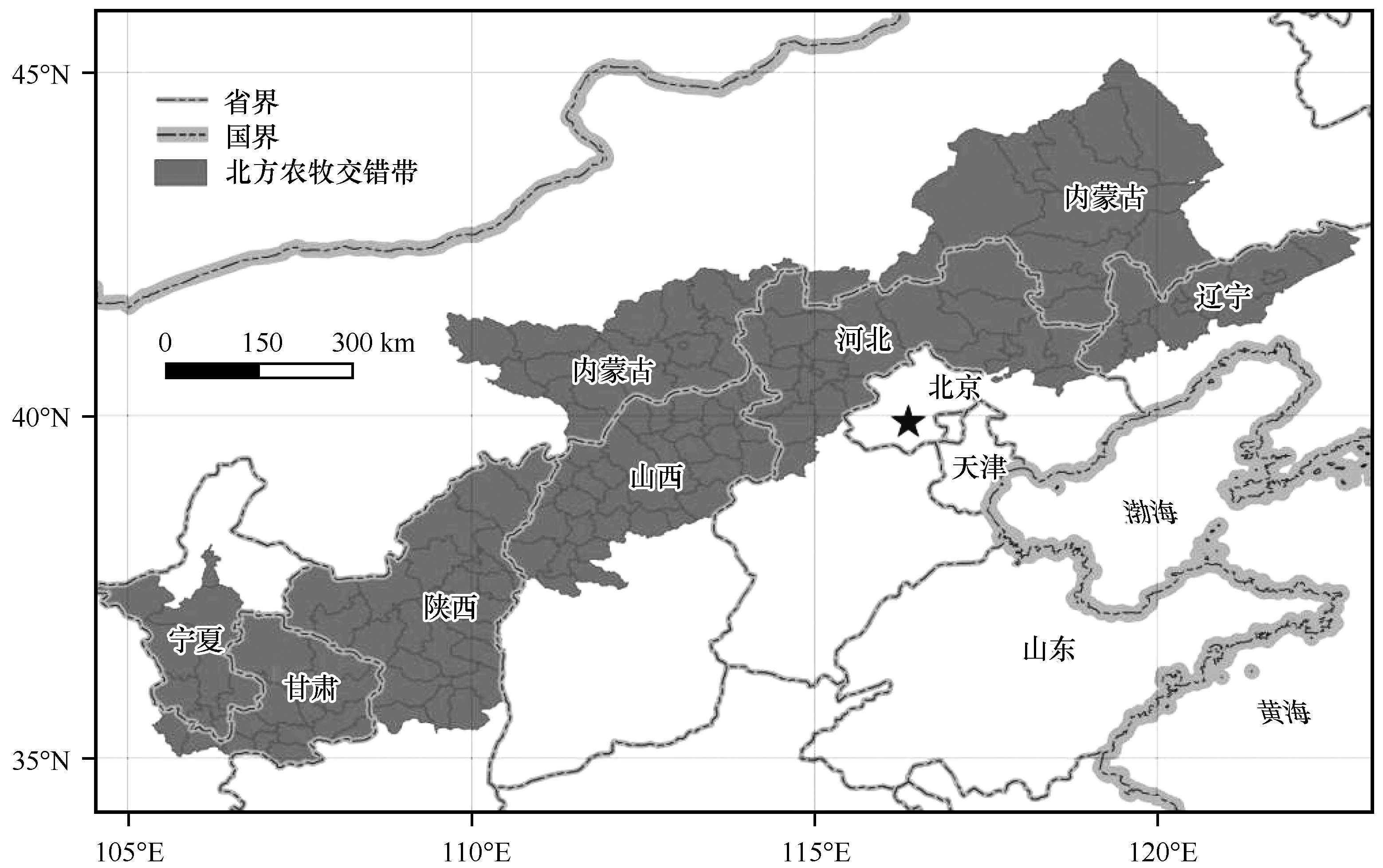
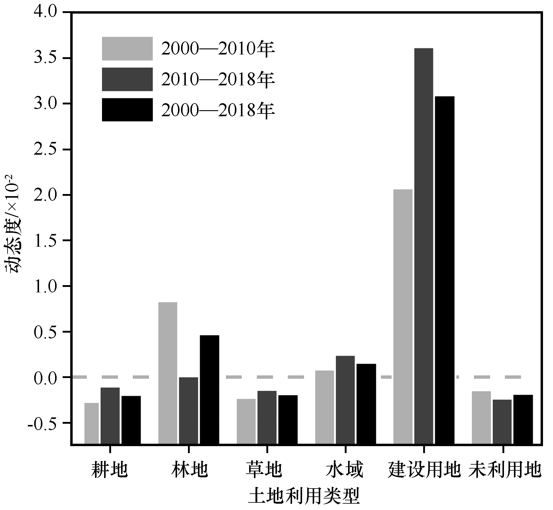
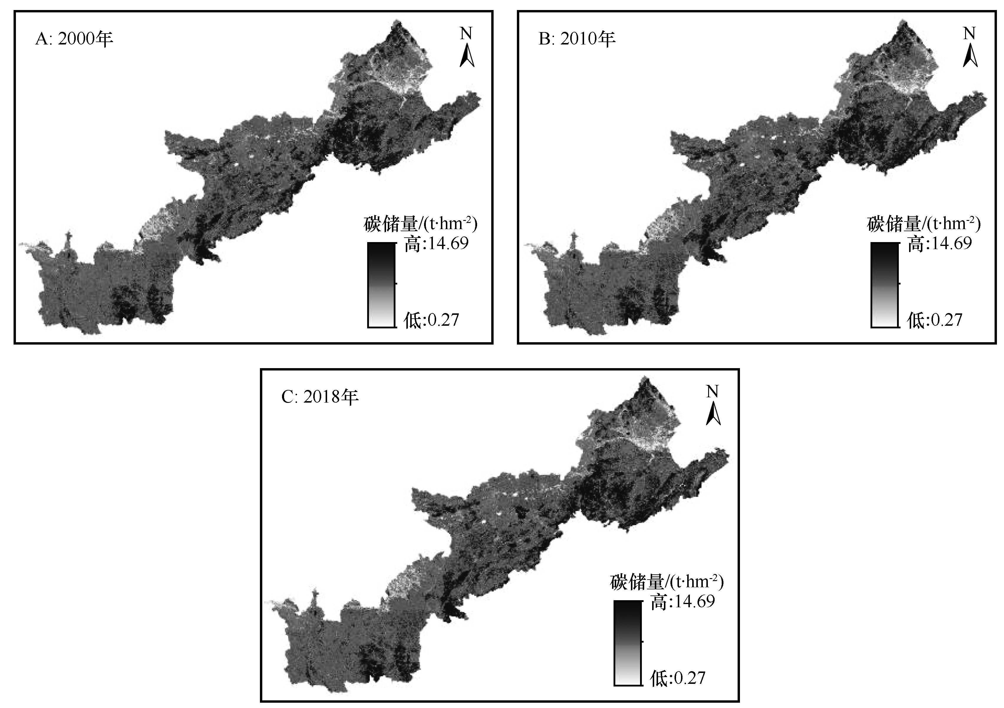
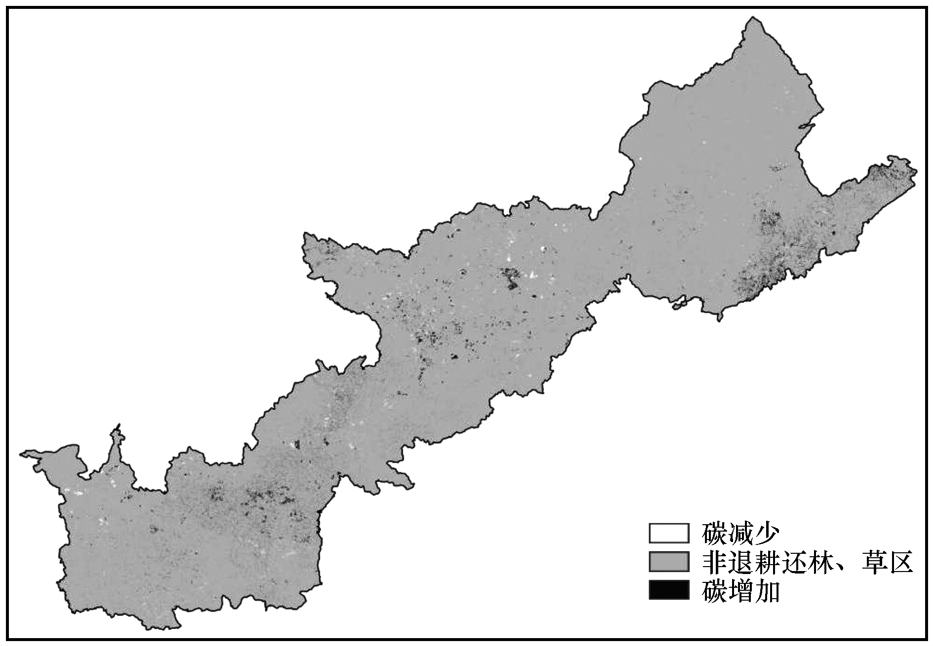
为明析退耕还林(草)背景下生态环境较为脆弱的北方农牧交错带土地利用及碳储量变化,基于该区2000、2010、2018年土地利用数据,通过动态度、土地转移矩阵,景观指数等指标从土地利用变化的数量、速率以及空间格局特征加以分析,同时基于InVEST模型定量估算了该区近20年来的碳储量变化。结果表明:(1)北方农牧交错带土地利用类型以草地、耕地、林地为主,面积合计逾4.30×10⁵ km2,占比超过91.83%;林地、建设用地显著扩张,草地与耕地有明显减少趋势,同时两者之间流转面积最多,高达1.67×10⁴ km2,研究区景观格局总体上收敛于“集中—分散”;(2)近20年来北方农牧交错带总碳储量51.44—52.81亿t,总体呈增加趋势,碳密度稳定在110 t·hm-2左右,退耕还林(草)政策下碳储量净增加逾300万t。北方农牧交错带土地利用变化程度较为剧烈,退耕还林(草)政策不仅是土地更迭的主要驱动因素,也是该区固碳功能显著提升的重要原因。

关键词: 退耕还林(草), 北方农牧交错带, 土地利用, 景观指数, InVEST模型, 碳储量

Abstract:

The well-researched analysis of land use change and carbon storage in the northern farming-pastoral ecotone such a fragile ecological environment, under the background of returning farmland to forest (grass), could help generate a scientific basis for local regional ecological construction and sustainable development. Based on the land use data of the three periods of 2000-2018 in this area, the quantity, rate and spatial pattern characteristics of land use change in the past two decades were investigated through land transfer matrix, landscape index, and meanwhile carbon storage also got estimated quantitatively by InVEST model. The final results indicated that: (1) The land use types mainly consisted of grassland, cultivated land and forest land in the northern farming-pastoral ecotone, covering an area of more than 4.30×10⁵ km2 and accounting for 91.83% of the total area. Among them, forest land and construction land expanded significantly, and meanwhile grassland and cultivated land declined remarkably because the area of their mutual circulation was the largest, as high as 1.67×10⁴ km2. The landscape pattern of the study area generally converged to "concentration-dispersion". (2) In the past two decades, the total carbon storage floated at 5.14-5.28 billionton in the northern farming-pastoral ecotone, with a carbon increment of three million tons benefited from the policy of returning farmland to forest (grass). Besides, the carbon density reached nearly 110 t·hm-2. In conclusion, the change of land use grew increasingly vigorous in the northern farming-pastoral ecotone and the policy of returning farmland to forest (grass) not only had made some progress but also significantly improved the carbon sequestration function towards this area.

Key words: returning farmland to forest (grass), northern farming-pastoral zone, land use, landscape index, InVEST model, carbon storage

中图分类号: