img

官方微信

高级检索

中国沙漠 ›› 2023, Vol. 43 ›› Issue (2): 159-169.DOI: 10.7522/j.issn.1000-694X.2022.00084

• • 上一篇    

科尔沁沙地土地荒漠化敏感性评估

任雨1(), 张勃1(), 陈曦东2   

  1. 1.西北师范大学 地理与环境科学学院,甘肃 兰州 730070
    2.华北水利水电大学 测绘与地理信息学院,河南 郑州 450045
  • 收稿日期:2022-06-05 修回日期:2022-07-27 出版日期:2023-03-20 发布日期:2023-04-12
  • 通讯作者: 张勃
  • 作者简介:张勃(E-mail: zhangbo@nwnu.edu.cn
    任雨(1992—),男,河北承德人,硕士研究生,研究方向为荒漠化。E-mail: rs_renyu@163.com
  • 基金资助:
    国家自然科学基金项目(41561024)

Desertification sensitivity assessment in Horqin Sandy Land

Yu Ren1(), Bo Zhang1(), Xidong Chen2   

  1. 1.College of Geography and Environmental Sciences,Northwest Normal University,Lanzhou 730070,China
    2.College of Surveying and Geo-Informatics,North China University of Water Resources and Electric Power,Zhengzhou 450045,China
  • Received:2022-06-05 Revised:2022-07-27 Online:2023-03-20 Published:2023-04-12
  • Contact: Bo Zhang

摘要:

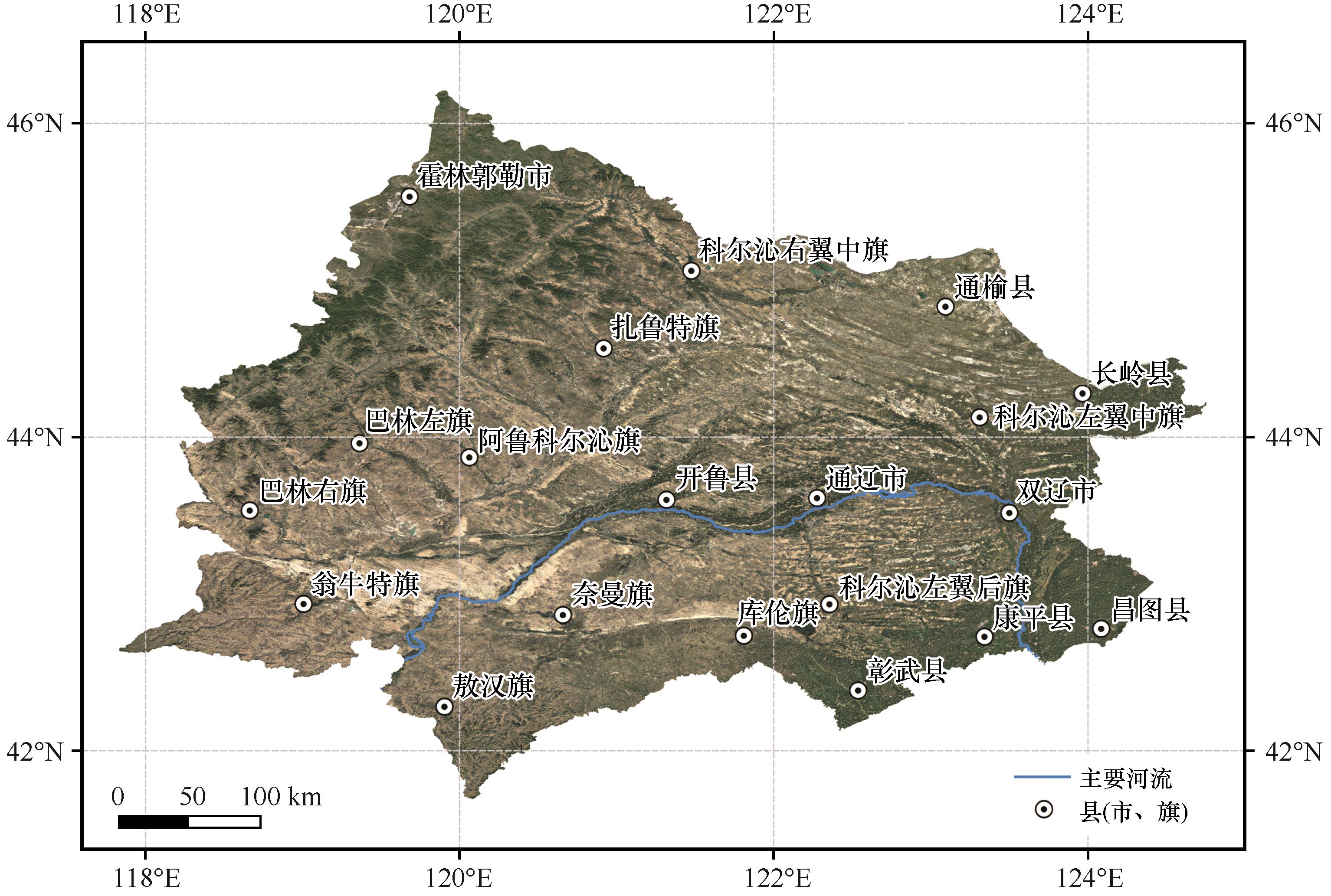
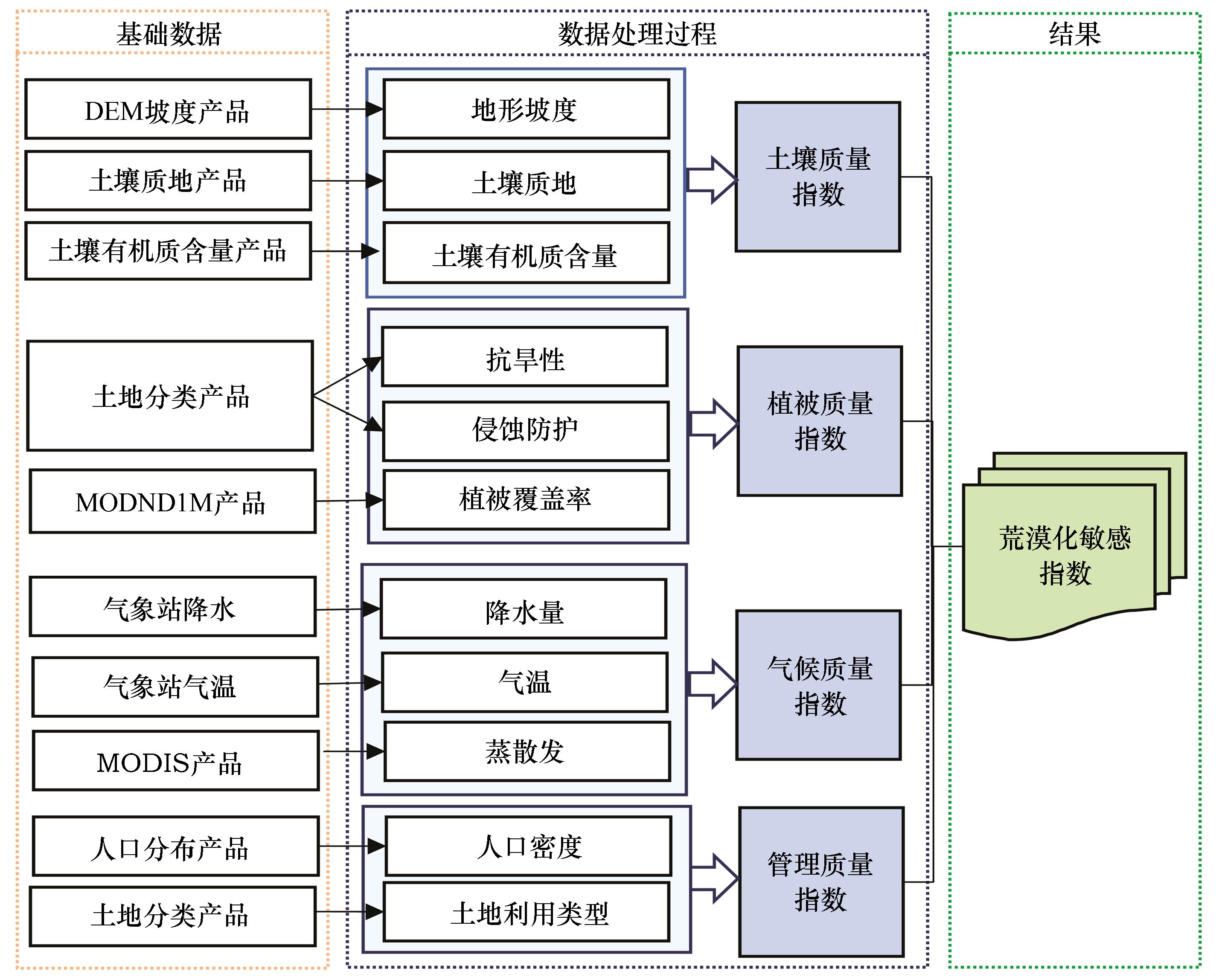
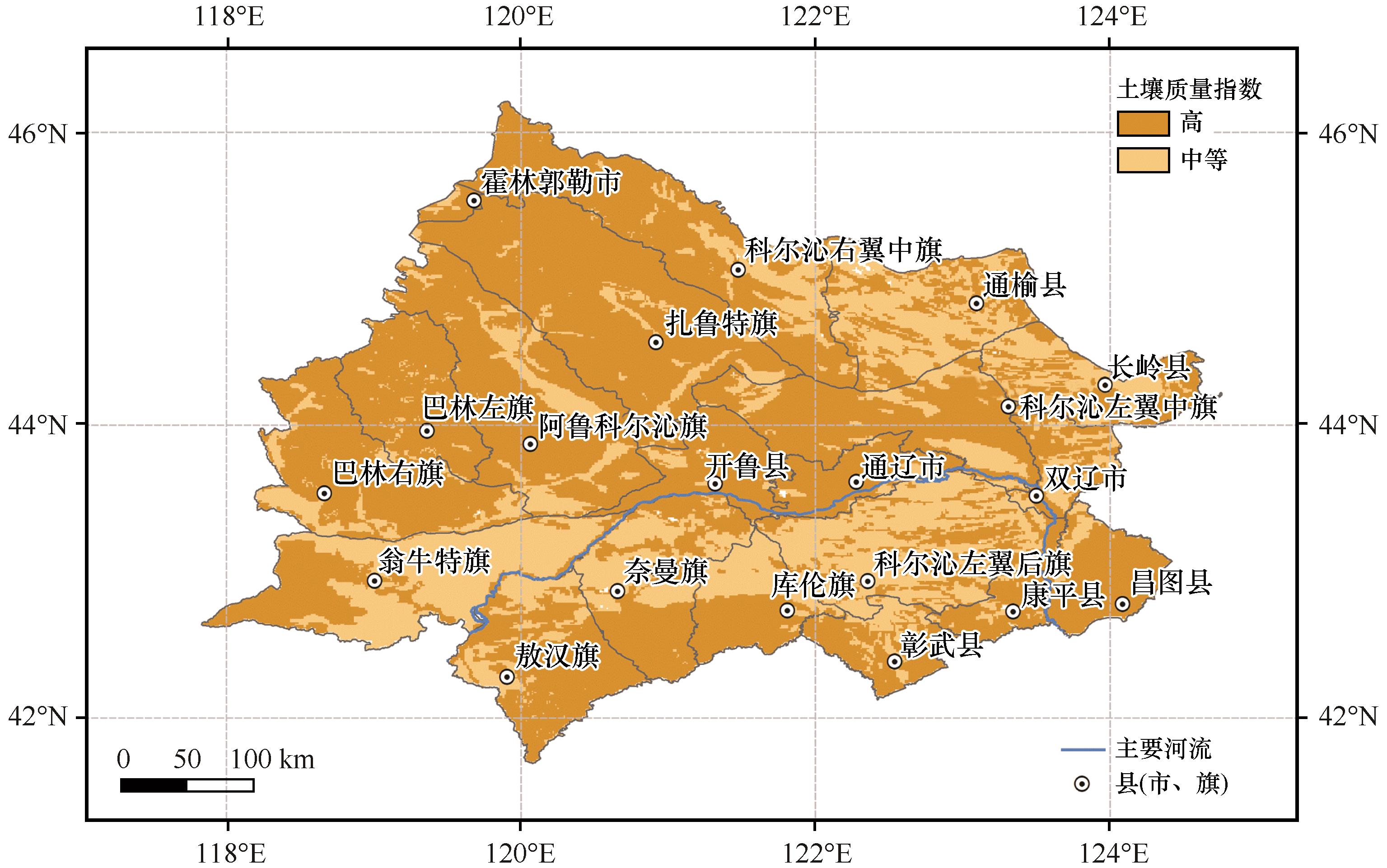
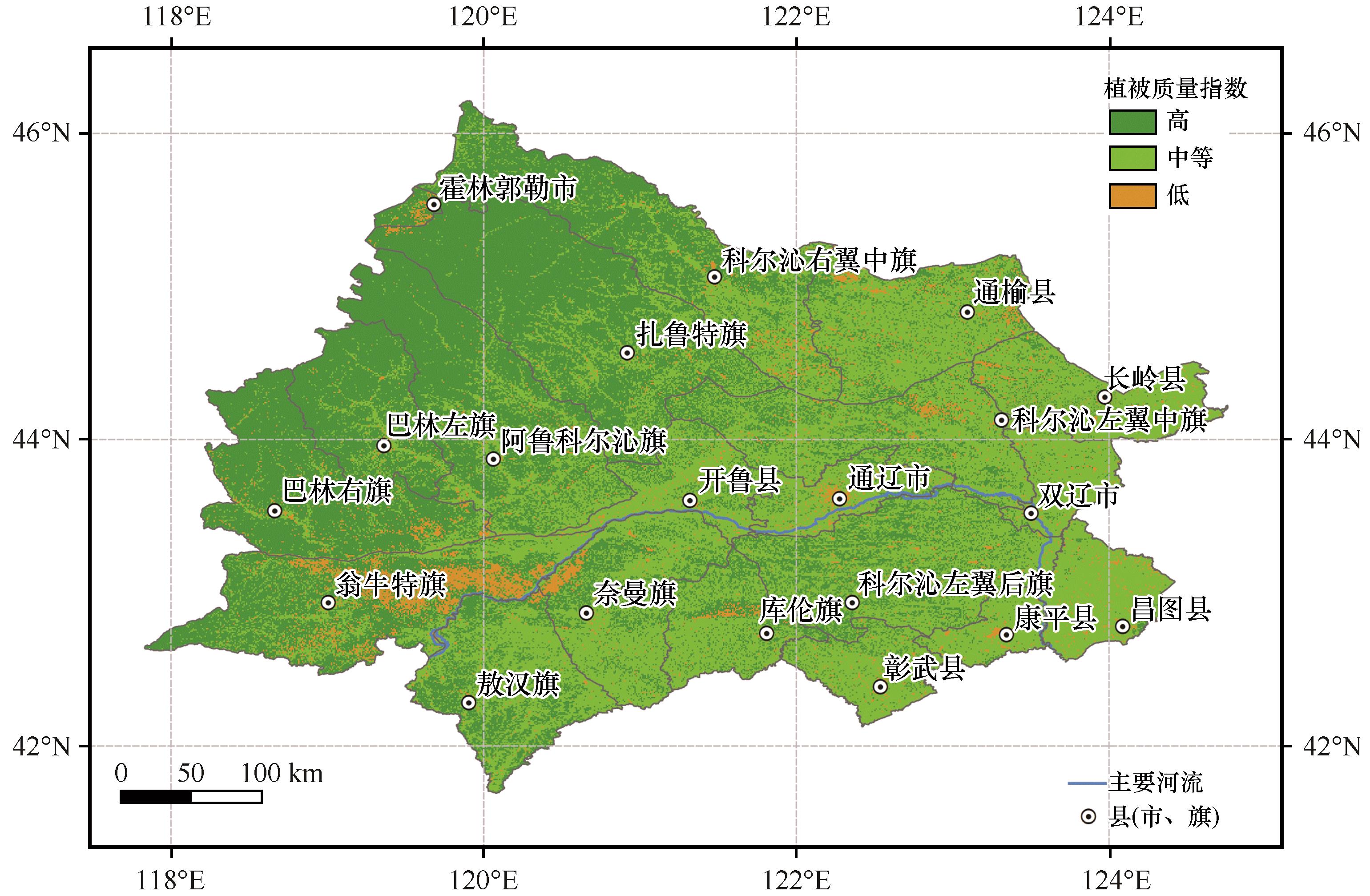
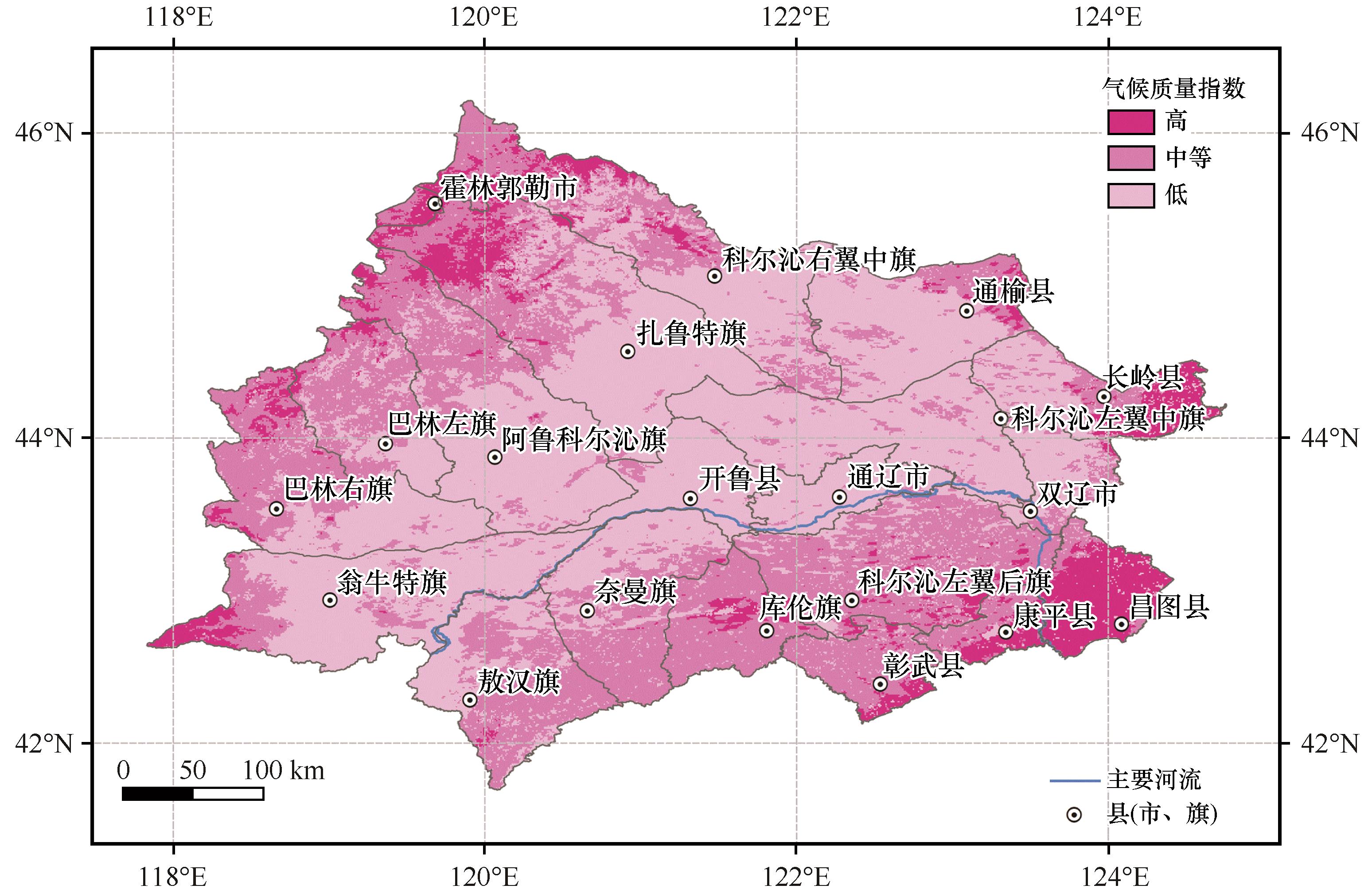
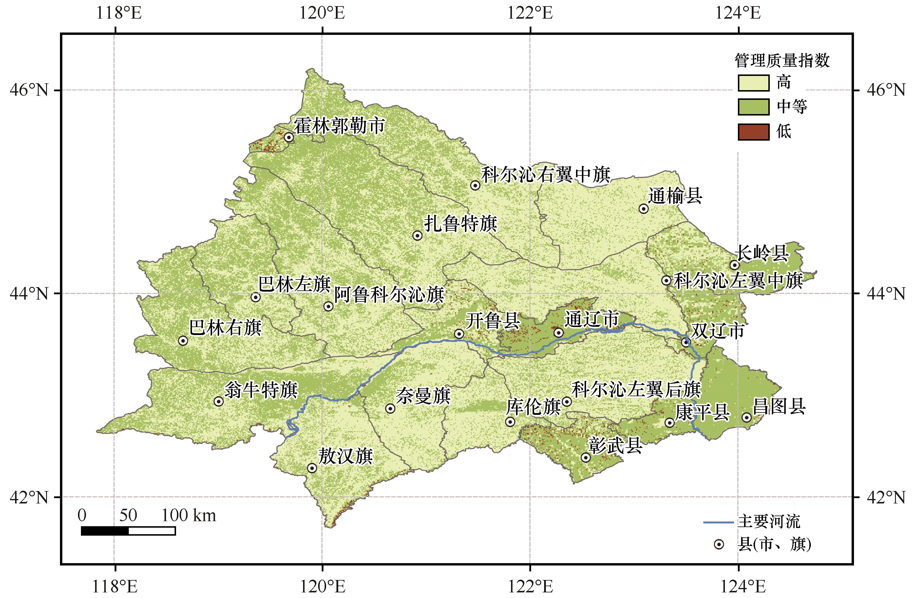
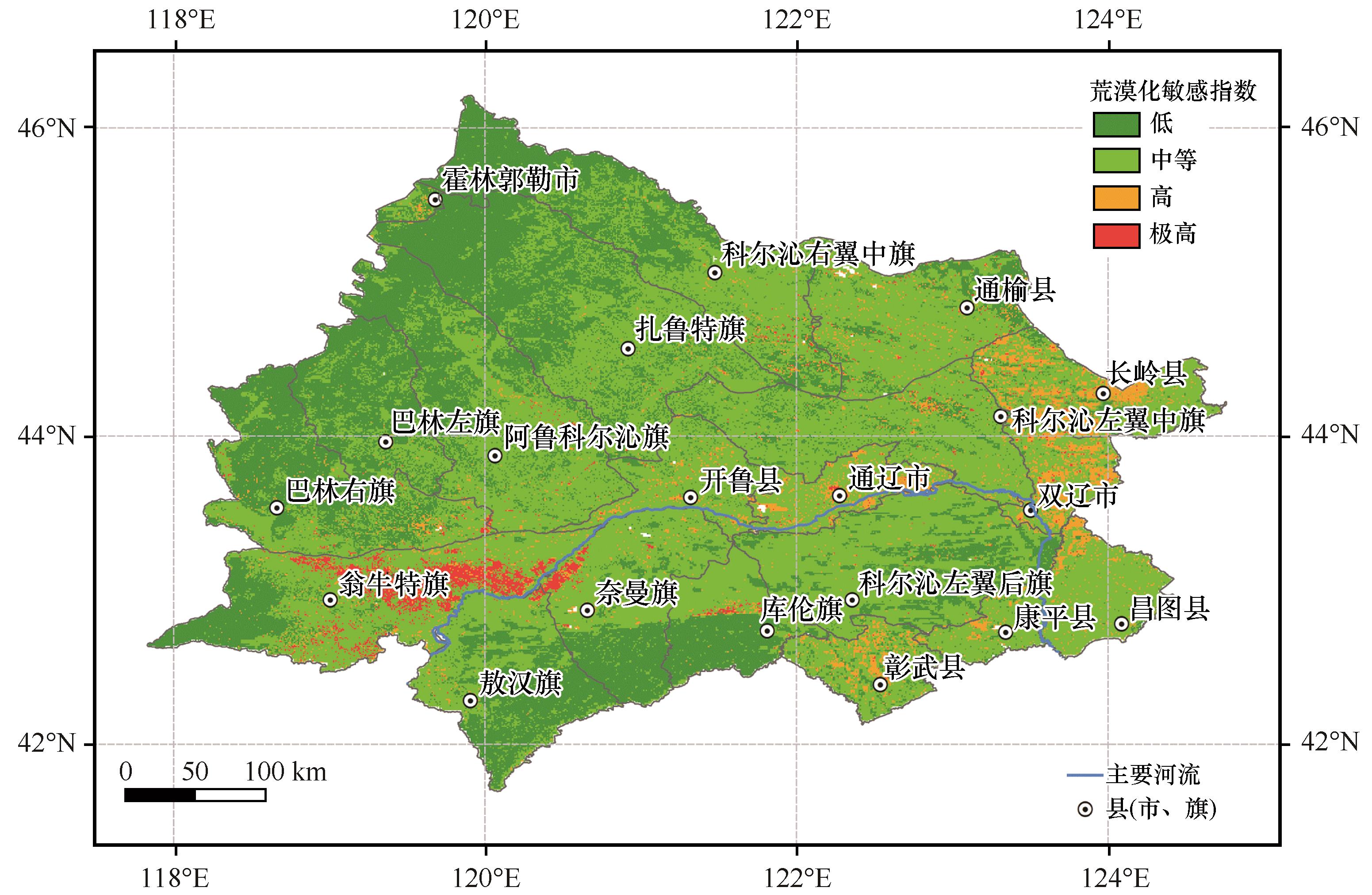
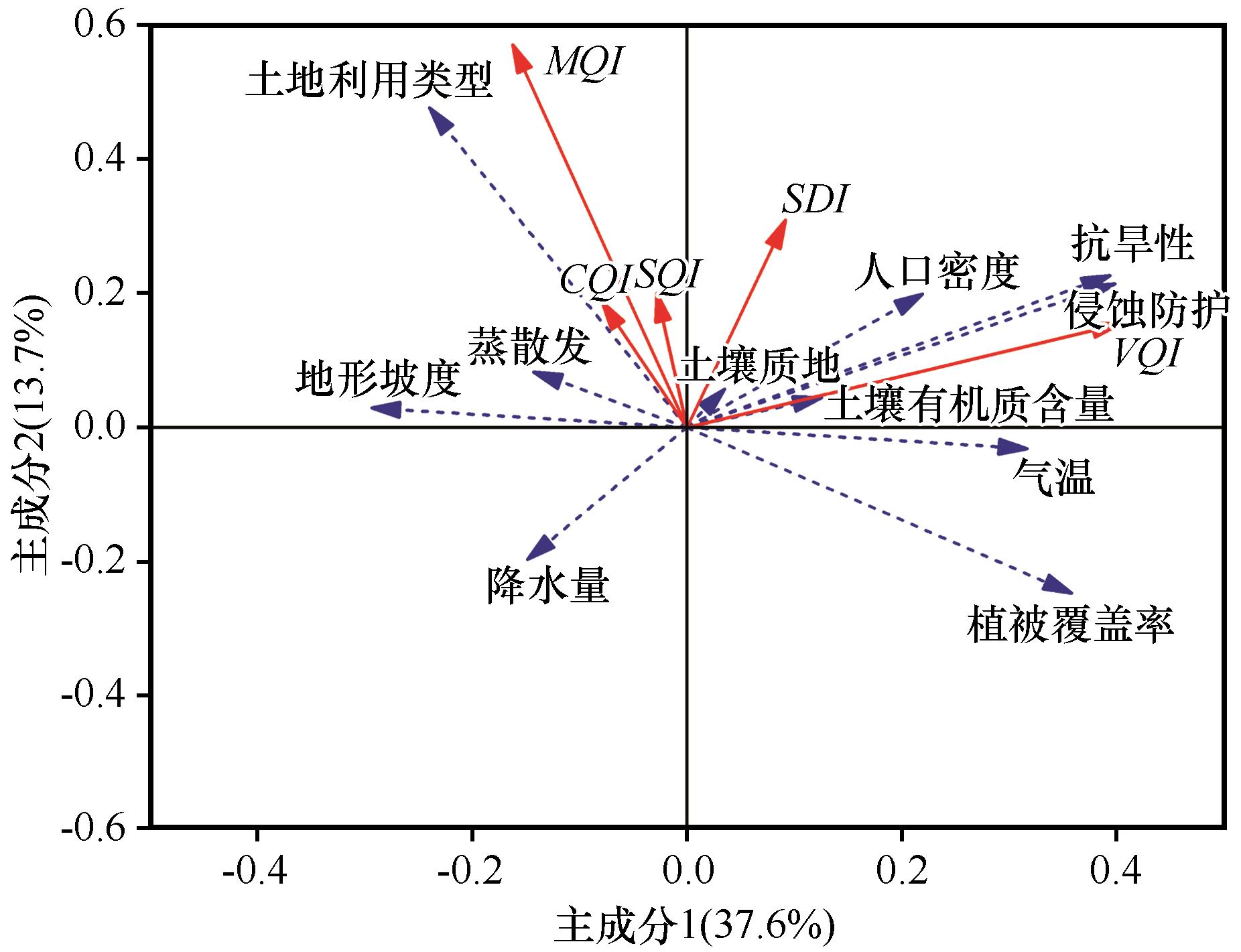
科尔沁沙地是中国四大沙地之一,也是京津冀风沙源的重要组成部分,其荒漠化加剧不仅直接对京津冀地区的气候环境产生了恶劣影响,还严重威胁了自然资源的可持续性。本文以MEDALUS模型为基础,利用遥感和地理信息系统技术,对科尔沁沙地土地荒漠化风险进行了评估。利用土壤质量指数、植被质量指数、气候质量指数和管理质量指数,构建了科尔沁沙地土地荒漠化敏感指数图。结果表明:科尔沁沙地土地荒漠化敏感指数极高区域2 986.60 km2,占研究区总面积的2.02%;高区域6 678.00 km2,占4.52%;中等区域89 633.18 km2,占60.71%;低区域48 352.20 km2,占32.75%。评估发现:(1)MEDALUS模型适用于科尔沁沙地土地荒漠化敏感性评估,其中荒漠化敏感指数极高的区域集中在科尔沁沙地腹地老哈河两侧,以翁牛特旗中东部、奈曼旗西北部和库伦旗中部为主;(2)土壤质量指数对荒漠化敏感性的影响高于植被质量指数、气候质量指数和管理质量指数,因此在科尔沁沙地防沙治沙工程中,可以从改善土壤质量入手,减轻科尔沁沙地的土地荒漠化风险;(3)以土地利用类型为主要驱动力,通辽市周边、长岭县西北部、科尔沁左翼中旗、双辽市、彰武县北部等地的荒漠化风险有所增加。地形坡度对科尔沁沙地荒漠化敏感性影响不大。

关键词: 科尔沁沙地, 土地荒漠化, MEDALUS, GIS, 质量指数, 敏感指数

Abstract:

Horqin Sandy Land is one of the four sandy lands in China. It is also an important part of the sandstorm source in Beijing-Tianjin-Hebei. The intensification of desertification directly affects the climate environment in Beijing-Tianjin-Hebei. Based on the MEDALUS model, remote sensing and geographic information system technology are used to evaluate the desertification risk of Horqin Sandy Land. The desertification sensitivity index map of Horqin Sandy Land was constructed using soil quality, vegetation quality, climate quality and management quality indices. The results showed that the area with extremely high desertification sensitivity in Horqin Sandy Land was about 2 986.60 km2, accounting for 2.02% of the total area of the study area. The area with high desertification sensitivity was about 6 678.00 km2, accounting for 4.52%; The middle area was about 89 633.18 km2, accounting for 60.71%; The low area was about 48 352.20 km2, accounting for 32.75%. The result showed: (1) MEDALUS model is applicable in the evaluation of desertification sensitivity of Horqin Sandy Land. The assessed areas with extremely high desertification sensitivity index are concentrated in the hinterland of Horqin Sandy Land, both sides of Laoha River, the central and eastern part of Wengniute Banner, northwest of Naiman Banner and the middle part of Kulun Banner. (2) The influence of soil quality index on desertification sensitivity is higher than that of vegetation quality index, climate quality index, and management quality index. Therefore, improving the soil quality is likely to be an effect way to reduce the risk of land desertification in Horqin Sandy Land. (3) With the land use type as the main driving force, the desertification risk has increased in Tongliao City, northwest of Changling County, Horqin Left-wing Middle Banner, Shuangliao city and northern Zhangwu County. In addition, slope has little effect on desertification sensitivity in Horqin Sandy Land.

Key words: Horqin Sandy Land, land desertification, MEDALUS, GIS, quality index, sensitive index

中图分类号: